Identifying the Location of the MH17 Linked Missile Launcher From One Photograph
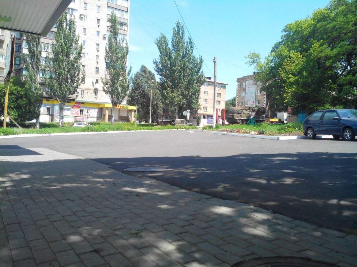
In the aftermath of the MH17 downing in Ukraine various images and videos were shared on social media sites claiming to show the Buk missile launcher that was alleged by some to have been used to shoot down flight MH17. One photograph was shared on social media sites, reportedly showing the missile launcher in Snizhne, close to where a video show a Buk missile launcher was filmed
There doesn’t seem much to go on in this picture, but one of my long term followers, Aric Toler, managed to piece together the location using a variety of open source information, in a way that impressed myself and others who have spent their time geolocating images from conflict zones. I asked him to talk me through the process, and here’s what he told me.
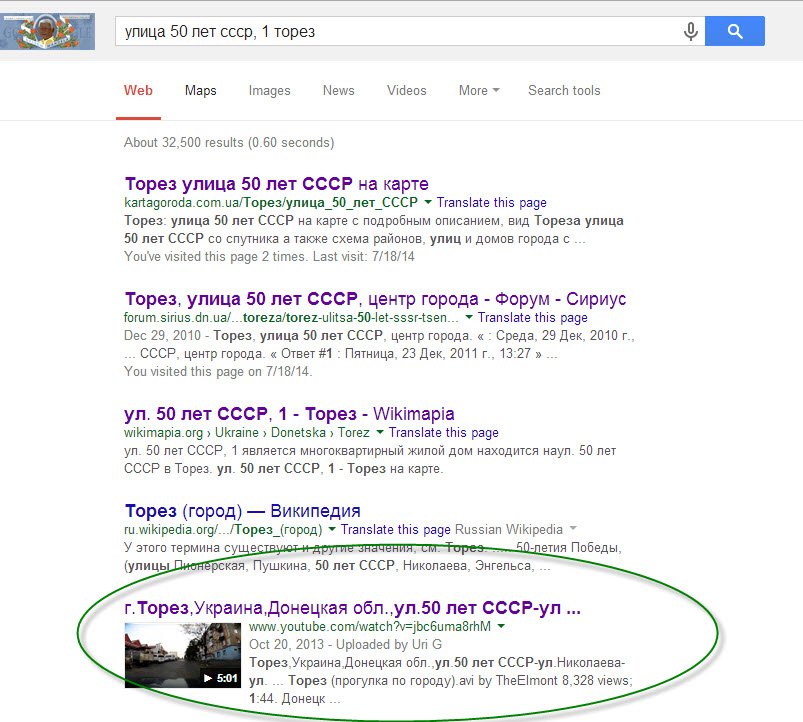
His first step was to identify the store with the yellow facade in the picture. Aric has knowledge of Russian, and he was able to piece together the visible letters on the stores sign, and from that he was able to search for chain stores which contained those characters, which he discovered was Строй Дом. He searched for Строй Дом in Snizhne, but was unable to find any. He searched through Google results for the name, and eventually found a reference to one here, located in the town of Torez. He then found the specific address by search the terms “стройдом” “торез” “50 лет ссср” on Google, the name of the shop, the town, and the street. This found a court document with the name of the shop and it’s address as part of a testimony from a witness. From knowing the address he was then able to identify the location on Yandex Maps
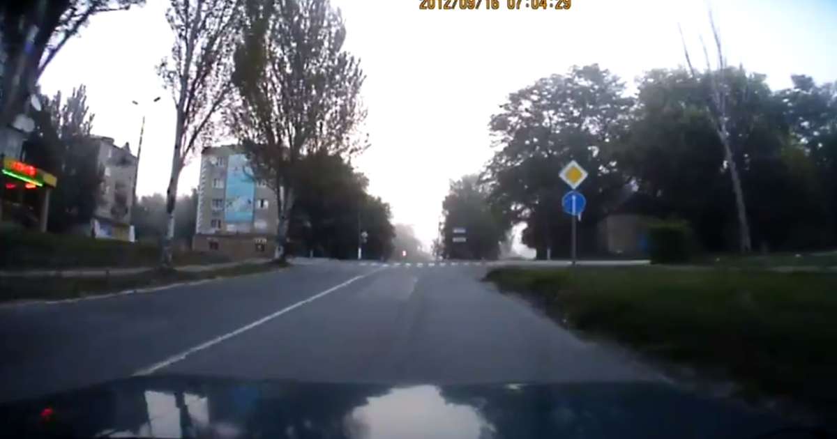
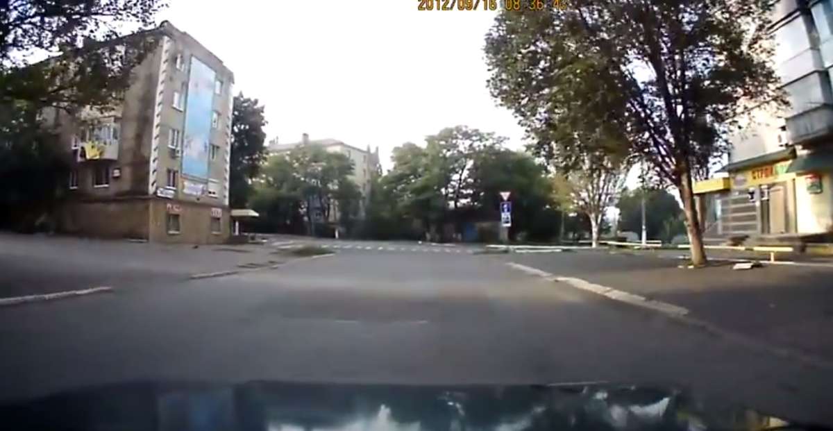
Something else that came up in the searches were videos filmed by someone who had been posting videos of himself driving around Torez
These videos stated the roads they were filmed on, and include shots of the store from the east heading west, and the north heading south
Visible in both videos were the store and the distinct apartment building with black and white stripes down each corner of the building. It was then possible to follow the path of the car in the videos on satellite maps, confirming the position of further landmarks along the route.
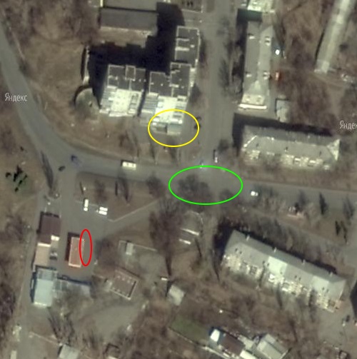
Based on that information it was possible to say the camera was positioned (marked in red) in the forecourt of a garage south of the store (marked in yellow), and the approximate position of the Buk missile launcher (marked in green)
Aric didn’t use any specialised knowledge, beyond his language skills, to do this that would have been beyond anyone else doing the same investigation. All the information was available online, and from a single photograph he was able to establish the exact location of the missile launcher. Speaking as someone who has done this for a while, it’s very difficult to establish a location from one photograph alone, so the fact this was his first attempt to geolocate something like this is really impressive, and sets a great example to anyone who might be thinking about trying some geolocation.
