Geolocating the Missile Launcher Linked to the Downing of MH17
Translations:
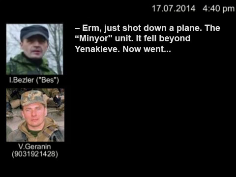
Shortly after reports of flight MH17 being shot down in Ukraine began emerging, the following video was posted online, claiming to show a Buk missile launcher travelling through Snizhne, a rebel held town near the Russian border.
The original video was quickly deleted from YouTube for unknown reasons, but one lesson to learn earlier on with any video of interest is to immediately download it. A variety tools are available to do this, including Keepvid, which I used in this instance.
The obvious question is whether or not this is actually Snizhne, so the first thing to do is see if there’s any obvious landmarks in the video. In this case, the road is a dual-carriageway with trees in the middle, and looking at satellite images from Snizhne it seems quite unusual. I shared the video with my Twitter followers, asking if anyone could find the area (crowd-sourcing these things can be useful), and quickly several people pointed to an area south of the center of Snizhne
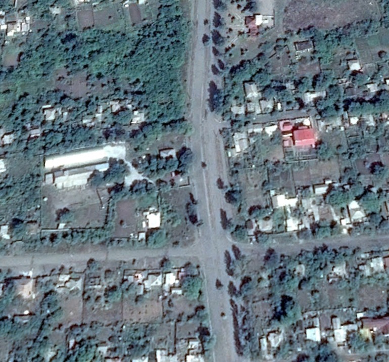
The road appeared to share the same layout, with the trees in the middle, and had the slight turn visible in the video. Based off this, it seemed the camera would have to be north of the road, facing south. Aside from the road layout, something else stood out in the video, the height of the camera. It was clear the camera was positioned much higher than the buildings to the south, suggesting it was either on a hill or on top of a tall building. To test this, I used the ground-level view option in Google Earth, and positioned the cursor on the road, facing north, towards the camera
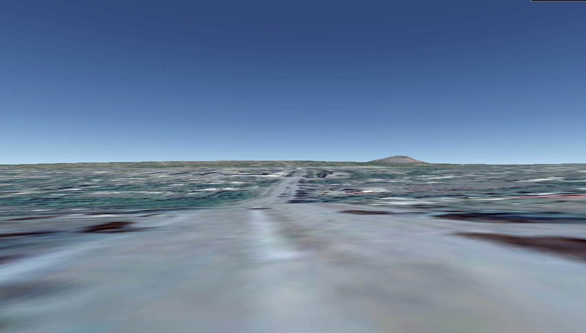
It seemed the only hills in the area were far in the distance, and by examining the map I was able to see apartment buildings to the north of the road
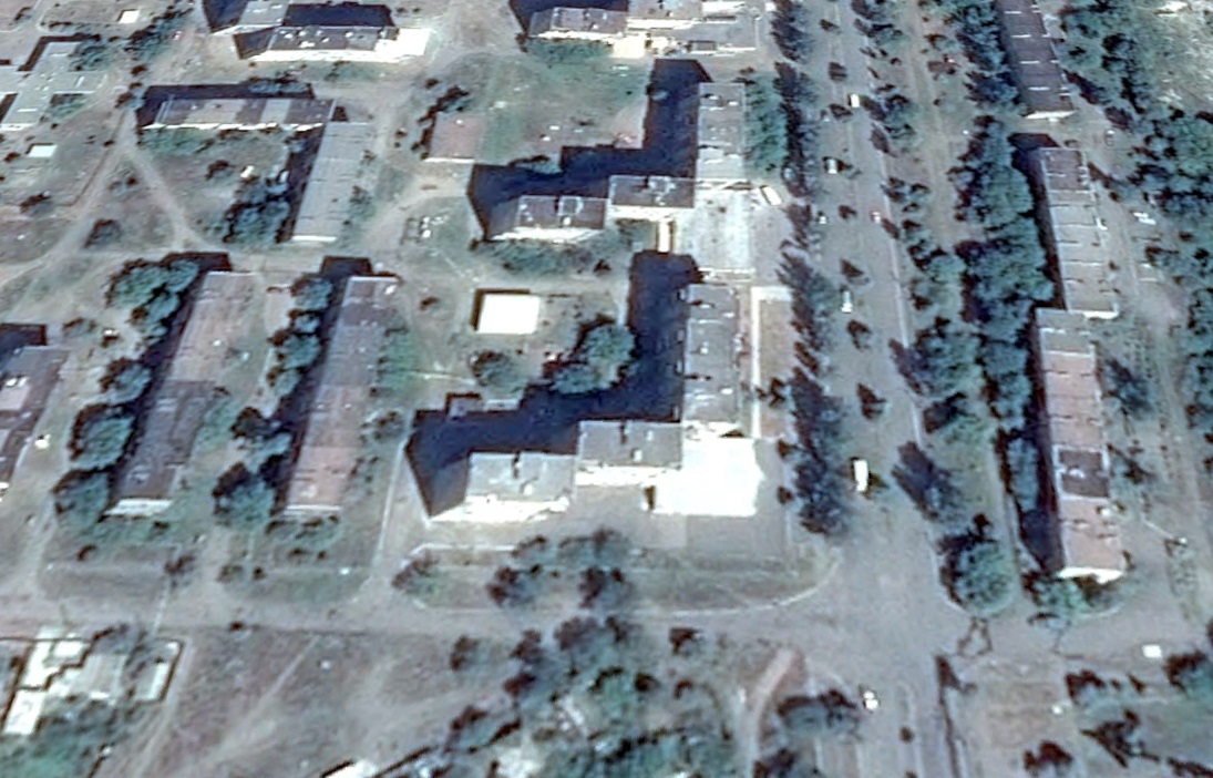
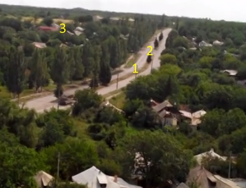
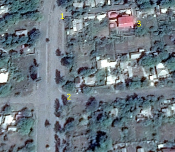
Based on that I now had the approximate position of the camera, and I was able to identify other features I would expect to see from that vantage point. First, three trees positioned to the north of the bend in the road
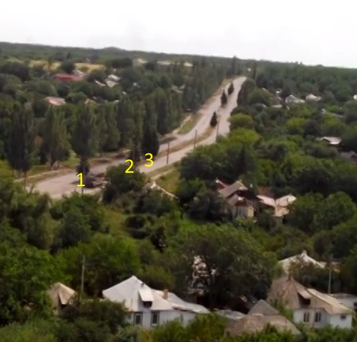

South of the bend it’s possible to identify two junctions on the road, points 1 and 2, with one tree visible between the junction on both the video and map. At point 3 the red roof of a house is also visible in both the video and satellite map
Based on this information it seems likely that this is the correct location of what’s claimed to by the Buk missile launcher, heading south away from Snizhne. Based on initial information about the location of the crash site, it appears this location was around 10-15km of the crash site.