Two More Key Sightings of the MH17 Buk Missile Launcher
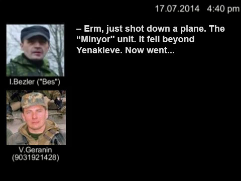
Since the downing of flight MH17, several photographs and videos of the Buk Missile Launcher linked to the attack have been collaboratively investigated and located by many different people, in the rebel held towns of Torez, Snizhne, and Luhansk. Now, another video and another photograph have appeared that gives us even more of an understanding of where the Buk Missile Launcher was on July 17th.
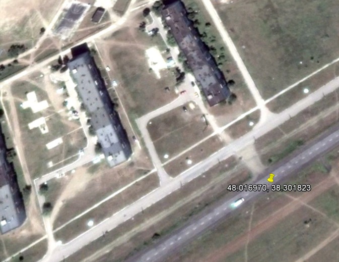
This first video was rather unique as the apparent poster gave the exact location and time it was posted, so it was a case of verifying that information. The co-ordinates given were 48°01’01.1″N 38°18’06.6″E, in the town of Zuhres, at 11:40am on July 17th.
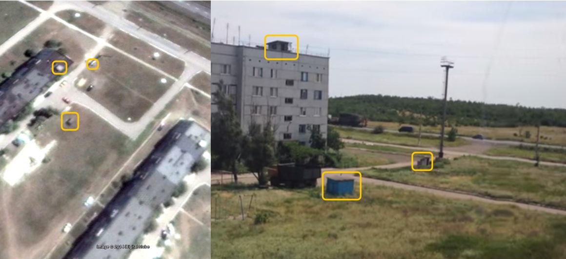
Based on the position of the buildings in the video, if this was the correct position then the camera position would be northwest of the road, in the apartment building. This seemed to match, as the position of several objects in the video matched what was visible in satellite map imagery
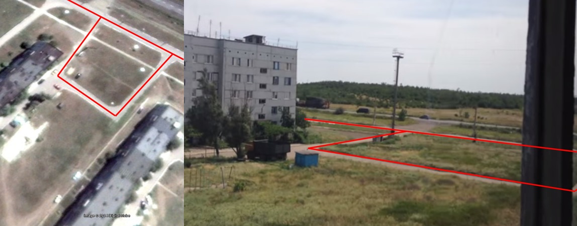
The arrangement of pathways in the area also matched
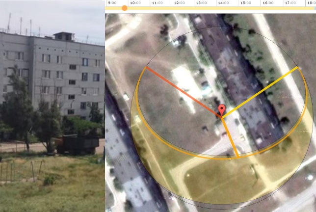
Based on the above matches, it seems highly probable the location is correction. Using SunCalc, a website that allows you to see the direction of shadows at different times of days, it appears the shadows cast by the trees fits to around 11:40am (note the time shown below is -2 hours local time)
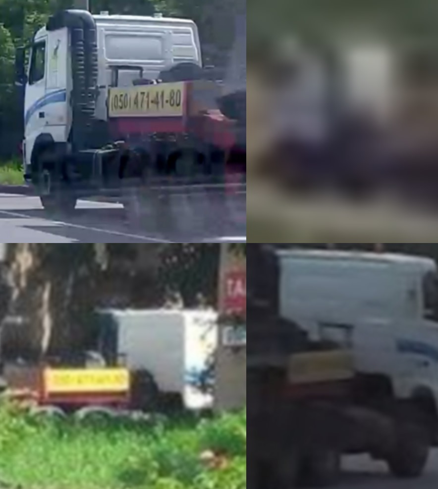
The next image is a photograph from Paris Match, showing the Buk loaded on what appears to be the same trailer seen in images from Zuhres, Torez, and Luhansk. The below image shows the truck from the Paris Match photograph in the top left, the top right shows the Zuhres truck, bottom left the Torez truck, and the bottom right the Luhansk truck
They all appear show the same truck, with the same strip on the cabin, the same black exhaust on the left side of the truck, and the yellow sign is clearly visible in three of the images. While not readable, in the Torez and Luhansk pictures it appears text is also present. Paris Match called the number, and the person who answered claimed the truck had been stolen from them in Donetsk. In fact, it has been possible to track down the company it was “stolen” from, which is located here, in Donetsk.
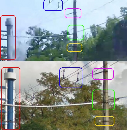
But can we confirm the claim of the witness it was in the town of Snizhne, near the possible launch site? In fact we can’t, because it has been possible to locate it in a different town altogether, Donetsk. The Ukraine@War blog highlighted the work of Chris Postal, who managed to find the precise location by creating a route between Donetsk and Snizhne using a route planning website, and checking the the road along the automatically created route.
It’s possible to match many elements in the Paris Match photograph with that in the Google Street View image
Considering the time difference between the two images, that’s a good match, but there’s one more thing that makes this an excellent match
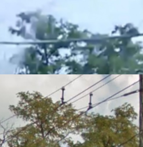
The tree tops visible in the Street View images and photograph appear to be very similar, in not nearly identical, which combined with the rest of the matches in the picture makes it certain this is the same location. Using SunCalc the shadows point to the Paris Match image being from early morning, roughly around 9am. In my next post, I’ll take a look at all the evidence that has been gathered so far, and how it all fits together.
