
Tracking Your Search: A Guide to the Grid Generator
Open source investigations often involve analysing vast areas of satellite imagery. The new Bellingcat Search Grid Generator aims to simplify such tasks, by overlaying a simple grid, turning your search into manageable sections. It helps to eliminate the risk of duplication, preventing redundant searches of the same location. It also enables teams to divide up the work, assigning each member to specific squares.
Launched by our tech team at the end of last month, the Search Grid Generator was built in collaboration with our Discord volunteer community. It’s simple to use and requires no installation, coding, or understanding of complex GIS software.
Generating Your Grid
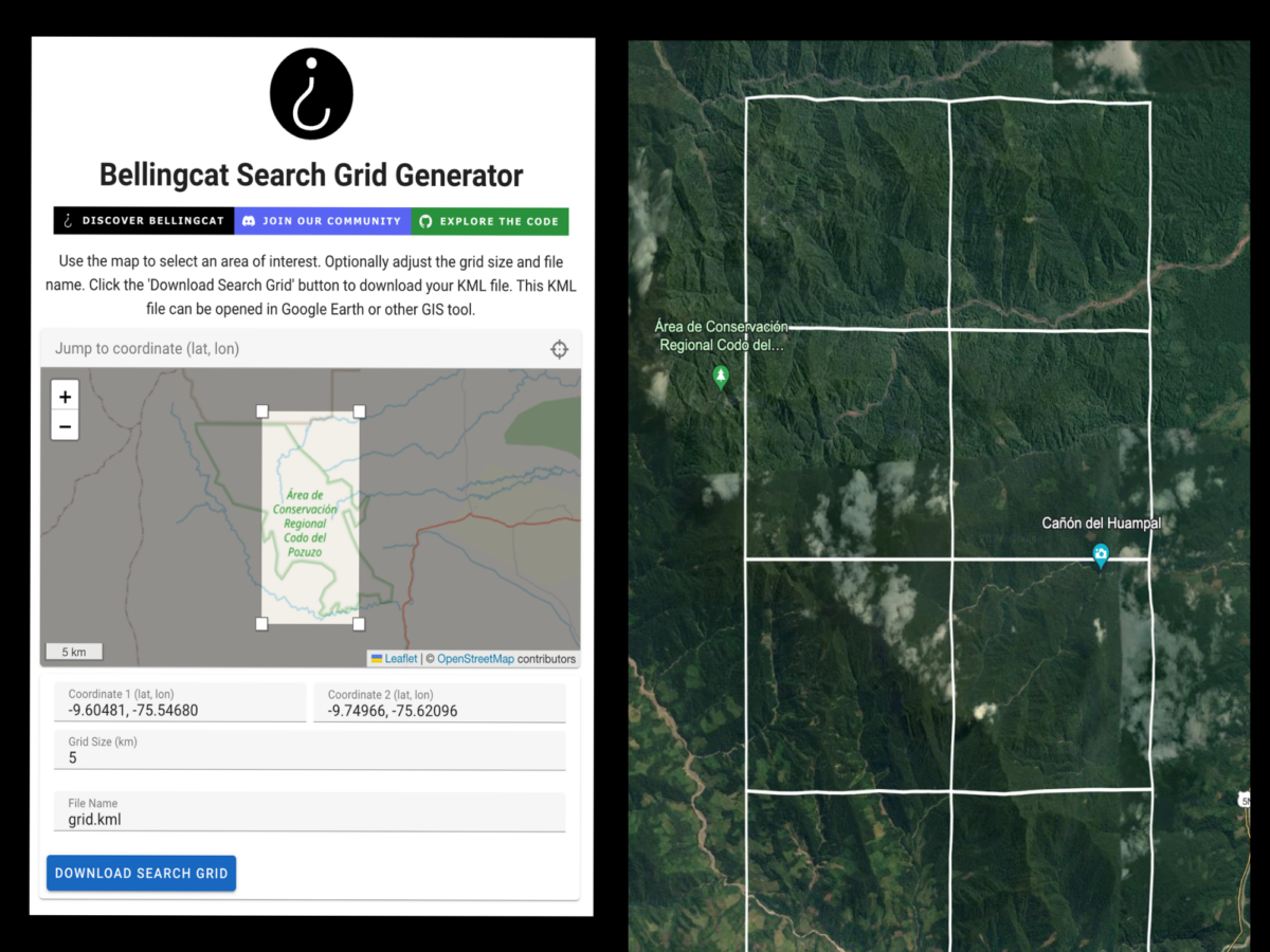
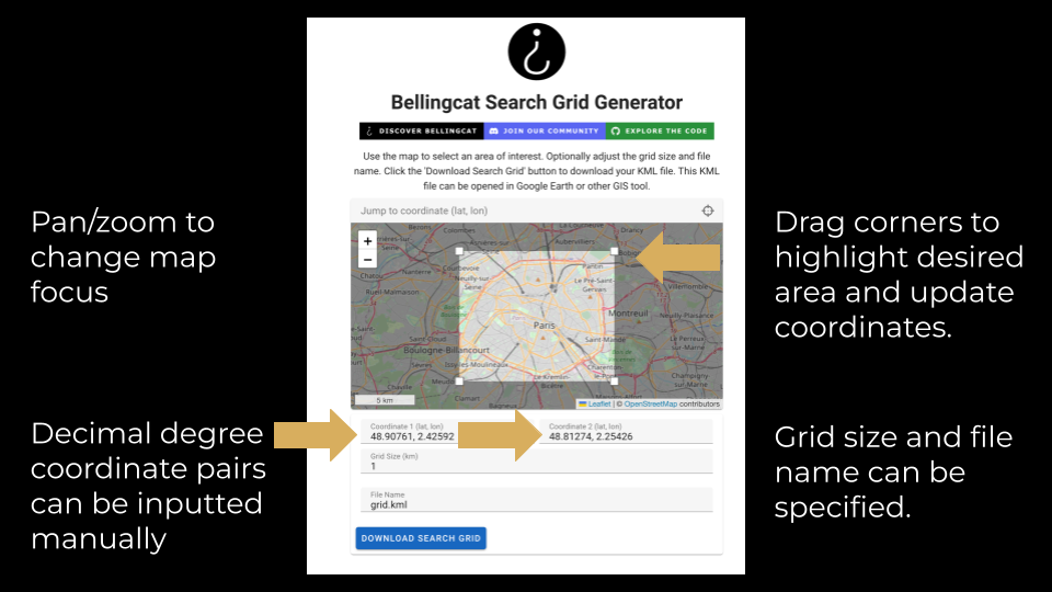
To generate your search grid, go to https://grid.bellingcat.com/
In the interface, either add your coordinates or drag the corners of the in-built map over your location. Confirm your grid size, which defaults to one sq km. Click download to produce a KML file, which you can then import into Google Earth, or your GIS tool of choice.
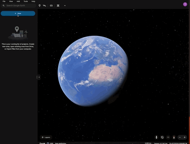
Google Earth Web offers a particularly user-friendly interface for working with these grid overlays. But for larger projects or if grid-based searches are a significant part of your workflow, you might want to consider a GIS system like QGIS.
To import your download into Google Earth Web, in the left hand sidebar click ‘Projects’ > ‘New project,’ then select ‘Local KML file’ to upload from your computer.
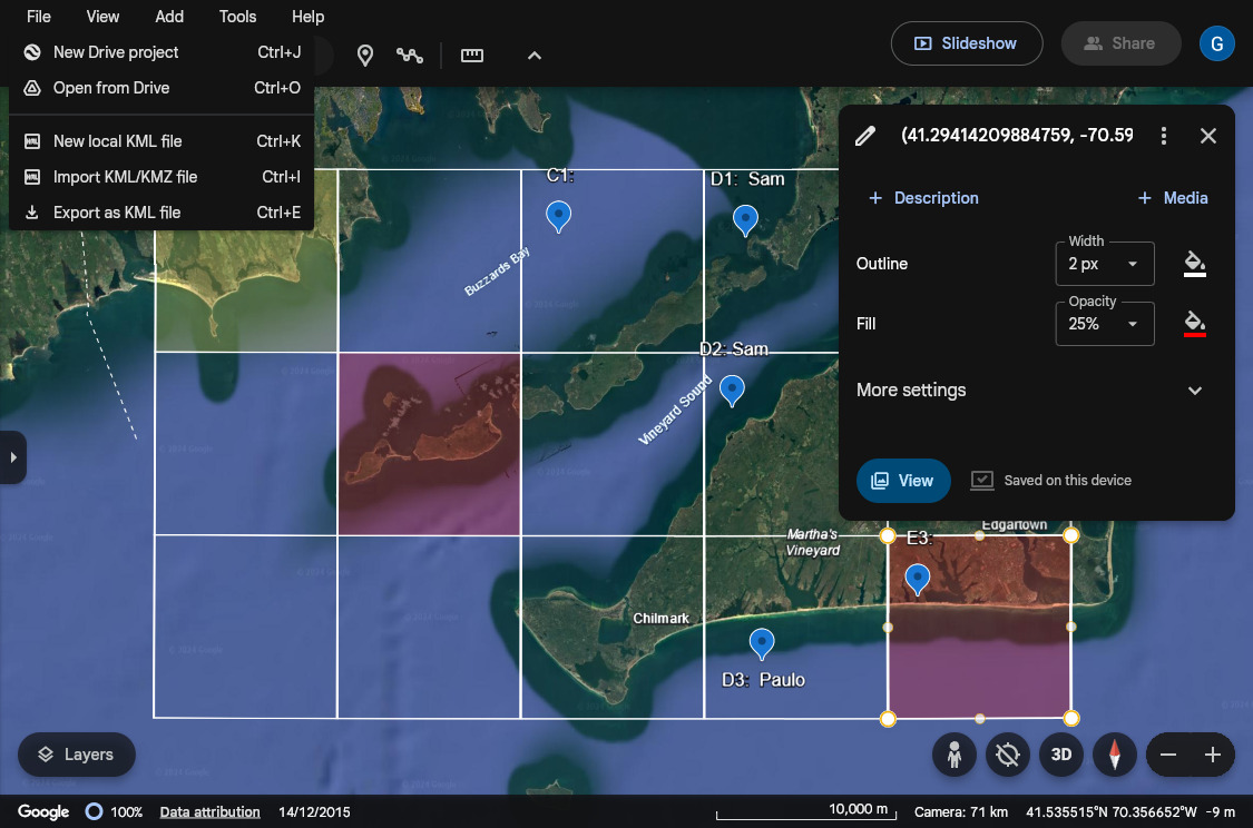
Google Earth Web’s interface makes it straightforward to toggle grid visibility, fill squares with different colours, and add placemarks as labels. You can also export your grid, including all markups, as a KML file to share with collaborators, as well as importing other KML files to enrich your search with data.
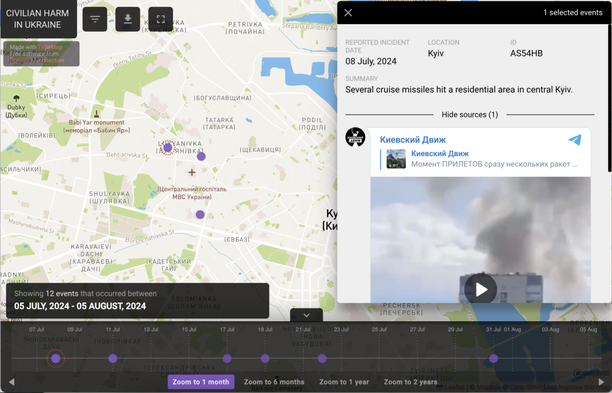
Released at the end of July, the Search Grid Generator is already being used by Bellingcat’s volunteer community to geolocate possible incidents of civilian harm inside Ukraine. Online posts, such as videos of missile attacks or photos of destruction in civilian areas, are at first archived by Bellingcat staff. The Search Grid Generator tool is then used by our Global Authentication Project volunteers to divide up potential search areas and to pinpoint a location within 150 metres of where incidents took place.
Developed by the Bellingcat tech team, in collaboration with our Discord volunteer community and Project Owl contributors, the Search Grid Generator exemplifies how community engagement shapes our resources. We’d love to hear from anyone who’s using our tools. Join our Discord community to share your feedback. Fresh ideas not only help us to refine existing tools, but also inspire new ones.
Bellingcat is a non-profit and the ability to carry out our work is dependent on the kind support of individual donors. If you would like to support our work, you can do so here. You can also subscribe to our Patreon channel here. Subscribe to our Newsletter and follow us on Twitter here and Mastodon here.