The Process Of Video Verification - Rabaa, Egypt, August 14th 2013
Frequently I’m asked how I go about verifying videos I come across on Youtube, and this following video reportedly shot in Rabaa, Cairo, showing a woman holding a camera getting shot while filming the dispersal of pro-Morsi protesters, can be used to show how you can get the exact location a video was filmed using tools readily available to anyone online
The video may look like it doesn’t give us much to go on, it’s a bad angle, doesn’t give much of an idea of the surrounding area, and spends most of the video looking downwards. However, we can gather some information from the video, and combined with the fact this was supposedly filmed in Rabaa, we can narrow down our search. First of all the buildings shown in the video
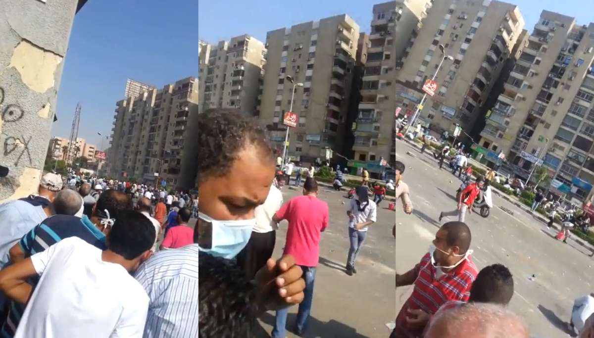
These three stills from the video show quite a bit of useful information to get started with. In the left image we can see the people in the video are taken cover behind what appears to be a solid structure, likely a wall or the corner of a building. Because we’re so close we can’t get an idea of the size of the building, just that it’s there. We can also see a multistory building with a billboard on the roof in the distance, and to the left we can see some sort of aerial tower.
In the middle image we see a shot of road, which appears to be pretty wide, with a small amount of greenery, either in the middle of the road, or at the far side. The building in the middle of the picture is a different design to the buildings either side of it, and faces the road.
In the right hand image we can see the third building, which seems to share a similar design with the building in the first image. The position of the camera appears to be in front of the third building, and it appears all three buildings are pretty close together.
From here we can put together a rough sketch of the area. Usually I use a bit of paper, but here’s a very rough MS Paint sketch

The circle represents the approximate position of the camera, and the box with a cross the approximate position of the aerial tower. This might not seem like much to go on, but we know that this is meant to be a location in Rabaa, and thanks to Google Maps, Wikimapia, and Bing Maps we have satellite maps of the area we can examine. Several news websites produced maps showing the location of the protest camp, for example the BBC, so that can help us narrow down our search.
Knowing what we already know we can start eliminating certain areas. We know what shape the buildings are, their position relative to the road, the a rough idea of what the road looks like. Here’s some examples of areas we can eliminate
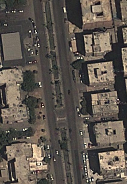
Straight away we can see the buildings on the right hand side are likely too far apart. If you compare the size of vehicles on the satellite images to the gaps between the building you get a sense these are a few car widths apart, more than we can see on the video. The buildings also don’t match the shape of what we can see on the video.
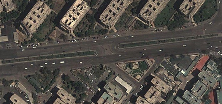
Right away you can see the buildings are in completely the wrong position in relation to the road, so this area can be easily dismissed.
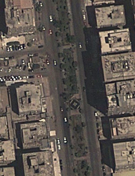
This time the the center of the road clearly has a lot of greenery, and judging by the ways the shadows are cast, and the way some of the green areas overlap the road, it seems almost certain these are trees, not bushes.
There’s also another tool in our kit aside from satellite maps. There’s a number of sites that have photographs tagged to the points they were taken on on satellite maps. On Google Maps you just have to click and drag the little guy on the top left corner onto a blue box to get a photograph displayed that has been taken at that point, and in some countries Google Street View is available.
As part of the investigation into this video, I was involved with a discussion on this video at Storyful’s Open Newsroom, an experiment in crowd-sourced journalism (more details here). The poster Operation Egypt highlighted a possible area, and included an image of a nearby aerial tower, a possible match to the one in the video
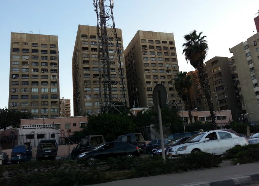
Again, not much to go on, but in the top right corner of the image there’s something that might be a billboard on top of an apartment building, and that would match with the video if it was filmed from the right of the picture. That certainly seems to point to the area being worth a closer look, so back to the satellite map
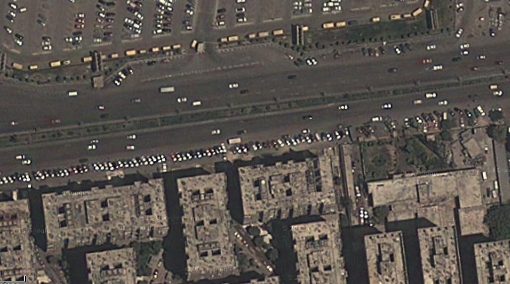
The aerial tower would be over to the far right, and as there’s no buildings on the north side of the road we can should take a look at the three buildings on the south side of the road. I’ve rotated them slightly here, and taken the rough sketch I did and turned it 180 degrees
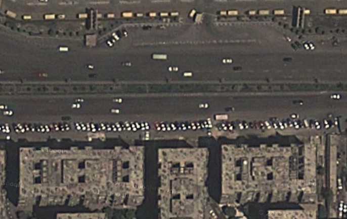

It would seem that this is a good match, the outline of the buildings match, and on the north side of the road there’s even a small structure on the left in the position where the camera appeared to be. There’s one final image that confirms this is the location. This image is taken from Google Maps, tagged to the left of the area we are looking in, but the locations aren’t always 100% precise
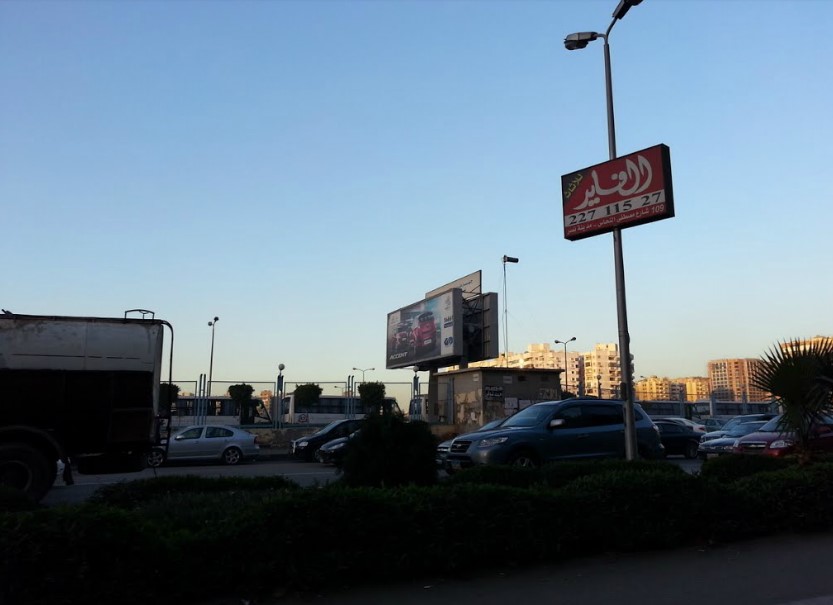
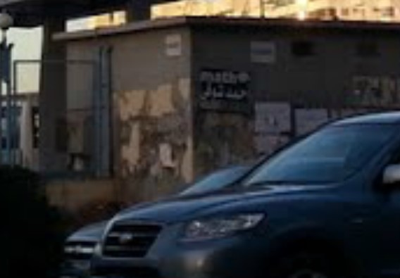
Here we see the small structure on the north side of the road, and we can actually confirm the exact location the video was filmed. This image shows a close up of the structure
Here’s the structure in the video
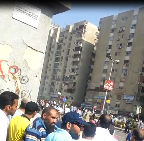
Note the flaking finish on the wall, how the missing finish on the corner is slightly higher than that on the left. Also note to lip of the roof, and the white poster at the top of the wall. In both the photograph and the video they both match. Using all the evidence available it seems 100% certain this was the exact location that the video was filmed from, around 800 meters to the east of the Rabaa Adawiya mosque, where many of the wounded and dead were taken.
What this has hopefully demonstrated is some of the techniques that can be used to confirm the locations videos were filmed, and that even from a short, badly filmed clip you can extract a lot of useful information.
