Torching And Extortion: OSINT Analysis Of Burning Agriculture In Iraq
In early May 2019, it was reported that agricultural areas of central and northern Iraq were being set ablaze — allegedly by remaining pockets of fighters from the so-called Islamic State.
The motive was said to have been punishment of farmers who refused to pay protection money to the terrorist organization. There is evidence that in the no-man’s land between Kurdish positions near Makhmour and federally-controlled Hamrin, ISIS members have been torching crops to force farmers to pay them taxes:
Exclusive footage: ISIS militants have been seen in 27 villages around Qarachogh, Iraq, demanding taxes from farmers and torching fields of those who refuse to pay. pic.twitter.com/FjPjBTqig9
— Rudaw English (@RudawEnglish) May 15, 2019
In Diyala governorate, similar tactics were used against Kurdish-populated villages. According to Kurdish farmers, this is also an attempt to drive them off their lands, as there have been a number of attacks targeting Kurdish farms in disputed areas near Taz Khurmatu in Salahadin governorate, and near Khanaqin, Diyala province — these came without warning or demand for ransom. Similar incidents have also been reported south of the Mosul lake in Ninewa governorate.
Eventually, the Iraqi government was forced to respond. It provided different statements, initially denying the link between ISIS and the crop fires, saying it’s a practice by farmers to fertilize the soil, only to state the next day that they will investigate the fires and prosecute those responsible:
وزير الزراعة يحضر اجتماعا برئاسة النائب الأول لرئيس مجلس النواب لوضع حد لحوادث حرق المحاصيل الزراعية حضر وزير الزراعة…
Geplaatst door اعلام وزارة الزراعة العراقية op Dinsdag 21 mei 2019
وزارة الزراعة : ماتم حرقه من مخلفات الحقول في بعض المحافظات قضية علمية ولا علاقة لها بالتخريبتبين وزارة الزراعة ان حرق…
Geplaatst door اعلام وزارة الزراعة العراقية op Maandag 20 mei 2019
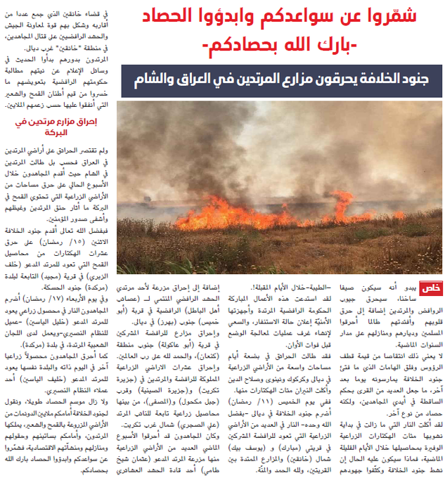
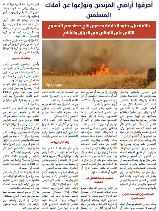
In late May, the al-Naba newsletter, produced by ISIS, published an article on this tactic. The article began with: “Roll up your sleeves and begin the harvest: God bless your harvest. Soldiers of the Caliphate burn the farms of the apostates in Iraq and al-Sham, IS warns of a ‘hot summer’.” It provided a number of claims of attacks on farms and farmlands in Iraq and Syria, providing names of towns in Diyala, Ninewa, Salahadin, Kirkuk, and also in Deir ez Zor and Hasakah.
On May 30, the newsletter put out a new article: “Burn the land of the Apostates and avoid the properties of Muslims.”
This second article claimed attacks on farmers and croplands in various towns and cities in Salahadin, including Shirqat and Haditha, as well as smaller villages in the Abbassi district in Hawija, south of Kirkuk, and a number of orchards and crop fields in Diyala. It also claimed responsibility for attacks on firefighters, which resulted in the killing and wounding of a number of them. Attacks on electricity generators and tractors were also claimed.
Scorched-Earth Tactics
Burning down crop fields is not a new phenomenon as far as ISIS is concerned, as even in their pre-2014 insurgency phase, they often deployed this tactic of destroying the livelihood of Iraqi farmers. This was a tactic also used by Shia militias to take revenge on Sunni families. The scorched-earth method has and does still pose major problems for Iraqi food security, employment, socio-economic opportunities, and environment.
The recent uptick of attacks indicates ISIS will continue to resort to crop destruction as a way of extorting money to fund their operations, or as a revenge tactic against Iraqi communities.
In my Burning Borderlands article, I previously looked at how wildfires in Kurdistan caused by military activity created severe problems, ranging from displaced communities to firefighters being killed while on duty.
This article will briefly explore the trail of agricultural destruction in central Iraq, using open source methods and remote sensing to underscore the importance of this overlooked consequence of conflict and will provide a brief background on the importance of agriculture in Iraq.
My research visualizes the size and locations of burned vegetation and crop lands as seen on Sentinel-2 satellite imagery in central Iraq throughout the month of May. Such visualisation can be helpful in understanding the scale of the problem and should ideally spur a response to address issues in affected communities.
While it is often possible to link burned areas to specific attacks, this is not always the case and its important to make this disclaimer: Damaged crop fields or other burned areas can also be caused by residue burning done by farmers, accidents with cigarettes, sparks carried over from other fires, or even sheer coincidence — for example, pieces of glass magnifying sunlight and thus setting dry vegetation on fire. Yet one must also note that controlled fires usually differ visually from arson attacks and accidents, as I will explain below.
Cradle Of Civilisation: Importance Of Agriculture In Iraq
Mesopotamia, the part of Iraq located in the Euphrates and Tigris valley, is often cited as the world’s first civilisation, where agriculture was key to this development of society.
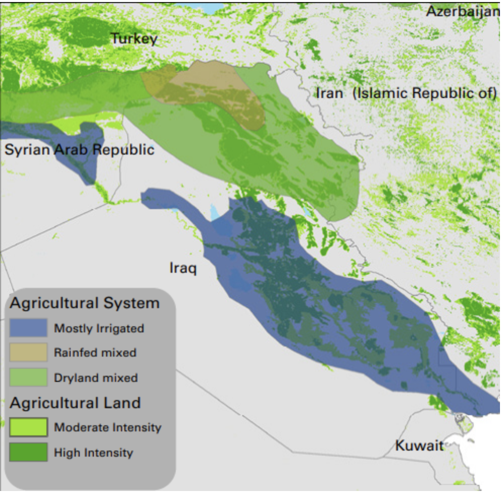
Throughout the ages, agriculture has been crucial for rural economies — and it still is. Current data provided by the UN’s Food and Agriculture Organisation (FAO) states that one third of Iraq’s population, roughly 12 million people, live in rural areas and are dependent on agriculture for their livelihoods and jobs.
Crop production constitutes 74% of the agricultural income in Iraq. Prior to the conflict with ISIS, there were already concerns expressed by the UN on environmental damage caused by climate change, deforestation, and mismanagement, all of which impacted food security, while the ICRC warned of the precarious status of Iraq’s agriculture.
With the rise of ISIS in 2014, the situation in the agricultural sector rapidly deteriorated due the influx of IDPs, destroyed irrigation equipment, looted materials, and abandonment of agricultural lands under threat of violence from the conflict, as per this 2016 FAO assessment of liberated areas.
In their 2017 report, FAO warned of how the conflict has seriously impacted Iraq’s agricultural sector. The report noted that, “Harvested wheat, barley and vegetables were lost due to population displacements, looting and the burning of grain bin.” It also pointed out that, “Severe damages to agricultural infrastructure were reported in liberated and ongoing conflict areas, including damage to food storage and crop processing infrastructure, as well as significant farm equipment losses.”
In another assessment of the impact of ISIS on the agricultural sector in Iraq by the Regional Food Security Analysis Network (RFSAN), the researchers found that, “Throughout its occupation, ISIS has looted harvests and agricultural equipment, sabotaged storage facilities, and poisoned land as a form of collective punishment. In the most extreme cases, agriculture itself has been militarized [emphasis mine] as irrigation pipes have been appropriated to make Improvised Explosive Devices (IEDs), and agrochemicals and fertilizers have been used to make weapons and bombs.”
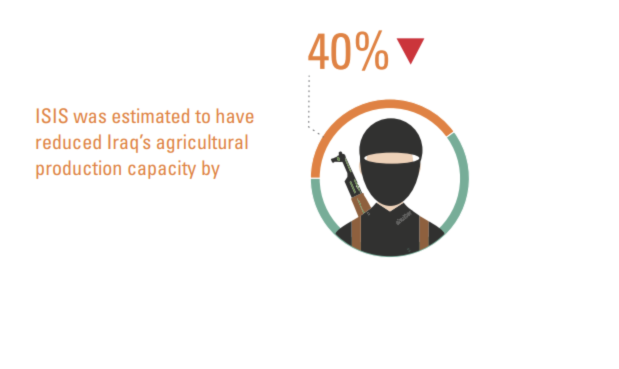
According to the report by FAO, ISIS was responsible for a 40% decrease in agricultural production. Graphic source: FAO
These and other alarming observations were frequently reported by local and international news outlets. They strongly indicate how issues surrounding food security are exploited by ISIS.
At the same time, while ISIS faced less pressure during the relatively stable period in the areas that weren’t directly witnessing armed conflict, the group also profited from agricultural income, as this provided them a way to collect taxes and fund their war machine.
A GIS and remote sensing analysis of crop production in areas controlled by ISIS in the period 2014-2015 demonstrated the continuation and sometimes even improvement of crop growth.
This analysis was also supported by research of Lundt University, in which researchers Lina Eklund and others analysed cropland under ISIS rule. According to their remote sensing analysis, ISIS controlled 15% of all Iraq’s cropland at the peak of their power in June 2015. Their findings state that, “The emergence of the IS [ISIS] and the related violence have reshaped the agricultural landscape of Iraq and Syria in some areas, but that low-intensity agriculture has generally been maintained and even expanded in some places.”
There have also been reported cases wherein Afghan ISIS members grew poppies for opium production. It was claimed that over 16.000 square metres of poppy fields were burned in Sharqat, near Qayyarah, after being retaken from ISIS in October of 2016. No visual evidence via remote sensing in the area has been found to support this claim, though earlier reports, from 2008, noted an increase in opium production in Al-Qaida controlled areas such as Diyala in Iraq.
In areas about to be retaken by the Iraqi army and the Kurdish Peshmerga, ISIS resorted to pillaging and destroying agricultural infrastructure, or else laid waste to the lands as they retreated, or else destroyed irrigation systems and equipment. And in Sinjar, destruction of irrigation systems by ISIS severely impacted the livelihoods of people, as documented by Amnesty International in their 2018 report Dead Land.
The practice of targeting agriculture is as ancient as warfare itself, as food security is key to survival for communities and cities. Taking away the means for survival impacts both civilians and the military. This is something that farmers, in many countries the cornerstone to society, have all but too often felt when being targeted in conflicts and insurgencies.
A similar scenario has now unfolded again in Iraq and this is my attempt to visualize the scale and intensity of these tactics.
Collecting The Data: A Short Guide
I made use of various remote sensing tools that provide imagery from NASA’s Landsat 8 and ESA’s Sentinel-2 to link stories found in local, national, and international reports with satellite imagery of those locations. This helped to understand the location and scale of the burning.
Where possible, I aimed to support the imagery with reports from various news sources that provide an indication as to what the cause of the burning could have been, but this was not always possible to pinpoint. This effectively means that other non-conflict related triggers could have been the source of fires.
Therefore, I mainly included areas of burned land that can be directly linked with media reports, or where the probability of such a link is quite high, as the fires occurred in known military activity hotspots.
Other practices, such as burning of residue crops or burning of top layers of vegetation to make the soil more fertile for future use, must also be noted as frequently occurring. However, these practices can be spotted more easily as the boundaries of those fires are often similar to the boundaries of the square crop fields, while uncontrolled wildfires stretch over different patches of land in an irregular shape.
Also, harvested land that is subsequently burned is also distinguishable from land that isn’t harvested by using the vegetation colour as indicator, as the harvested land has different colours that areas that have not been harvested. Lastly, due to many reports on the attacks, it is possible to link the areas where the attacks have taken place with burn scars appearing on satellite imagery, making causation obvious.
Burned areas are relatively easy to spot with low-resolution imagery, such as that via Sentinel-2, which has a 10-meter resolution, as well as Landsat 8, with a 30-meter resolution.
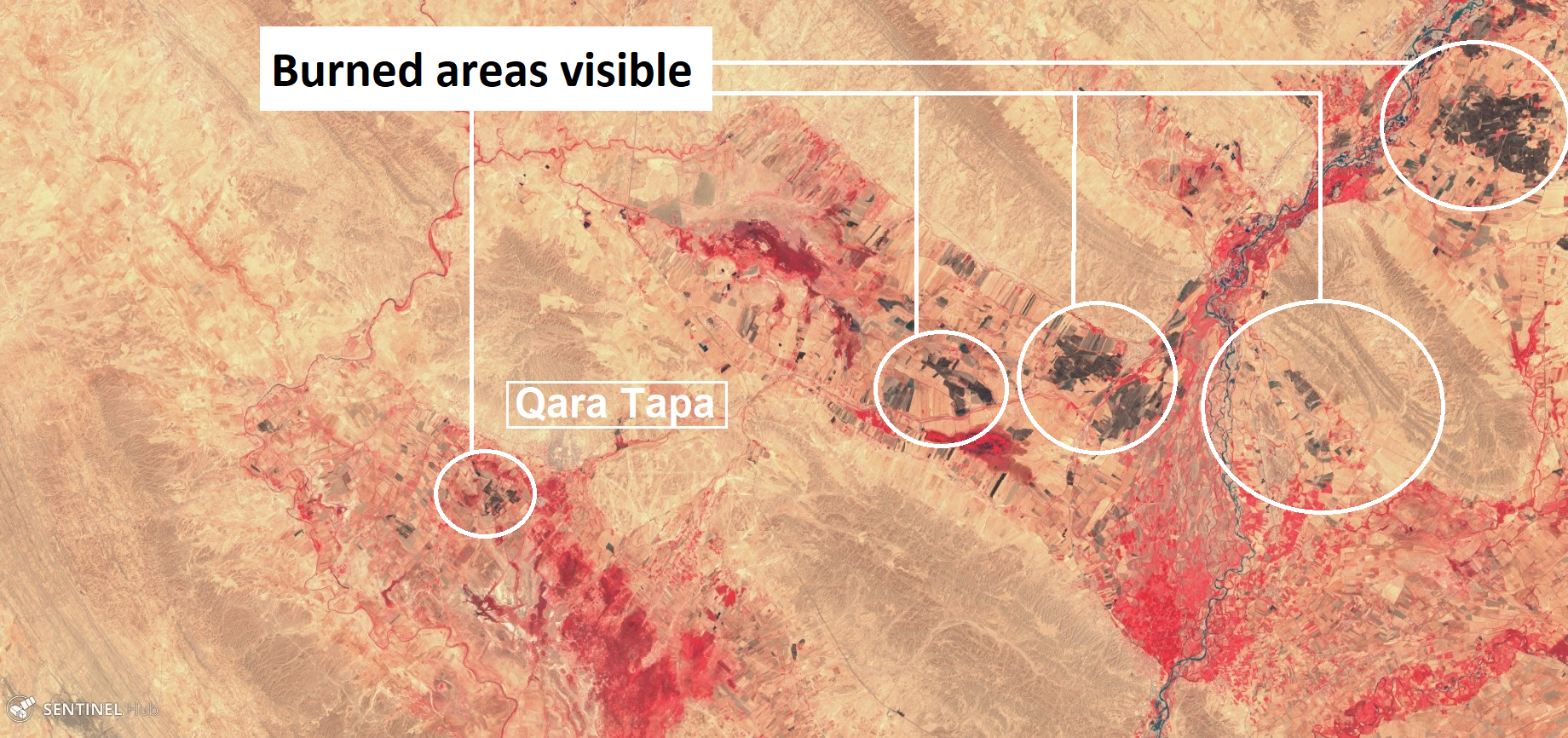
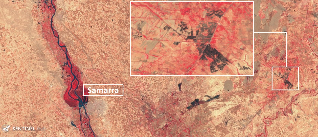
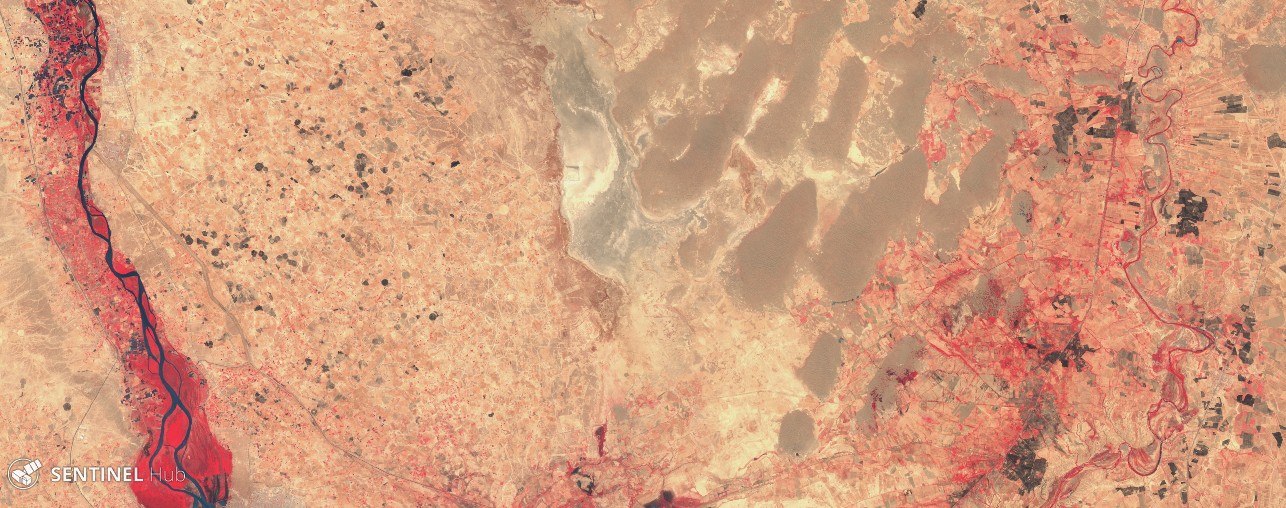
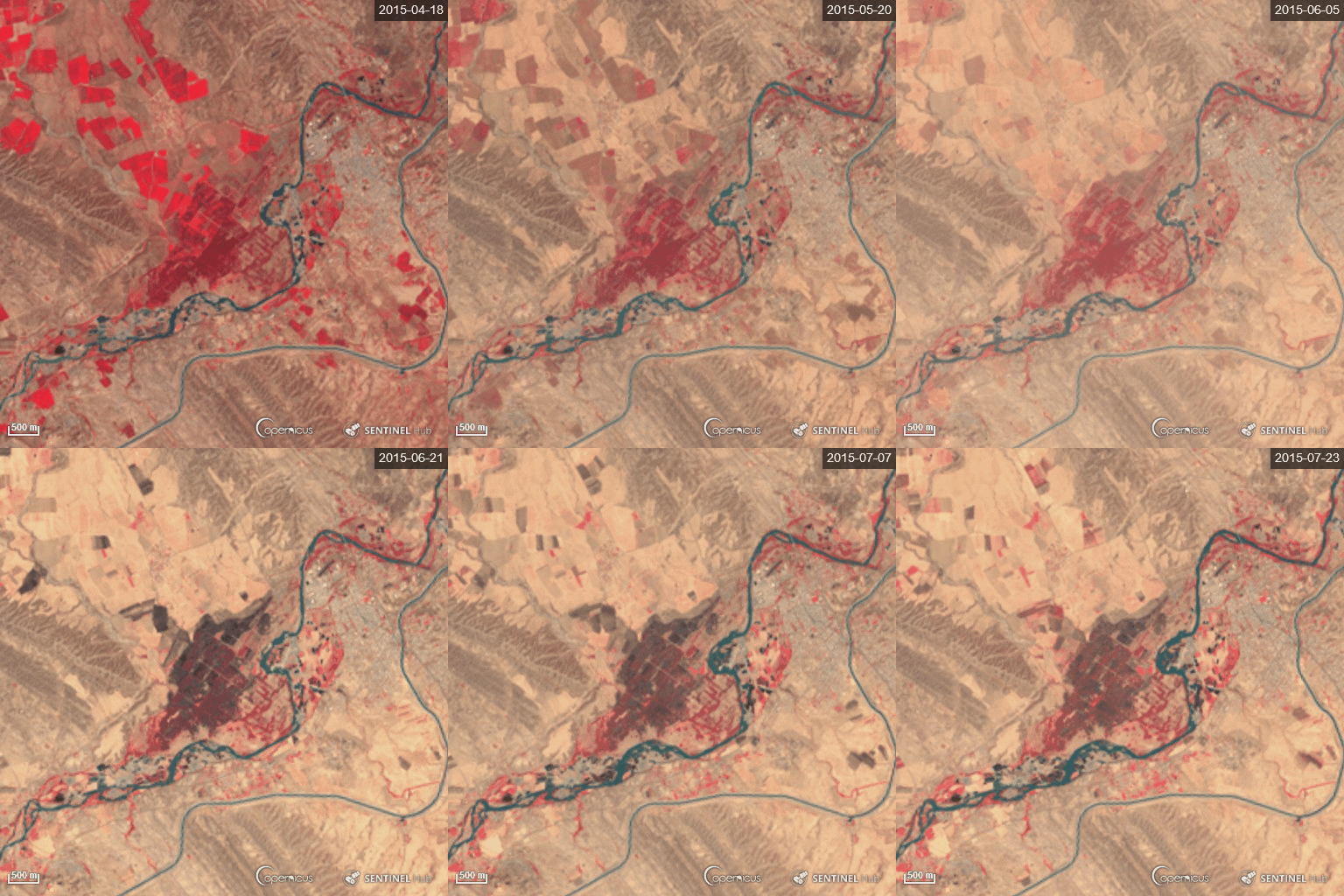
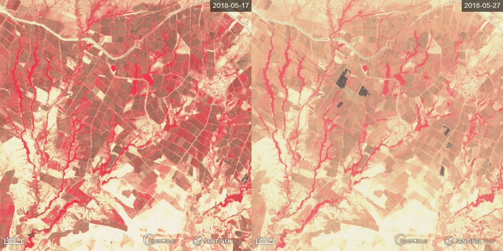
Various visual bands such as colour-infrared can be used in programs like Sinergise Sentinel Hub’s EO Browser to help spot the colour difference between healthy vegetation and areas affected by the fire, and to measure the size of the burned areas. For this article I made use of the Color Infrared (Vegetation) index, which makes it easy to spot burned land, which is black in colour, versus vegetation, coloured in shades of red.
There are also custom-made scripts by experts like Pierre Marcuse who combine different bands to spot fires, which I also made use of in my research. Meanwhile, open access to satellite imagery from NASA and ESA has been made easier through platforms like Sentinel Hub, EOS Landviewer and USGS Landsat Look, which can be incorporated in free GIS programs like QGIS to easily map burned areas.
Another tool that is helpful in spotting fires is the Active Fire Data set collected by NASA’s MODUS and VIIRS satellites. These satellites pick up heat signatures from all kind of sources, be it the oil industry’s flaring gases to the heat of wildfires. When you filter out the data from known sources, such as oil installations, the remaining data can be very useful to identify potential fire outbreaks. The datasets are made available through their portal and can be downloaded into your GIS program, but are also made available online through the website fires.ru, making life even easier. See below an example of what that website is showing for Hawija, south of Kirkuk in central Iraq:
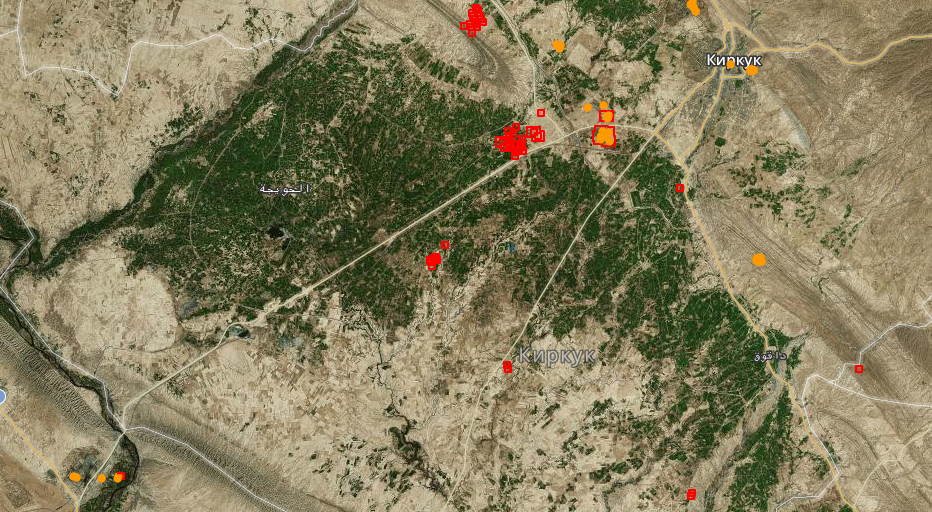
Overview of heat signature spotted with satellites, made available through fires.ru — note that most orange spots are flares from the oil industry
Another note to make is that due to the increase of rainfall in late 2018/early 2019, there has also been an increase in vegetation growth. The current heatwave in Iraq has also resulted in rapid withering of the vegetation, making it more vulnerable to fires.
ISIS: A History Of Arson Attacks
In mid-2014, ISIS went on a swift offensive throughout Iraq, combining their forces coming in from Syria with local insurgent groups to take over large parts of the country’s north. ISIS took the wheat harvest from farmers to sell it on the Kurdish or Iraqi markets, making millions of dollars which would flow back into the group’s revenue stream.
In Diyala, in northeast Iraq, the group started to target farmlands in July of 2014 as the fighting heated up and they were pushed back. According to a local news source, the insurgents deliberately fired mortars into the wheat fields they lost control of. This article from 2017 has a local official referring to an attack in May of 2014:
“The largest [fire] was on May 8th, 2014 when wheat farms in the town of Qarah Tabbah [also known as Qara Tapa] that stretch over 500 dunams, were torched by ISIS elements.”
Landsat 8 doesn’t show any burned areas in May of that year, but it does show large burned areas in July 2014, which could indicate that the official remembered wrong, or that another attack took place around those dates.
Another report, this one by the Institute For the Study of War, stated that the group “burned thousands of acres of crop” near Samarra in May, 2014. I only found one location northeast of Samarra which indicates that cropland in May was burned, but am currently unable to verify if this was the location as indicated in the report.
There are burned crop circles visible in late May 2014 and early June, yet most of those seem to have been done post-harvest — as these are likely controlled burning of crop residues, based on the burn patterns.
The use of crop torching as an extortion tool came into greater focus in 2015, as a report on ISIS activities indicated that the group was stepping up this practice in Kirkuk as they lost access to the oil field in the Hamrin mountains. When Iraqi and Kurdish forces made progress in pushing ISIS back, the group started to destroy the areas they had to give up. One such area was Dibis forest, Iraq’s second largest remaining lowland forest, located in the mountainous area east of Kirkuk.
As described by a farmer to environmental journalist Peter Schwarzstein for his 2016 article on ISIS scorched-earth policies throughout northern Iraq: “Never before, though, had people deliberately torched our fields. Never had they tried to completely wreck our livelihoods. Never have we encountered such animals.”
These practices continued even after ISIS lost control over its territory. On May 17, 2017, they claimed an attack in Diyala that burned down 350 dunams, i.e. roughly 90 acres, of wheat. Satellite imagery shows burned areas north of the city of Adaim (also known as al-Azim) that appeared between May 12 and May 22.
In 2018, a handful of incidents around burned croplands linked to ISIS attacks were reported on, most of them in Hawija and around Kirkuk, such as this burned crop area in Qara Tapa on May 24:
After they lost control over territory in Iraq, the group continued their operations in Hawija.
Local media reported that in June of 2018, ISIS insurgents burned down wheat and barley crops in Hawija as means to pressure local communities to provide support to the group. A number of burn scars are visible in the period reported, though it’s unclear which ones are caused by attacks and which ones are the result of burning crop residue. At the same time, in Sunni areas around Mukhdadya in Diyala, Shia militias were blamed for fires used as a means to displace farmers, which underscores that these appear to be methods used by various armed groups in Iraq.
2019: Stepping Up The Tactics Of Burning
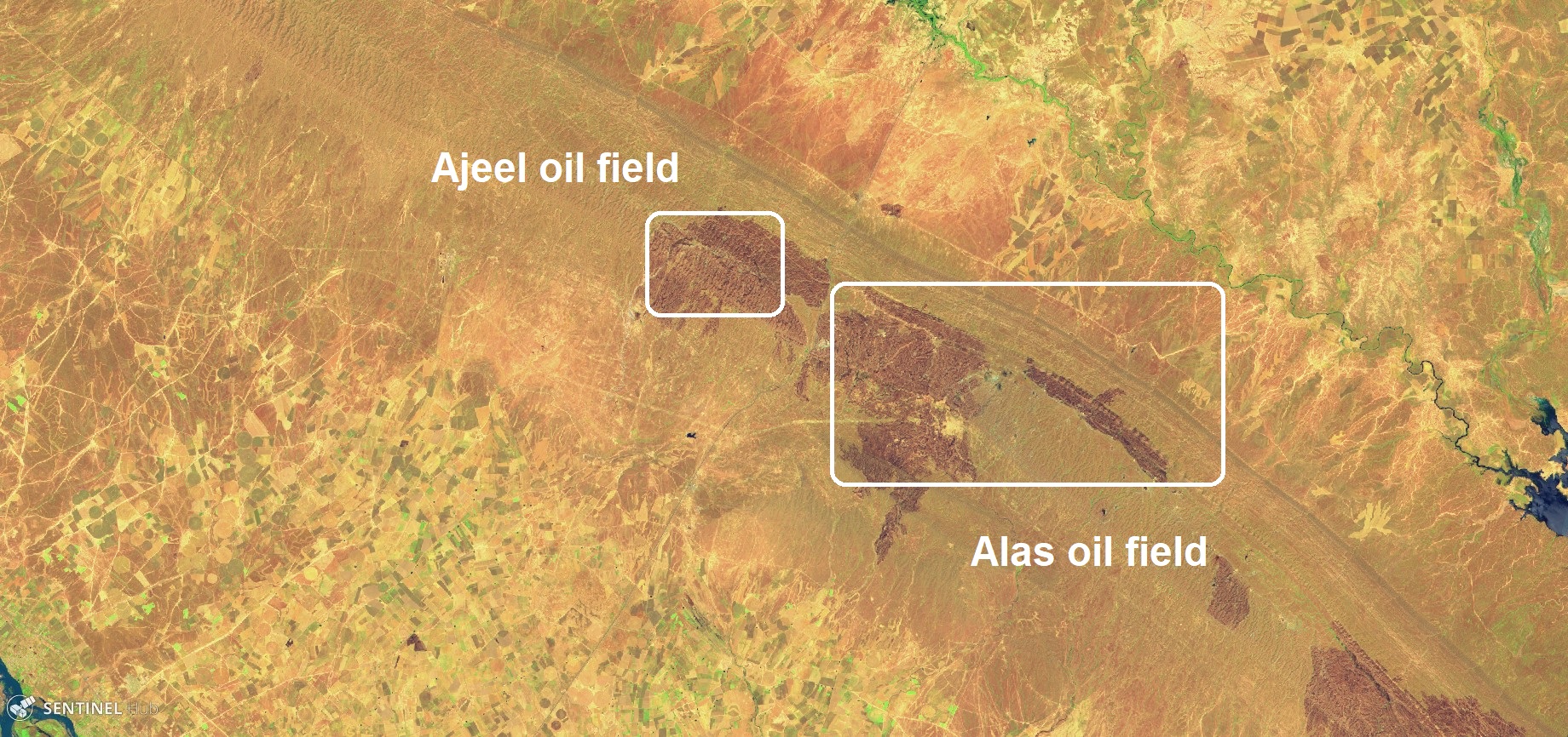
In May of this year, multiple reports of wildfires in the provinces of Kirkuk, Salahadin and Diyala were were coming in via social media and news media. Large fires destroyed orchards, wheat, and barley crops fields — and have threatened to encircle military installations and critical infrastructure such as oil fields.
A significant portion of these attacks have been linked to ISIS insurgents, as their own press agency, Al Amaq, soon claimed responsibility for the fires, in particular in the area around Makhmour, Hawijah, and in Diyala (around the city of Khanaqin in particular) and Salahadin, where ISIS cells are active.
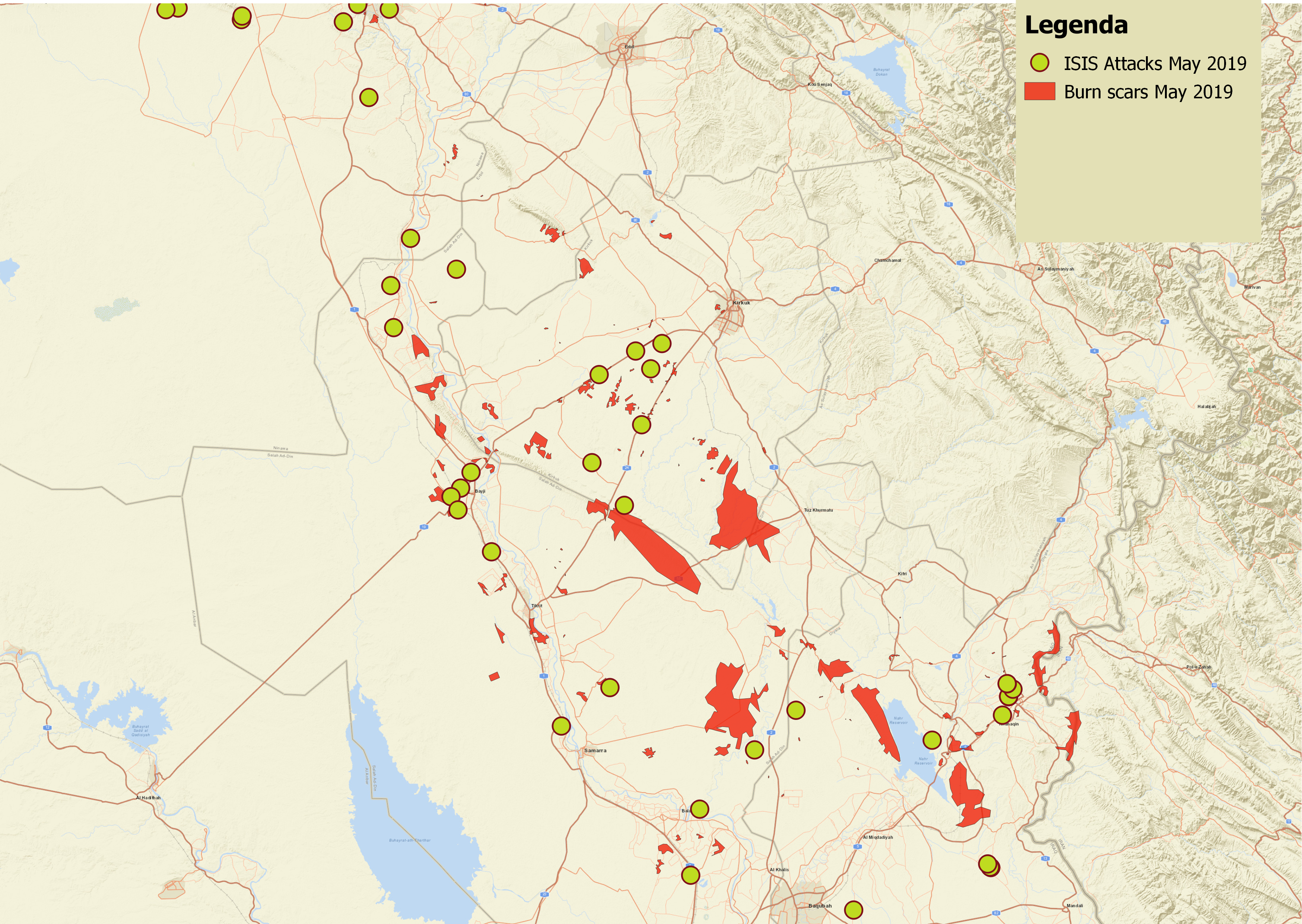
The outbreak of fires increased after May 17, and at the time of publication of this article, I have counted roughly 150 large, medium and smaller sites with burn scars using Sentinel-2 imagery. A quick and dirty measurement with Sentinel’s Hub EO Browser tool showed that the total size of the burned areas at those 150 sites is at least 1000 square kilometres combined.
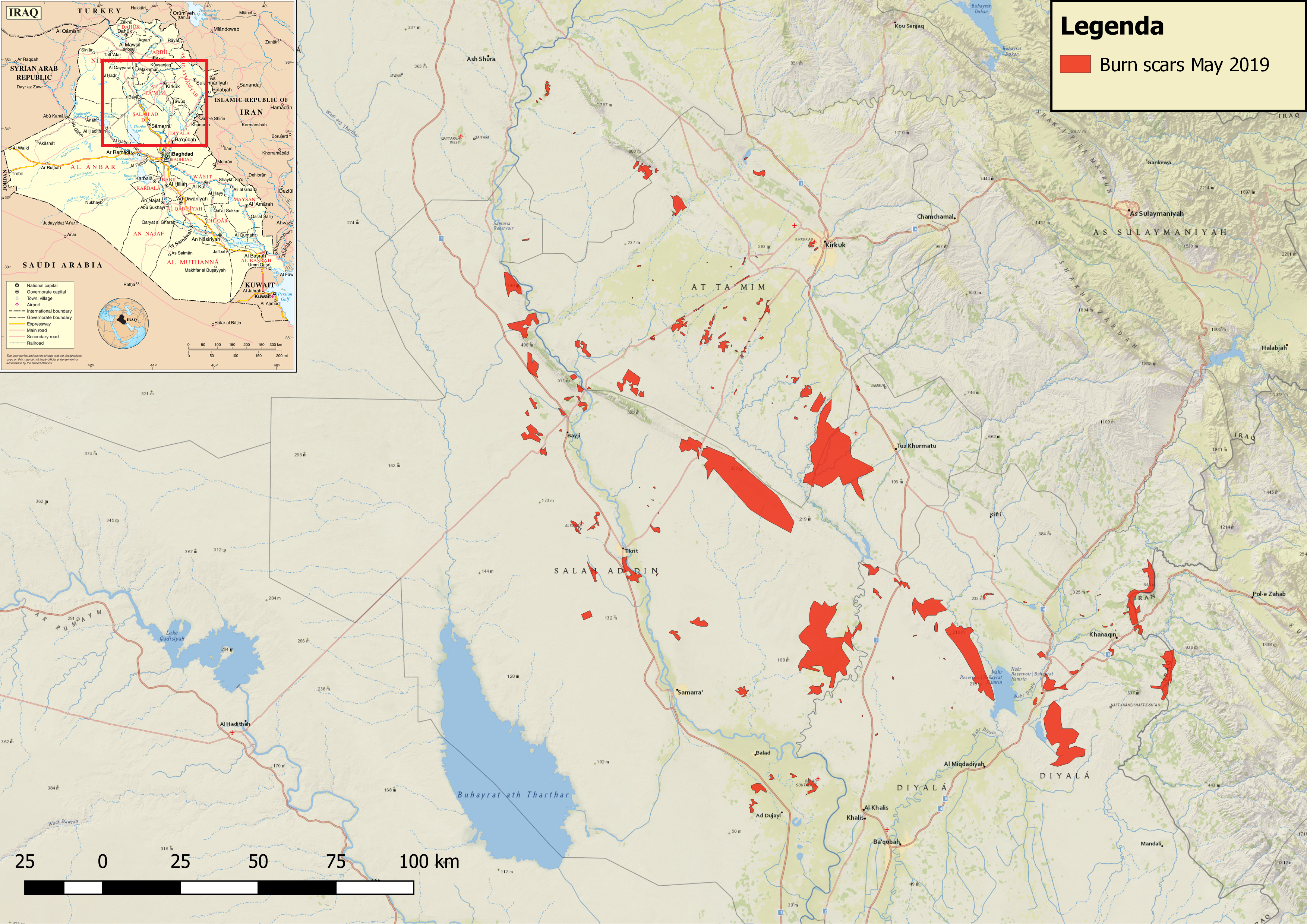
Overview of burned areas focussed on Kirkuk, Salahadin and Diyala governorate. Made with Sentinel-2 and QGIS
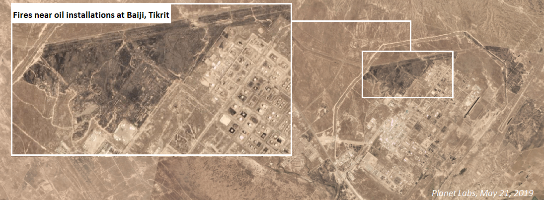
Not only did the fires result in the destruction of agricultural land, there were also fires near critical infrastructure such as power plants, oil fields and refineries around Hamrin and Baiji, which were caused by insurgent attacks, IEDs, and arson.
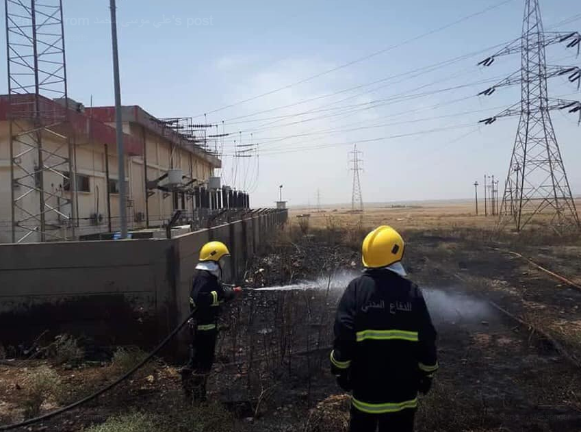
Firefighters putting out flames outside a powerstation near the Baji oil refinery, May 2019. Source: Twitter
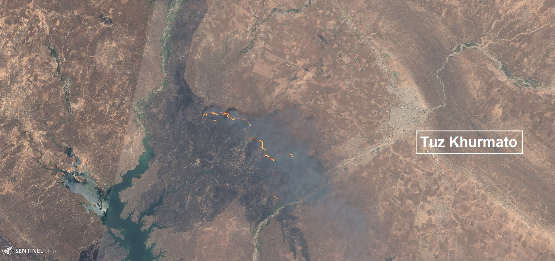
220 square kilometres of burning vegetation and crop land south of Tuz Khurmato, May 26, 2019. Via Sentinel-2
Other causes of these fires could be a combination of an ongoing heatwave in Iraq with airstrikes by the Iraqi Air Force against ISIS insurgents — for example in the Hamrin mountains.
Reported incidents — for example, the work done by Tomasz Rolbiecki and by LiveUAMap — can provide an insightful overlay to see if burned areas are likely to be linked with claimed ISIS attacks or military operations.
With what is yet another disturbing tactic that must be noted, ISIS members prevent the extinguishing of the fires by reportedly puttings IEDs in the fields to hinder firefighters. This is something that they did at the Qayyarah oil fields in 2016 as well, to prevent access to the burning wells.
Video shows #Kurdish owned agricultural lands and corps in #Daquq town near #Kirkuk burned by #IS terrorists .
According to local media reports IS bombing killed 5, injured 10 farmers who were extinguishing fire . pic.twitter.com/3oTGWJUjZk— Blesa Shaways (@Bilesa_Shaweys) May 26, 2019
Other major fires have occurred around the Speicher Air base near Tikrit, though these are alleged to be caused by flares from helicopters:
قصة الحريق في مدينة تكريت قرب قاعدة سبايكر غير مفهومة
الحشد يقول إن الأمريكان ألقوا مشاعل حرارية للتشويش تسببت بحرق الحقول المجاورة
لكن التشويش على من ولماذا؟!
أما حكومة عبد المهدي فصامتة لحد الآن ولا كلمة pic.twitter.com/Tgz1JkJuSF— حسين دلّي (@hu_dly) May 9, 2019
On Twitter, photos of various devices that were allegedly used to start the fires have appeared, though these images cannot independently verified:
The governor of Salah AlDin said
We find materials used to burn pic.twitter.com/2kfsmtmEpx— Ali Sahib (@ali731981) May 18, 2019
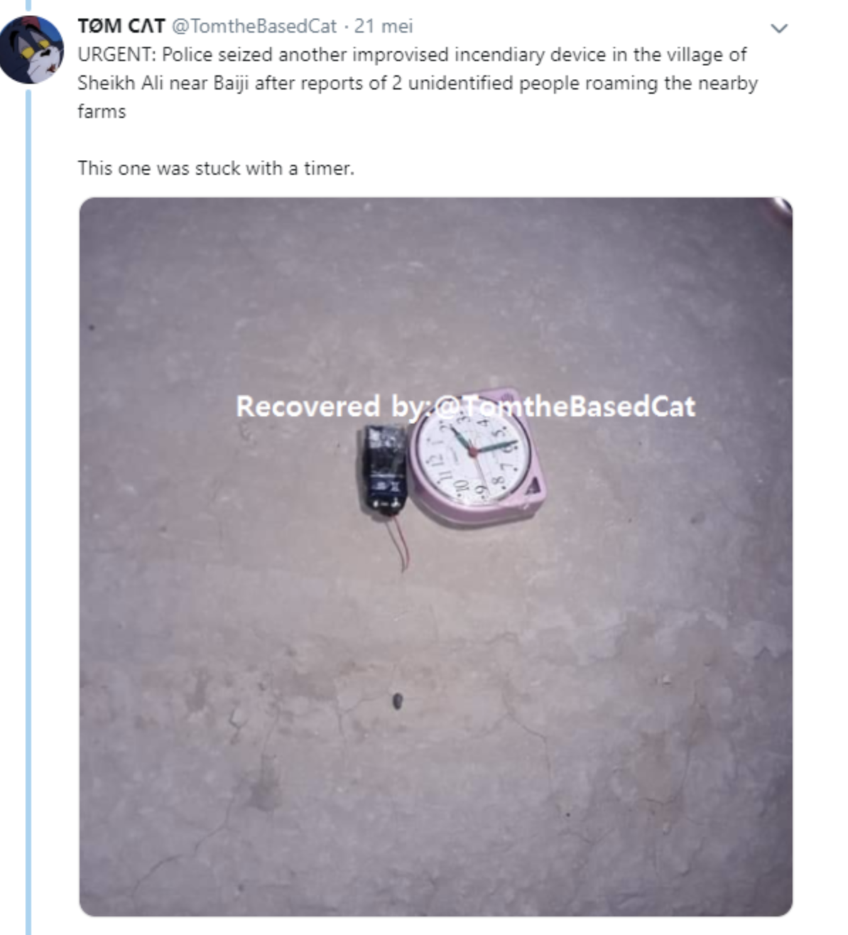
Another image of a device reportedly found near Baiji, Iraq. Source: Twitter
Conclusion
Based on open source reporting and available satellite imagery, the fires in May alone have already burned over 1000 square kilometres of land in central Iraq at least 50 sites, with a considerable amount being agricultural lands and orchards. This increased fire activity has combined causes, ranging from attempts by ISIS to displace farmers and extort money and as a scorched-earth tactic, to local gangs using it for extortion. Other causes include IEDs, counter-ISIS air strikes and, often, just plain accidents.
Considering that these events occurred on a much lesser scale in previous years, (based on a quick and dirty review of satellite imagery of the affected areas during harvest season in the period 2016-2018), and that quite a few started at night, ISIS insurgents are likely responsible for the bulk of the fires — as these can create maximal result with minimal effort.
This is another worrisome development of the weaponization of the environment, in this case croplands and other vegetation, to displace people and ruin their socio-economic opportunities by literally burning down their livelihoods.
In a call by FAO at the 2018 donor conference, it was urged that, “Restoring the crucial agriculture sector that has been severely damaged by ISIL’s [ISIS’] takeover of vast areas of Iraq is critical to the country’s recovery from years of conflict and to its long-term prosperity.” This issue remains pertinent today.
The current scorched-earth tactics applied by ISIS is putting an extra recovery dimension for post-conflict reconstruction programs carried out by the Iraqi government. Destroyed harvests and farms will require additional funding for recovery for local communities to rebuild their lives. Moreover, because this tactic is used as a tool for displacing farmers from minority groups in disputed areas, affected communities consequently require more local peace-building and reconciliation work.
Current open source mapping with the use of rapidly developing easy remote sensing tools can help in estimating the scale and intensity of the situation on the ground.
Weaponization of the environment in all forms and methods is on the rise, and we urgently need to hold those responsible accountable for their actions, as well as to better prepare our response to the environmental impact of conflicts on human lives and livelihoods.
I Would like to thank Nathan Ruser @nrg800, Harel Dan @Hareldan, Tomasz Rolbiecki @tomaszrolbieci for all their GIS and data support, Maha Yassin @mahaalghareeb for translation, Ali Sahib @Ali73181 for additional sources and information and Peter Schwarzstein @pschwarzstein for background information
