Civilians Trapped in Al Fashir as Rapid Support Forces Advance
A staggering 8.8 million people have been displaced since the start of the Sudanese Civil War in April last year, as the Rapid Support Forces (RSF) and Sudanese Armed Forces (SAF) battle for control of the country.
Currently the RSF is trying to take Al Fashir, the largest city in the Darfur region, and the last stronghold of the Sudanese Army in Darfur. The city has become a refuge for people fleeing nearby villages and towns and its population has swelled with internally displaced people. Conditions in the city are dire. The fighting has effectively cut the city off, with both sides striking critical infrastructure in the city, severely limiting access to healthcare, food and safe shelter.
Bellingcat worked with Sudanese Fact Checkers at Beam Reports to examine the escalating conflict in Al Fashir and understand its impact on civilians. Bellingcat used open source footage and images, satellite imagery as well as other remote sensing tools to monitor the latest escalation through May and June.
The Under-Secretary-General of the UN Alice Nderitu recently warned that the situation in Sudan “bears all the marks of risk of genocide,” and the International Criminal Court on Tuesday called for information – including any footage and images- from the ground in Darfur and Al Fashir to analyse alleged war crimes.
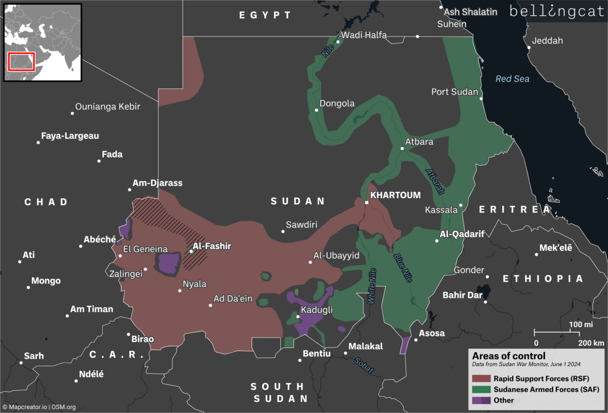
The Strategic Role of Al Fashir
Al Fashir is considered a strategic military location as it is positioned near the southwestern border leading to Chad and South Sudan. The RSF have developed weapons supply lines from Libya through Chad. The city also connects with the country’s north and is considered the only entrance for humanitarian aid convoys coming from Port Sudan on the Red Sea coast, from which aid is transported to the rest of the region. The strategic importance of the city has been outlined in more detail by our partners at Beam Reports, here.
The Rapid Support Forces have taken control of all other major cities in Darfur. Al Fashir is considered the last stronghold of the Sudanese army in the region and the Sixth Infantry Division is stationed in the city. Google Maps indicates a military base is located near the city centre, around here 13.628851, 25.349538 where a number of government buildings are located. The base is a few kilometres east of the city’s airport, where the Sudanese Army is reportedly relying on airdrops to resupply.
Most of the main roads out of the city are either closed, subject to significant movement barriers, or are unsafe due to the presence of military activities and armed groups, according to the UNOCHA.
Population Density of Al Fashir and Impacted Areas Geolocated by Bellingcat
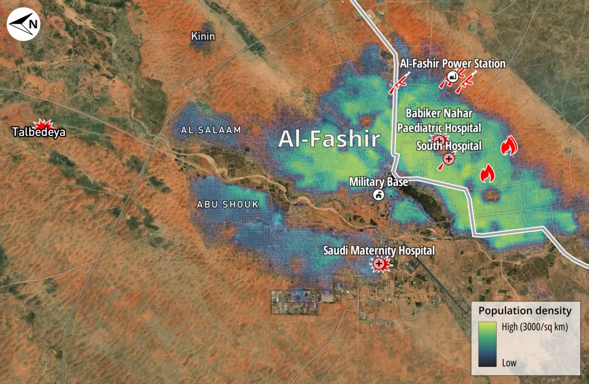
Population density is based on 2020 estimates from WorldPop, a dataset produced by the University of Southampton from a synthesis of official demographic data and land use. In recent months, an estimated 190,000 internally displaced persons (IDPs) have found shelter in Al-Fashir, according to the United Nations Population Fund.
Use of Heavy Weaponry in Urban Areas
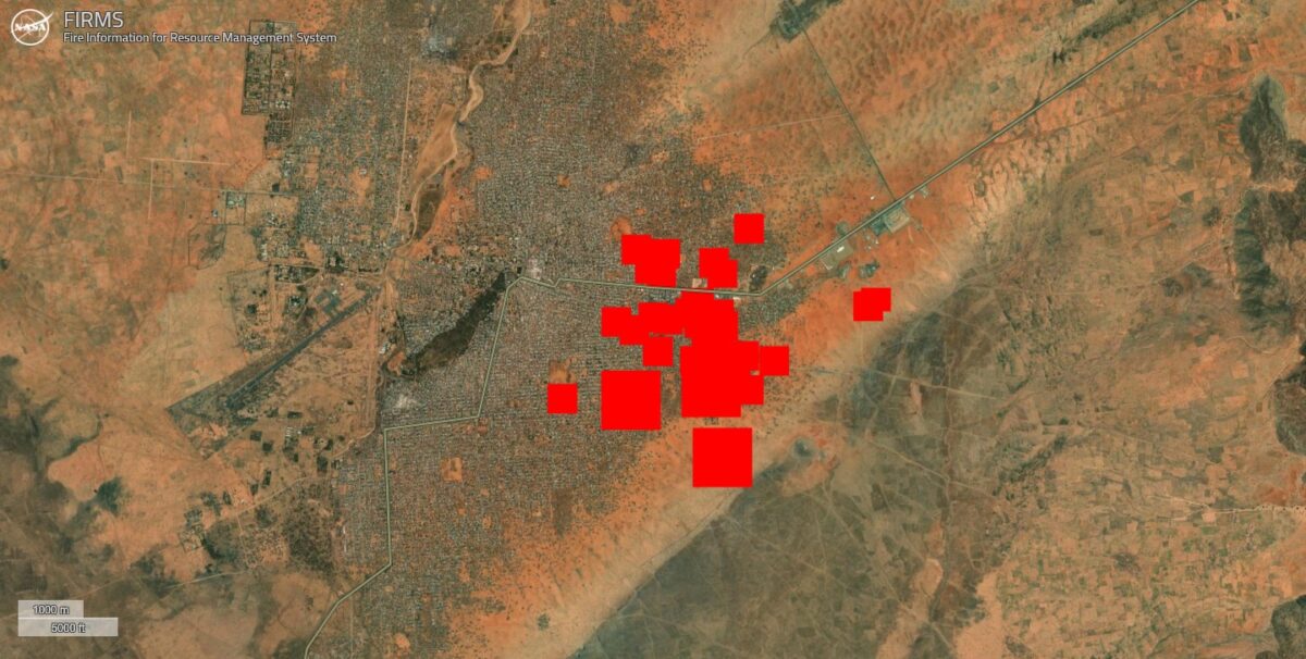
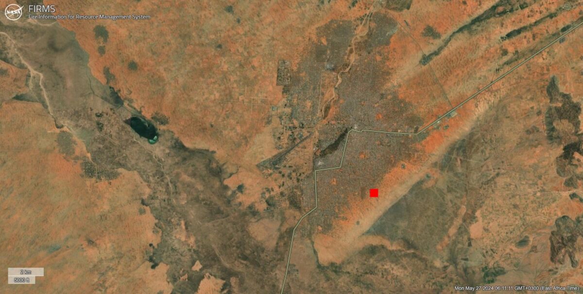
A key feature of the battle for Al Fashir has been the use of heavy weaponry within urban civilian areas. As forces from different sides take up positions within the city, indiscriminate airstrikes – the kind seen in Khartoum, have taken place. FIRMS data show heat signals around the eastern part of Al Fashir where the most intense fighting has been occurring.
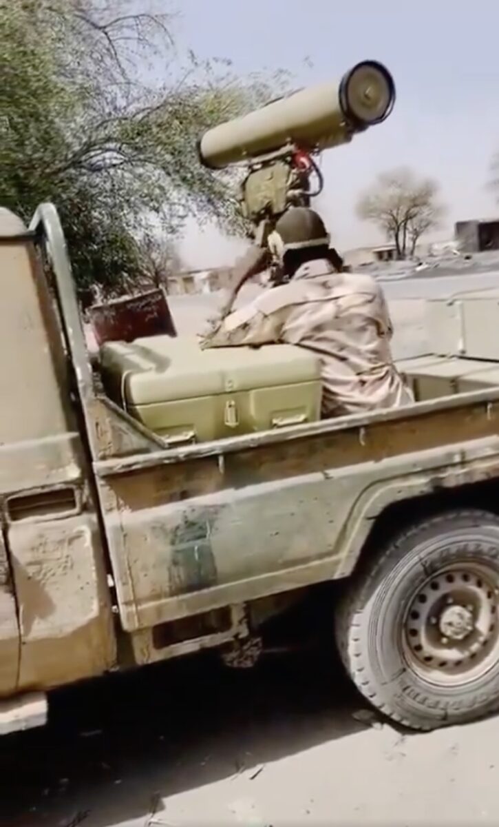
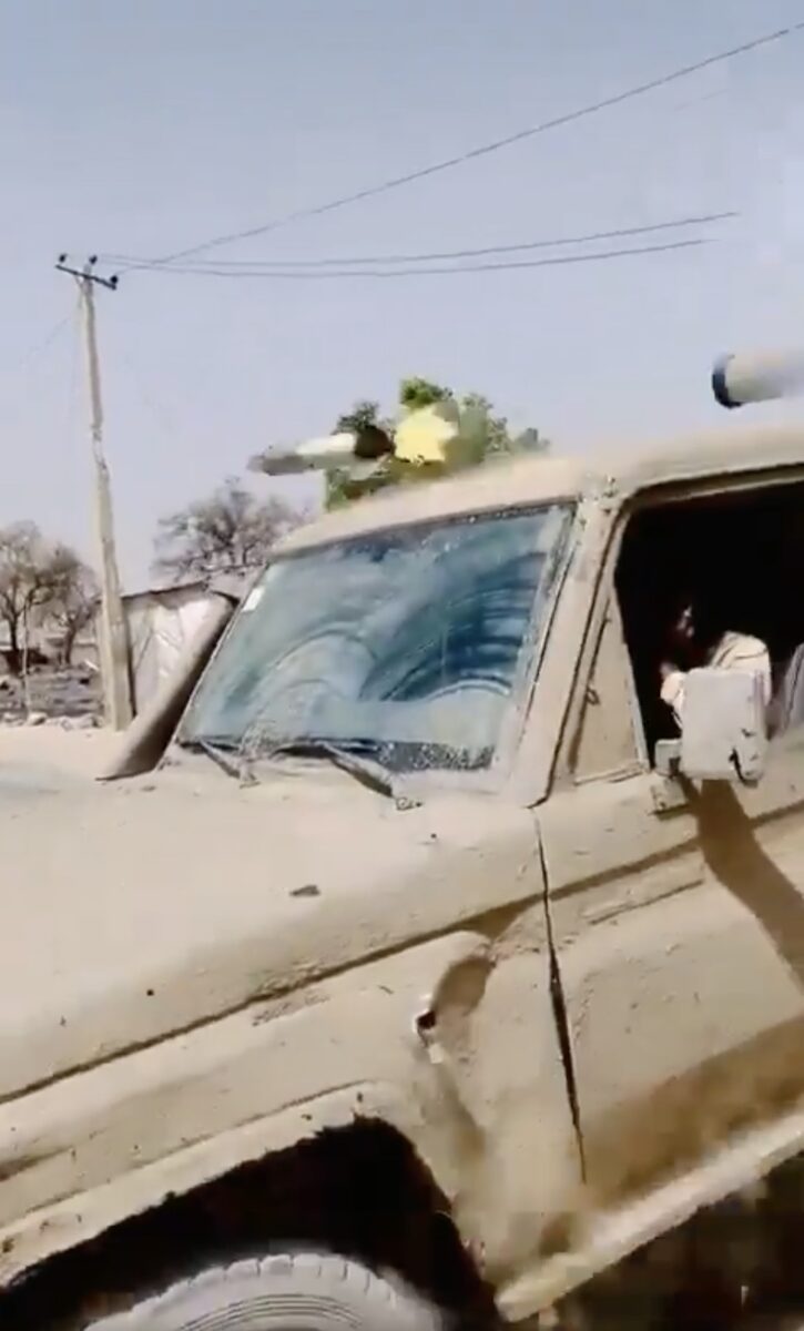
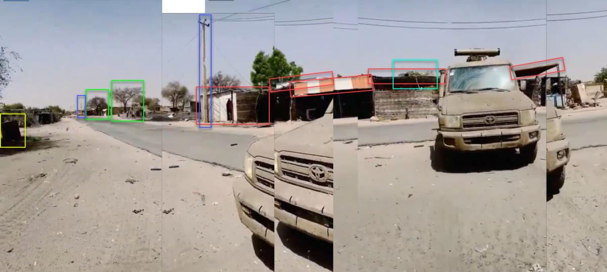
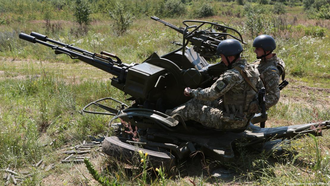
On May 13, a video was shared on the RSF’s Twitter channel showing a man in an RSF uniform using what appears to be a Kornet missile atop a Toyota.
This Russian-made portable anti-tank missile has previously been identified in the hands of RSF troops and has a roughly five-kilometre firing range.
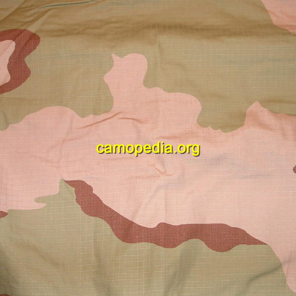
Manning the Kornet is an RSF fighter who is wearing the tricolour desert camouflage pattern which Camopedia describes as typical camouflage of the RSF.
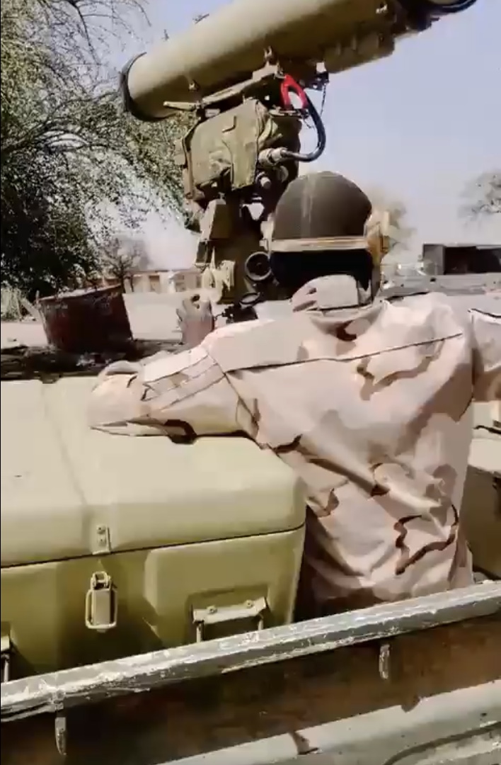
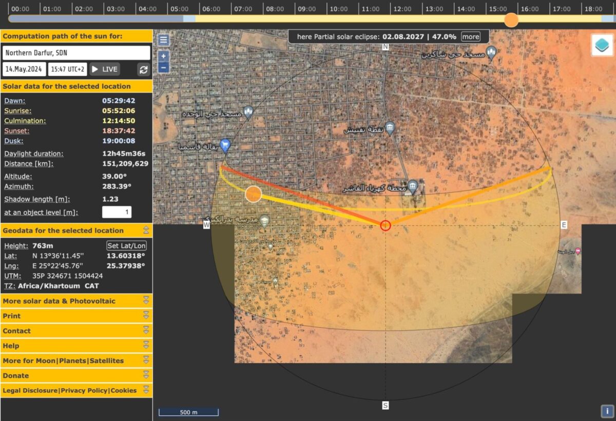
By using Suncalc and examining the shadows cast by the vehicle, it appears the footage was shot between 12:30 – 13:30 on May 13.
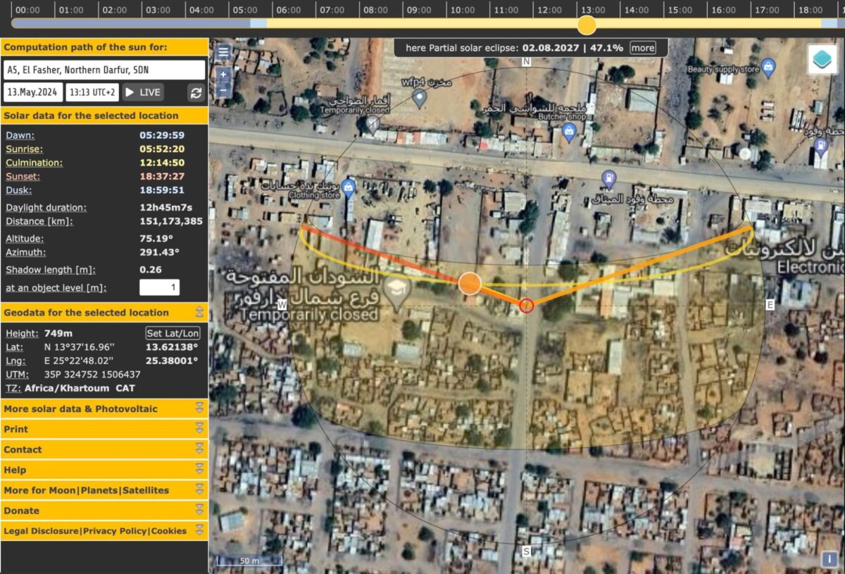
Bellingcat geolocated the vehicle to approximately here 13.621399, 25.380166, just off Al Fashir’s main highway located in a densely populated area in the city’s east.
Sudan’s ministry of health reported 38 people killed and 280 injured in the fighting over the course of two days.
In the four-day period between May 10-13, NASA FIRMS data showed heat signals- likely due to fires caused by the ongoing fighting- in the east of the city.
Nathaniel Raymond, Executive Director of the Humanitarian Research Lab at the Yale School of Public Health said that fighting taking place in Al Fashir is indiscriminate.
“They’re fighting in their positions which are close to residential areas taking a huge toll on the civilian population.”
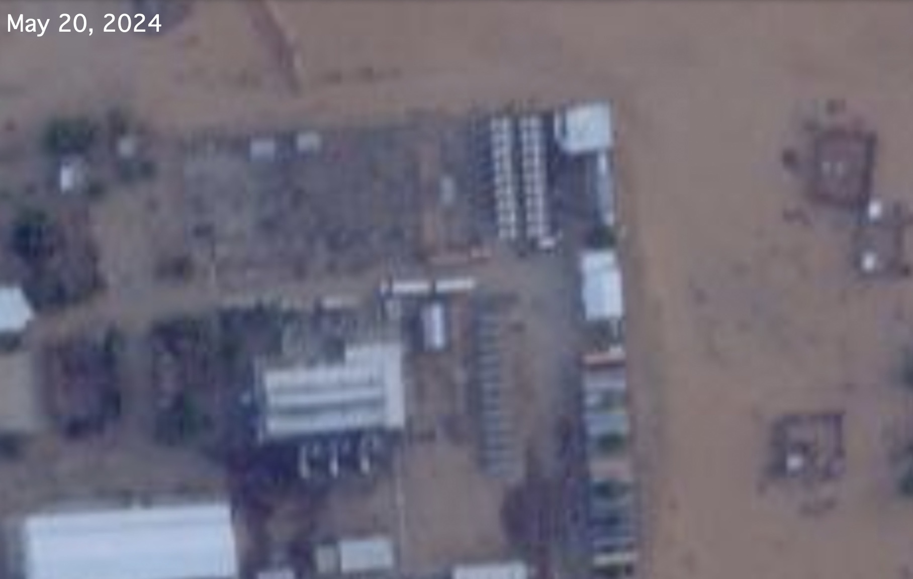
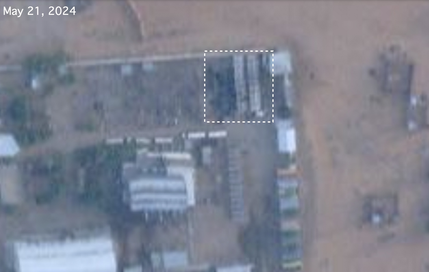
The RSF inside the City’s Power Station
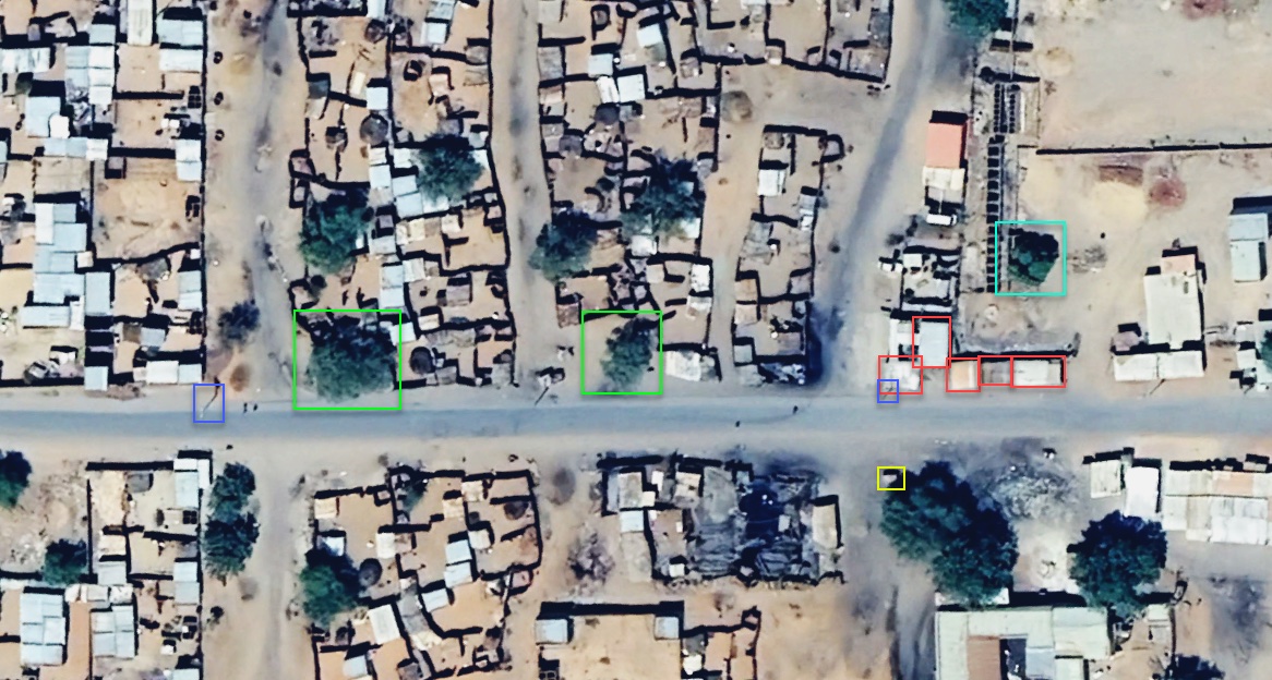
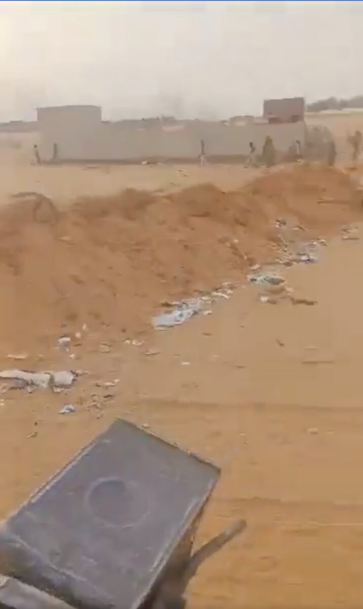
Footage published on X by a pro-RSF journalist on May 14 shows RSF soldiers atop Toyotas mounted with ZU-23 anti-aircraft cannons. Several soldiers are wearing the same tricolour pattern uniform outlined above and using the term ‘فلنقايات’ which roughly translates as ‘immoral servants’ a derogatory term used by RSF forces to describe the SAF.
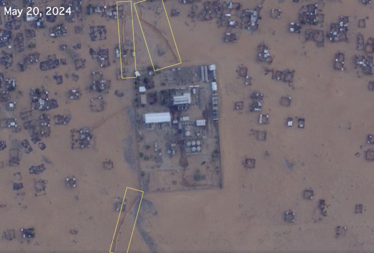
We located the troops to the eastern outskirts of Al Fashir, here: 13.603178, 25.379379 approximately 350 metres from the entrance to the Al Fashir power station.
In the video you can also see earthen fortifications around the power station that we matched to satellite imagery. We checked satellite imagery as far back as November, 2023 and found these earthen ramparts have been there since at least that time.
Using Suncalc, we managed to chronolocate the video and found that it was likely filmed between 15:30 and 16:30 on May 14.
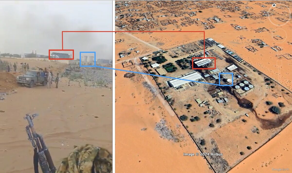
Around this time the SAF posted a video on Facebook claiming they were inside the power station and retained control of it, the video has since been deleted. However all open source evidence we reviewed indicates RSF soldiers were the dominant presence in the area from May 14.
Bellingcat also geolocated this video published on May 15 by a Sudanese journalist showing members of the RSF and a man in civilian clothing being held just outside the power station’s perimeter (around here 13.607588, 25.381050). Another video, which has since been removed, shows the same man being hit by RSF soldiers.
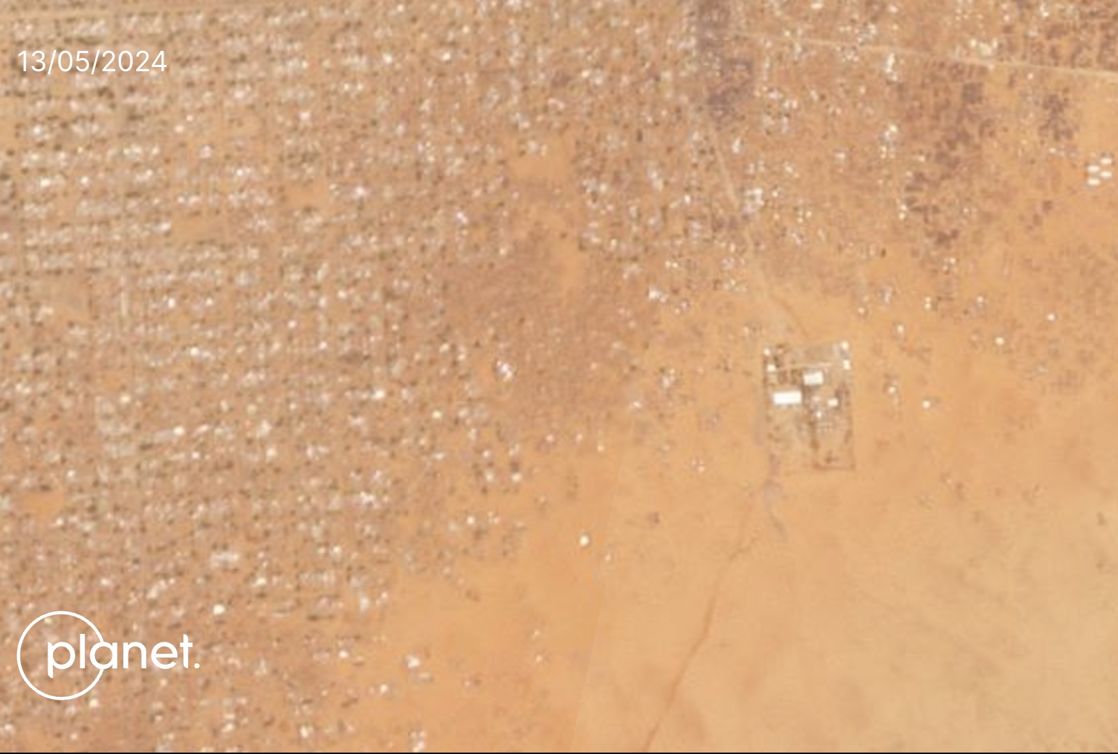
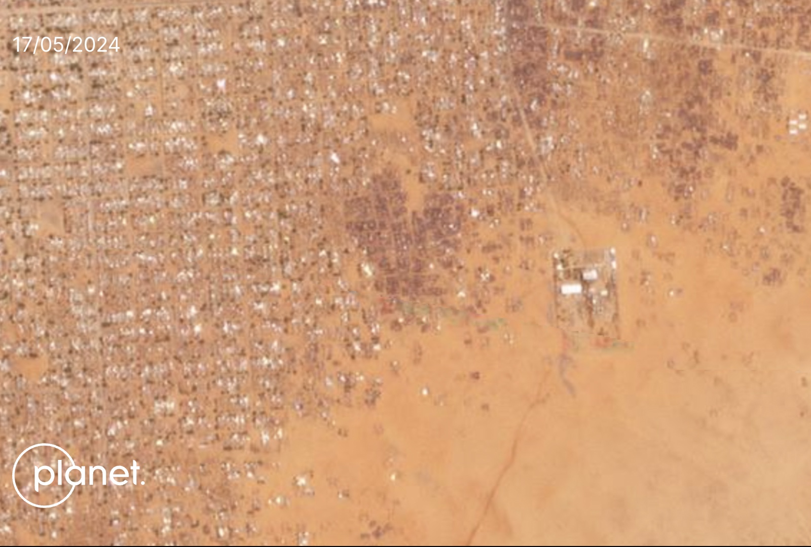
Satellite imagery from this time – between May 13-17- reveals significant burn marks across a residential area near the power station approximately 600 metres away from where the RSF were positioned.
We geolocated footage of RSF members touring inside the power station on May 20.
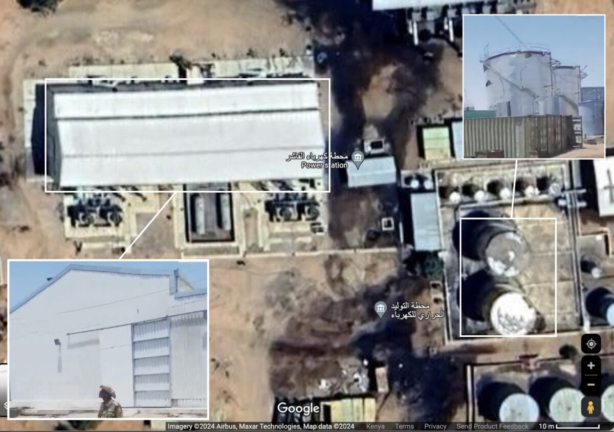
The RSF also claimed that an airstrike had struck the power station, however Bellingcat’s review of Planet imagery shows only limited burn scars to transformers. The limited amount of damage indicates it was unlikely to be caused by an airstrike. According to a report by the Humanitarian Research Lab at the Yale School of Public Health, power outages and communication network outages were reported across Al Fashir around this time.
Conflict Reaches New Areas of the City
A heat signal was detected on NASA FIRMS on May 26 in the southeast of the city. We cross-referenced the heat signal with Planet imagery from the same date and found at least one structure on fire and burn scars signalling the conflict extended to the southeast of Al Fashir.
Additionally, local news reported the city woke up to shelling in the south of Al Fashir on May 27.
Comparing later imagery from May 31 and June 1, we can see a further increase in burn scars towards the south around 13.592177, 25.361054 which appears to be a residential area.
Slightly northwest of that, smoke clouds can be detected on satellite imagery and via NASA FIRMS.
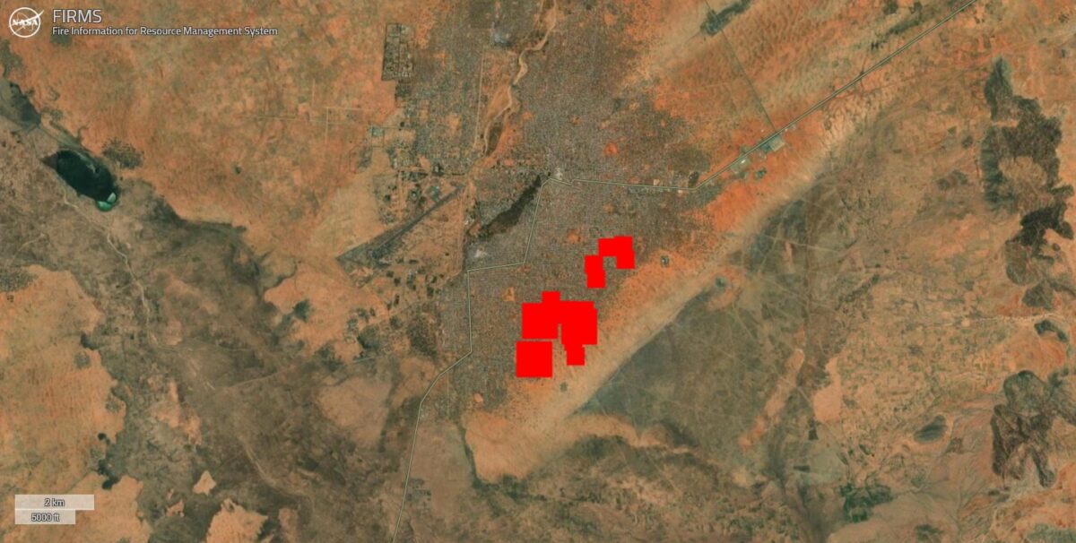
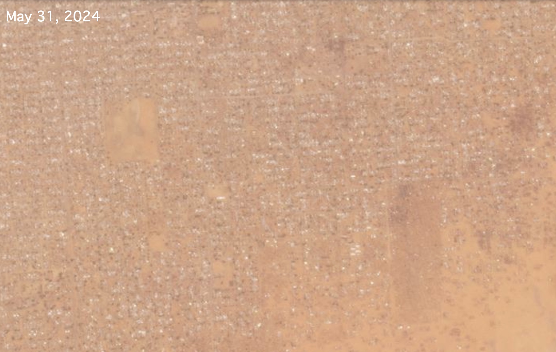
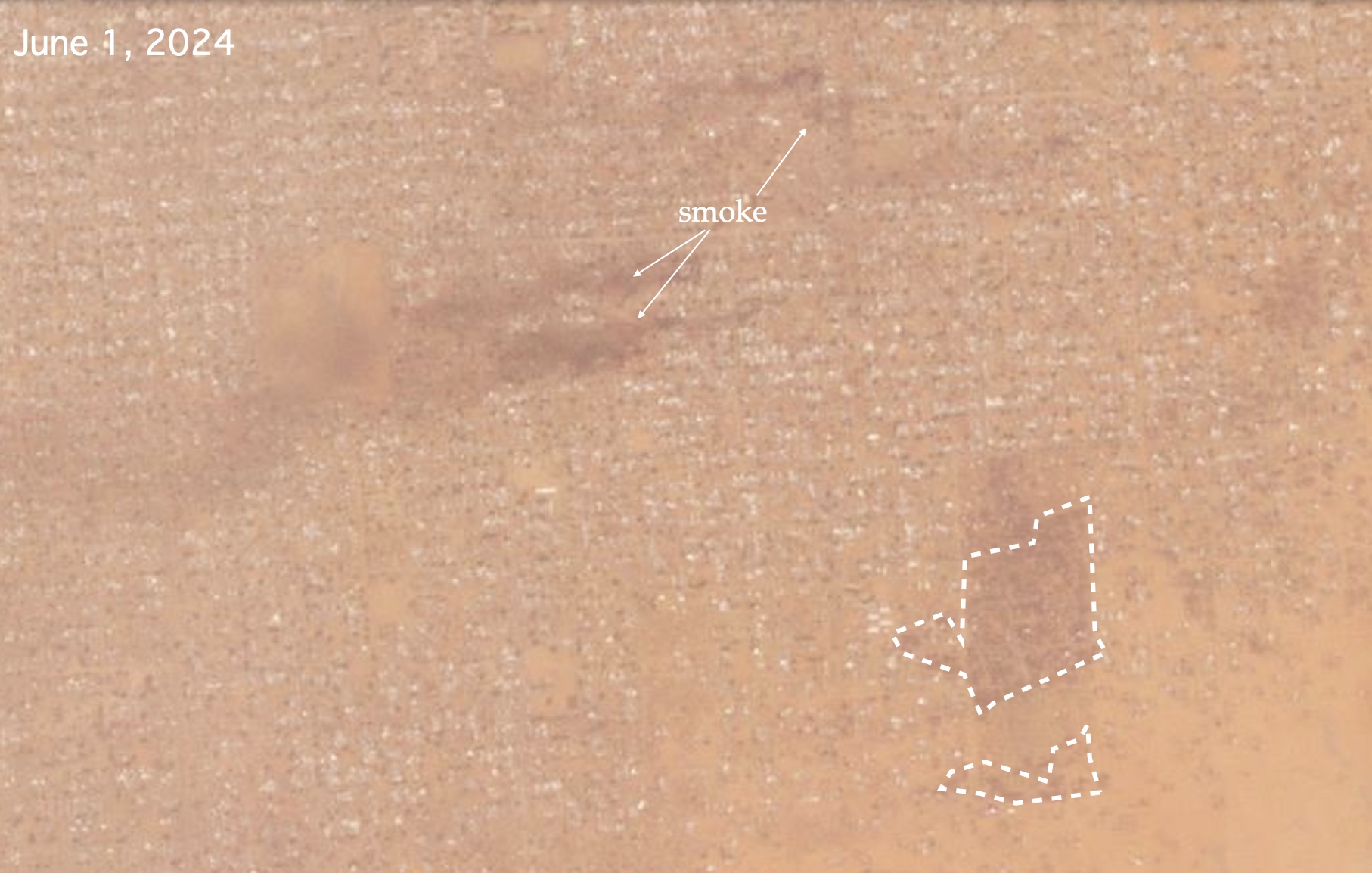
Low resolution imagery from May 31 and June 1 showing smoke around 13.598840, 25.353530 and damage around 13.592778, 25.360833. Source: Planet.
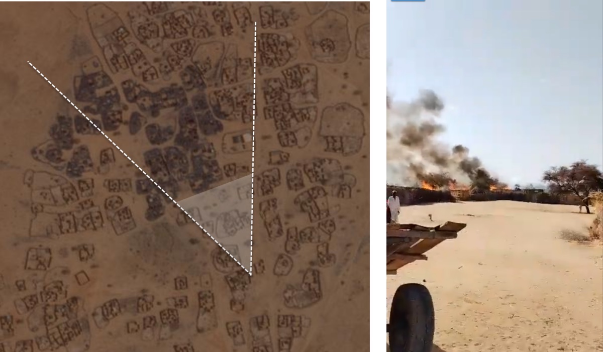
Strike on Talbedeya
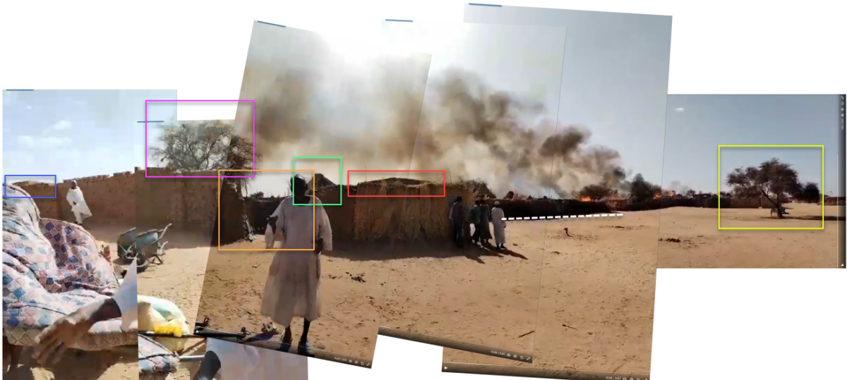
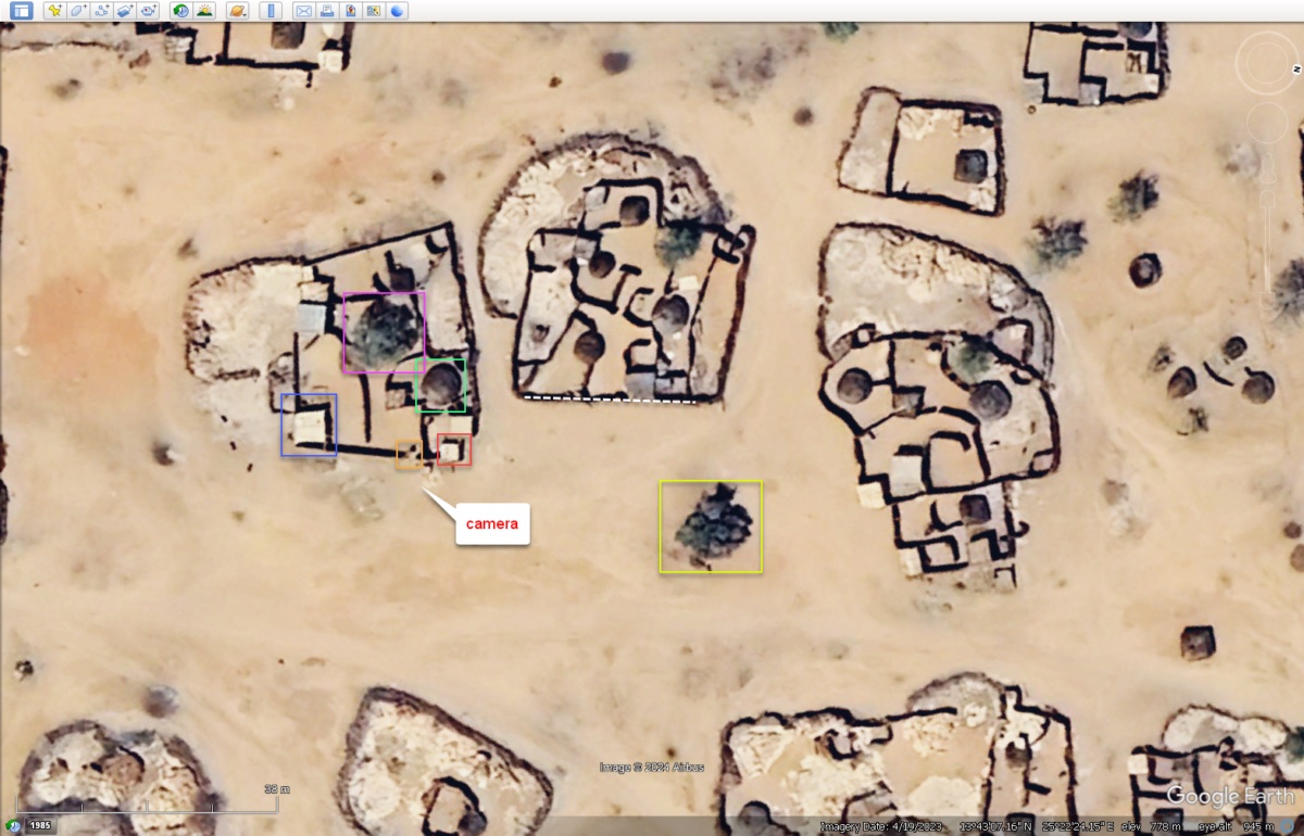
Although the fighting has been largely taking place in and around Al Fashir, Bellingcat detected the hallmarks of a likely airstrike on a town four kilometres from the city on May 25 using Planet imagery and this video which Bellingcat has also geolocated to a town that they refer to in the video as Talbedeya (13.718927823, 25.3737972754).
A group of people can be seen sheltering away from the fire that seemed to have taken over the small village, north of Al Fashir.
Attacks on Hospitals
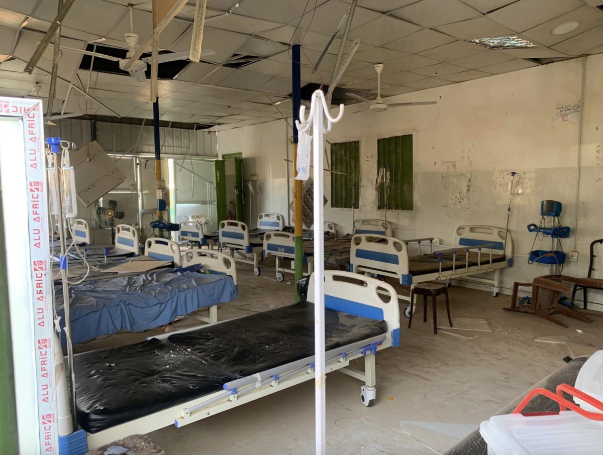
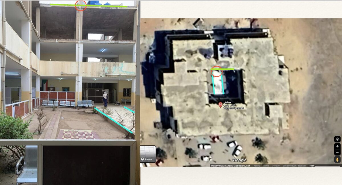
Bellingcat geolocated footage of the aftermath of a reported strike on Babiker Nahar Paediatric Hospital to here 13.611264, 25.363491. Photos taken outside and inside the building in the aftermath of the strike, show the partially damaged roof. Médecins Sans Frontières (MSF) said an airstrike on May 11 had forced the hospital to close. It had been one of the few specialist paediatric hospitals still functioning in the city.
More footage shows the extent of damage inside the hospital.
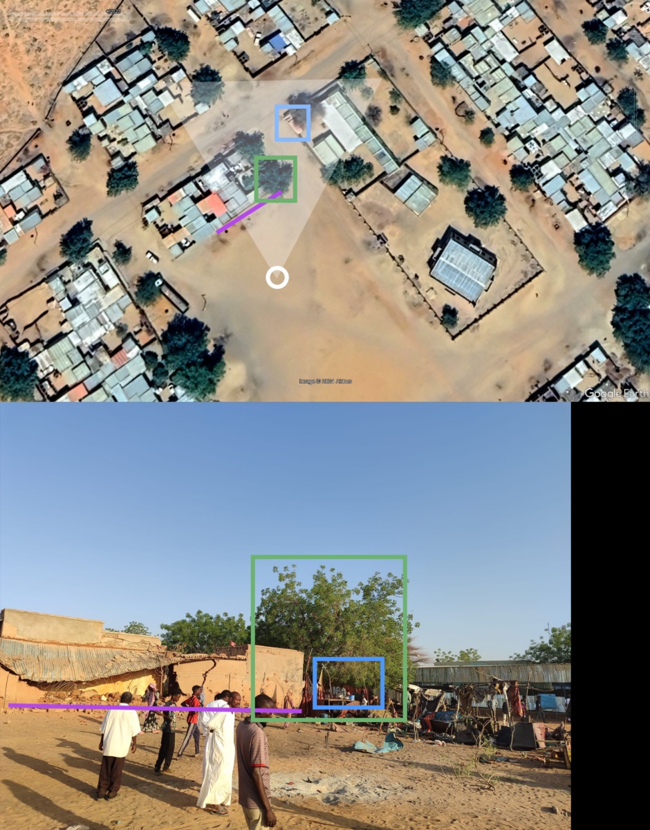
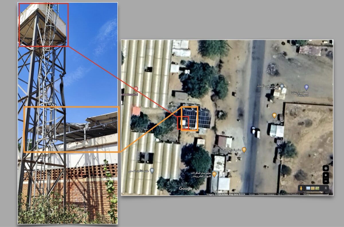
Attacks on hospitals continued with reports of a strike on the Saudi Maternity Hospital on May 19.
In the photo published by the Darfur Victims Support we can see a solar panel and water tank sustained some damage. We located the damaged hospital to these coordinates 13.629360, 25.329815.
MSF also reported the city’s main medical facility, the South Hospital, was hit on May 25 with a mortar that fell on the antenatal unit, killing one person and injuring eight. The following day, a shell reportedly landed inside the hospital and injured three people. Three other shells fell outside the hospital premises.
On June 9, MSF posted on X a press release announcing the RSF had attacked the South Hospital again, looted the premises and forcing the small number of remaining medical staff and patients to flee. Photos circulating on social media showed the abandoned hospital ransacked with blood stains inside. We managed to geolocate it to the South Hospital around 13.609335, 25.358040. The hospital was the last remaining medical facility still operating in the city up until June 9 when it was closed.
Risk of Genocide
A recent report by the Humanitarian Research Lab at the Yale School of Public Health, warned that the RSF will likely engage in direct ground combat in or at the SAF Sixth Infantry Division Base in Al Fashir in June. If successful in its current campaign to capture Al Fashir the Lab assessed that the risk of mass atrocity events, including ethnically targeted attacks on civilians occurring at scale was high.
Sudanese Political Analyst Kholood Khair told Bellingat that although the SAF is receiving weapons through airdrops in Al Fashir it is unlikely to be enough to repel the well armed RSF forces and stop them from taking the city. She said local mediation efforts were so far the most effective in trying to achieve some restraint by both forces but said international efforts — which include negotiations between both parties being hosted in Saudi Arabia- could do more to build on local efforts.
Khair told Bellingcat that if more attention is paid by the international community to the situation in Al Fashir it will help put pressure on the RSF to show restraint, in case it does take the city.
“Now, I think the RSF has become very acutely aware of how it is perceived as a genocidal force, and so it may show some restraint in that regard, but if they continue to operate [away from] international focus, then we will probably see an uptick of atrocities.”
Michael Sheldon and Jake Godin contributed research to this piece. Maps by Logan Williams.
Bellingcat would like to thank Beam Reports for sharing their research and findings. You can read Beam Report’s piece on the evolution of the conflict in Al Fashir and its strategic importance, here.
Bellingcat is a non-profit and the ability to carry out our work is dependent on the kind support of individual donors. If you would like to support our work, you can do so here. You can also subscribe to our Patreon channel here. Subscribe to our Newsletter or follow us on Instagram here, YouTube here, Facebook here, Twitter here and Mastodon here.

