Mahbere Dego: Clues to a Clifftop Massacre in Ethiopia
On an arid plateau somewhere in Ethiopia, a man in uniform pushes a dead body which goes tumbling head over heels off the edge of a cliff. More corpses are strewn around nearby rocks and boulders.
The scene comes from one of five graphic videos which started appearing from 9 March, 2021, on the EthiopiaMap Telegram channel. Viewed together, they show Amharic-speaking soldiers, one of whose uniforms bears the markings of the Ethiopian national flag on its sleeve, rounding up a group of around 25 to 30 people in civilian clothing. The captives file towards a precipice at gunpoint, where they are executed.
These videos were taken by the soldiers (mostly male and some female) themselves.
Since last November, a war has raged between Ethiopia’s federal government and rebel forces in the Tigray Region in the country’s North. Tens of thousands of civilians have fled across the border to neighbouring Sudan.
In recent months, credible reports of massacres, looting and rape have emerged from the region. As one UN official remarked to Britain’s Sky News this month “We don’t know what the situation is in rural parts of Tigray and what we don’t know really worries us”.
Bellingcat and colleagues from Newsy and BBC Africa Eye have located the execution videos from the EthiopiaMap Telegram channel to a cliff approximately 15 kilometres South of Aksum, a city in the wartorn Tigray Region. The closest town is Mahbere Dego, which may be the last place these men were seen alive.
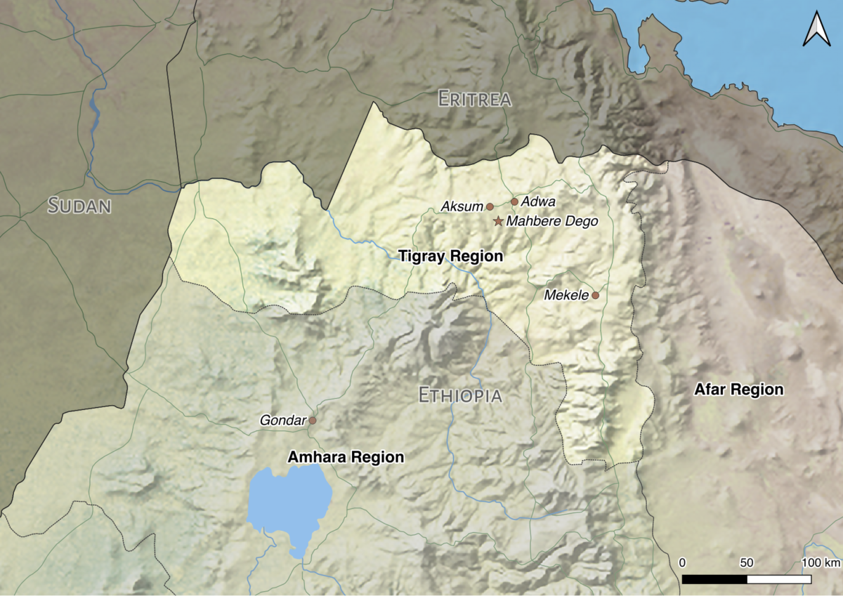
A map of the Tigray Region of Ethiopia. Credit: Logan Williams / Bellingcat / Natural Earth
We used satellite imagery, 3D topographic information and social media to identify the scene of the crime. To understand why this massacre occurred where it did, it’s necessary to understand how Tigray has descended into this brutal conflict.
What is the Tigray crisis?
Since it erupted in November 2020, Ethiopia’s Tigray crisis has escalated into a full-blown war.
Its origins lie in political disputes after reformist Prime Minister Abiy Ahmed took office in 2018. The country’s new ruler united a number of local ethnic-based political parties into a new Prosperity Party. But the Tigray People’s Liberation Front (TPLF) refused the merger. Representing the ethnic group which predominates in the Tigray Region, the TPLF had ruled Ethiopia for nearly three decades until the political upheaval which brought Abiy to power.
When Abiy postponed elections throughout the country due to the COVID-19 pandemic, the TPLF declared him an illegitimate leader, and pressed on with a local vote in September 2020 as planned. It was an act of defiance. The situation deteriorated rapidly, and in November 2020 the TPLF took up arms and attacked federal army bases throughout the region, prompting Abiy’s government to launch military operations in the province. When Ethiopian government troops took the regional capital of Mekelle at the end of that month, Ahmed declared victory.
However, the war has continued to rage. It has since drawn in the army of neighbouring Eritrea as well as pro-government militias from Ethiopia’s Amhara Region to the South.
“In the early months of the war, Tigray’s ousted leaders and their forces came under sustained military pressure, and they had to reestablish themselves as more of a guerilla force. They continue to have a territorial hold in some parts of central Tigray, where they primarily fled to after the government’s forces took Mekelle,” explained William Davison, Senior Analyst on Ethiopia for the International Crisis Group.
Davison added that much of Northern Tigray is currently controlled by the Eritrean military, while Amhara factions have claimed sections of the province’s West and South. He also said that while Ethiopian federal forces have control of urban areas and roads, the Tigray Defence Forces are still active in rural areas.
Challenges in Context
Geolocation is a vital step in verifying images and videos from a conflict zone. By determining where an image was captured, researchers can open further avenues of investigation, eventually establish culpability and — potentially — demand justice.
That’s because knowing the where is the first step to knowing the when, which in turn might help lead to the who. This process is arguably best exemplified in the Anatomy of a Killing investigation conducted by BBC Africa Eye alongside members of the open source research community.
Conducting geolocations in Ethiopia’s Tigray region can be complex. It contains large swaths of semi-arid, sparsely-populated mountainous areas which are poor and underdeveloped, with few businesses and institutions which might leave a digital footprint to aid open source research. Access to the region has been made difficult for journalists and researchers — whose work has been obstructed by widespread internet disruptions in recent months.
Given these challenges, often the only reliable reference material for large sections of the Tigray region comes in the form of satellite and topographical platforms. It was these sources that allowed for the geolocation of the massacre videos.
First Clues
There are five videos in total, which for the purposes of this article we have numbered one through five. The way we have numbered the videos does not denote the order in which they were taken, merely that they represent five separate videos. On first viewing, the videos contain a few clues that allowed for the definition of the search area.
First, some of the videos were filmed when the sun was low in the horizon. The screenshot below, taken from Video Three, shows a mix of people in military and civilian clothing casting long shadows:
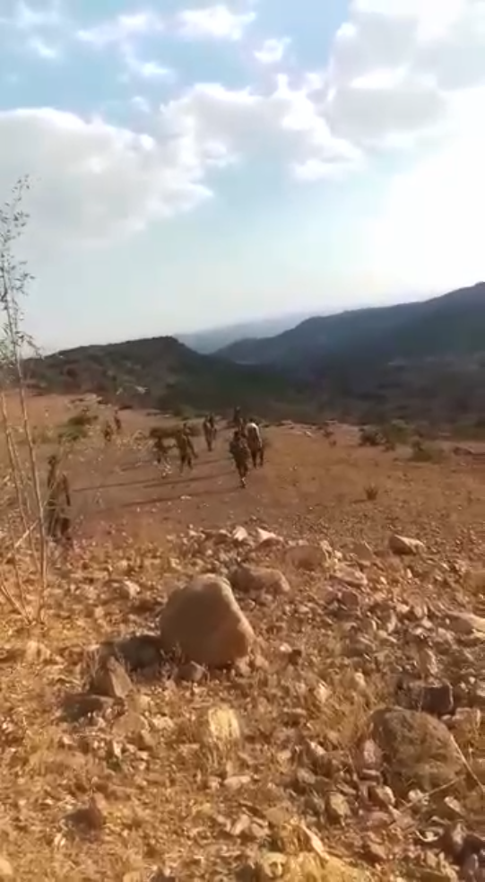
Note the shadows in this screenshot from Video 3
The next image is a zoomed-in, cropped shot of the previous image. It includes a red line that corresponds to the height of the individual casting the shadow. By copying that red line and shifting it horizontally, we can see that the shadow cast by the individual was more than than twice their height:
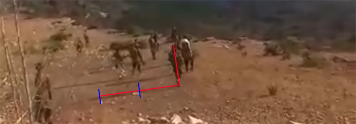
Because at this stage of the research process we did not know where these videos were recorded, it was not yet possible to conduct a shadow analysis to determine when they were captured. For our purposes at this stage, it only sufficed to see that the length of the person’s shadow was more than twice their height, indicating that the sun was relatively low over the horizon. Moreover, the direction in which the shadows were cast indicates that the sun was to the right of the person recording the video.
In this particular case the “when”, broadly defined, helped us find the “where”.
These shadows suggested that the sun was either near setting or near rising when the video was recorded: in other words, the sun was relatively low in either the western or eastern sky. This means the person recording the video was looking either North or South when they filmed the scene in the image above.
With this in mind, we hypothesised that the video had been recorded on a cliff that ran North to South.
Working Together on Google Earth Pro
Based on these first clues, we began to scan the Tigray Region for cliffs that ran North-to-South on Google Earth Pro.
Google Earth Pro has long been a staple for researchers conducting geolocations. The platform offers a number of useful features, including access to high-resolution historical images, and the ability to annotate the map with markers. These can then be saved as a .kmz file and shared with anyone, making it possible for teams of researchers to work together on geolocation tasks.
Social media was also a useful resource in helping to narrow down the search area. Within days of the videos’ appearance online, several Ethiopian users connected them to Mahbere Dego (ማሕበረ ደጎ), a small village South of Aksum. Their claims could not be taken at face value, but did provide a rough area to start our search (bearing in mind that different mapping websites show different toponyms in rural areas).
Google Earth Pro’s “Draw Polygon” feature allows the user to draw shapes anywhere on the map, which for our purposes allowed us to define an area of interest:
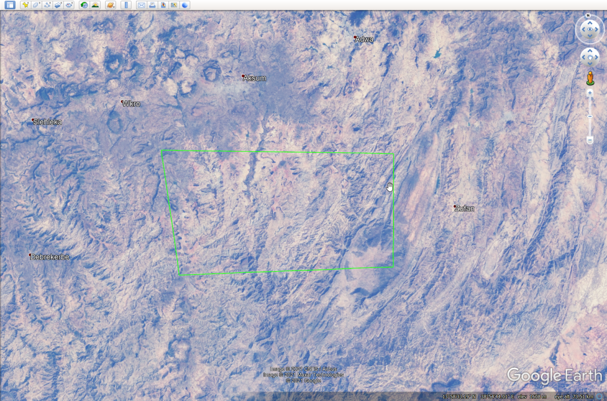
The green polygon indicates an area of interest inside which the videos may have been recorded (Source: Google Earth Pro)
As the geolocation process continued, we realised that the cliff from which the victims of the massacre were being thrown off might appear on satellite imagery. We also noticed that the Tigray Region — and in particular, the search area marked by the green polygon — contained several plateaus. We marked these on the map to further define the research area:
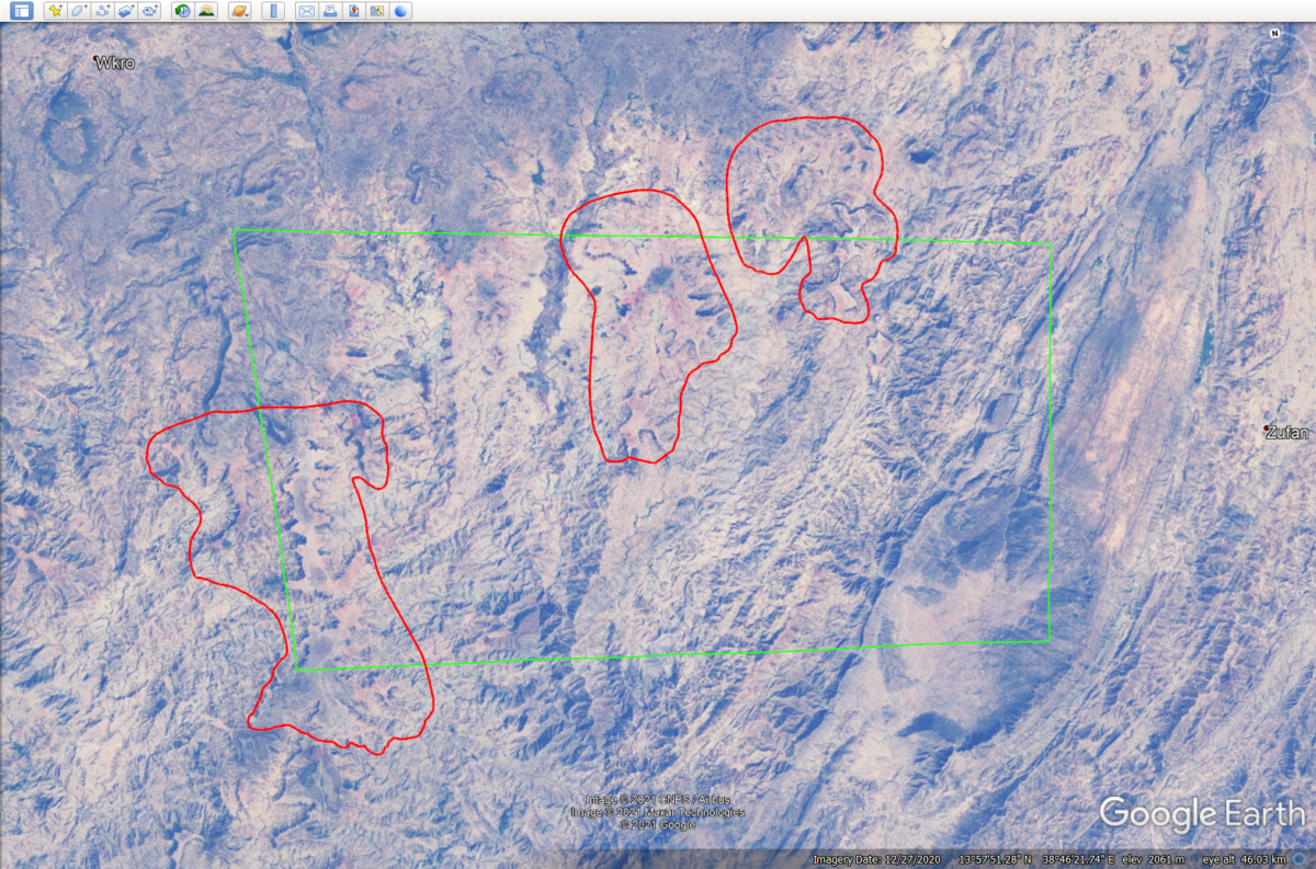
The red polygons mark sections of the search area that contain plateaus (Source: Google Earth Pro)
These markings act as visual boundaries that signal when you have gone out of bounds in a search.
While scanning the plateaus in the search area, we located a site that matched some of the features in Video Two and Video Three. First, this site includes a cliff that runs North to South, which fit our theory of its orientation based on the shadows in Video Three. Second, in Video Two, the person recording adjusts the cellphone in their hands as they walk. While adjusting the cellphone, the camera captures a distinctive plateau in the distance with two angled faces.
Those features were also visible on Google Earth Pro:
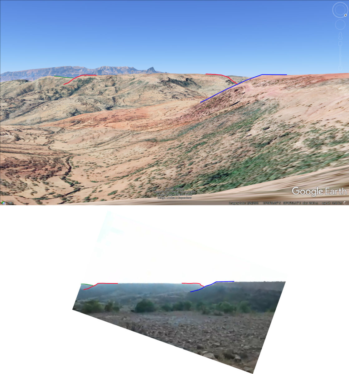
The collage above shows that some of the features in Video Two match data on Google Earth Pro, namely the position and sloping sides of a plateau in the distance (Source: Google Earth Pro)
The matches that we observed on Google Earth Pro led us to believe that the site that we had identified could be the spot where the videos had been filmed. This was enough reason to seek out more topographic information about the area from a different source.
A Second Opinion: PeakVisor
PeakVisor is a website and app service that draws landscapes, catering primarily to outdoor enthusiasts. According to the website, the platform has data on over 1,000,000 mountains around the world.
PeakVisor rendered the landscape features seen in the videos with more clarity than Google Earth Pro. This is partly because PeakVisor clearly outlines terrain with black lines, contrasting it from the background and making landscape features easier to spot with the naked eye.
The plateau in the distance in Video Two also appears in PeakVisor:
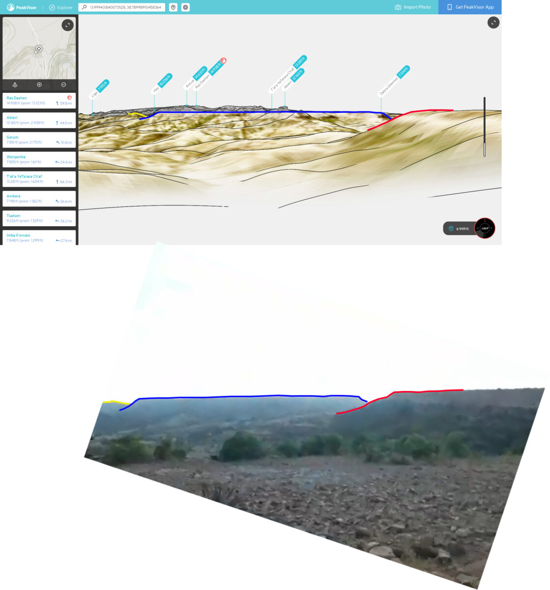
The plateau in the distance seen on Video Two as rendered by PeakVisor. (Source: PeakVisor.com)
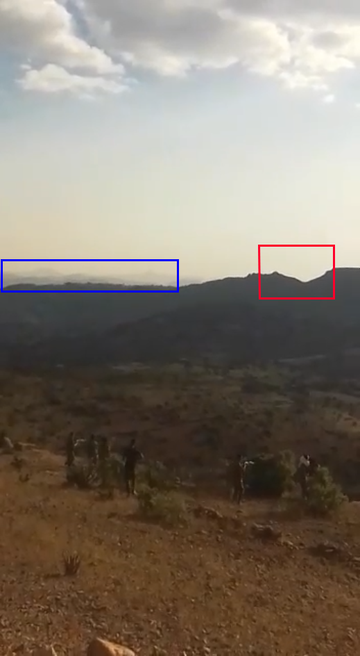
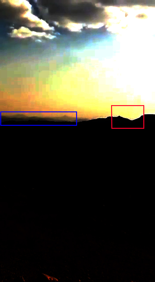
PeakVisor’s rendering of the area also accurately captured other distinctive features. In Video Three, the landscape in the background contains a noticeable gap in a ridgeline, as well as the presence of mountain peaks in the far distance.
Because the peaks in the distance (highlighted in blue below) appear faint in the video, we adjusted certain colour properties using image editing software to make them more noticeable. The slider below shows the original, unedited screenshot from Video Three and that same screenshot with brightness, contrast, and RGB-level corrections:
Below, the same view captured in the image above as seen on PeakVisor:
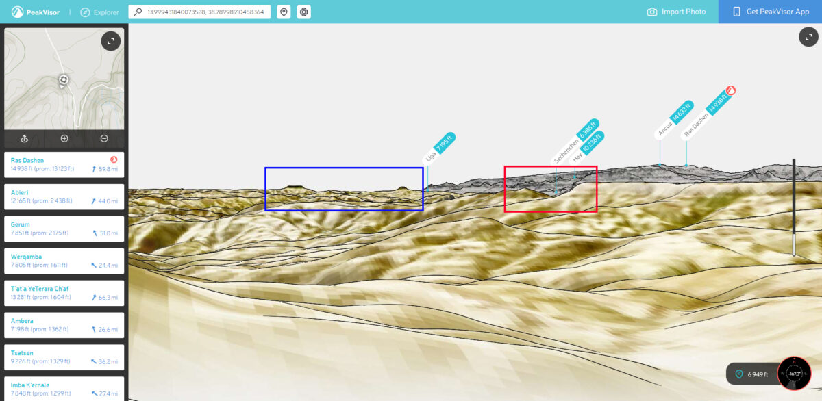
The landscape in Video Three as seen on PeakVisor (Source: PeakVisor.com)
For the sake of comparison, some of these features were not as clear on Google Earth Pro. This is partially due to the way that the platform renders landscapes. Still, both the gap in the ridgeline and the mountains in the background are also visible in Google Earth Pro:
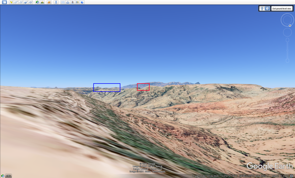
The landscape in Video Three as seen on PeakVisor (Source: Google Earth Pro)
A collage created from screenshots from Video Three shows the full landscape as rendered by PeakVisor:
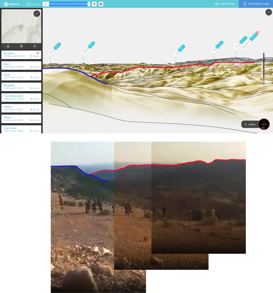
Image collage made from screenshots from Video Three showing the full landscape background as seen on PeakVisor (Source: PeakVisor.com)
Video One and Video Four
Having geolocated Video Two and Video Three, we turned to the other videos in the series.
Video One shows a group of soldiers by the edge of a cliff. The bodies of approximtately 10 people lie at their feet. The video shows a group of soldiers observing as one of their colleagues throws bodies off a cliff.
As described in the previous section, we geolocated Video Two and Video Three to this area. Video Two also shows a group of soldiers standing over the bodies of their victims by a cliff.
Video Two includes several frames that show a rock formation in the distance, atop the plateau on which the executions are taking place:
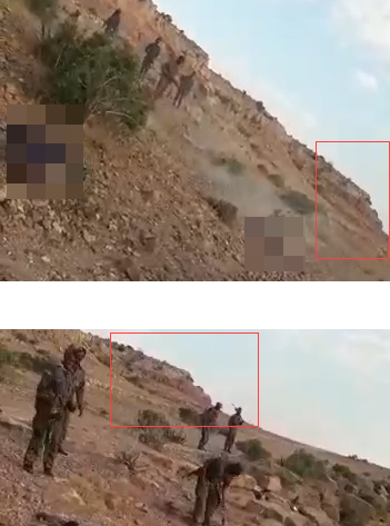
Note the matching vertical lines in the rock formation (blue) as well as the matching and rock formation (red) in Video Two and Video Four.
We can also connect Video Four to the site of the massacre using Video Two. Both videos captured the same vegetation atop a rock formation near the cliff where the massacre took place:
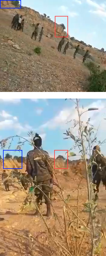
Note the matching vertical lines in the rock formation (blue) as well as the matching and rock formation (red) in Video Two and Video Four.
Video Five
Video Five was particularly difficult to geolocate. This video shows a group of 25 to 30 people in civilian clothing sitting in a group, surrounded by people in military uniform. The soldiers can be seen checking under the shirts and the upper torsos of two of their captives.
One of the men in uniform has what a patch which bears the markings of the national flag of Ethiopia on his right shoulder:

Note the flag patch on the shoulder of the man on the left of the image.
Through a process that involves splitting and adjusting the colour channels and increasing the contrast of the frames in the video, we were able to enhance the colours in the image showing the flag patch. We then compared the results with other national flags and those of Ethiopia’s regions.
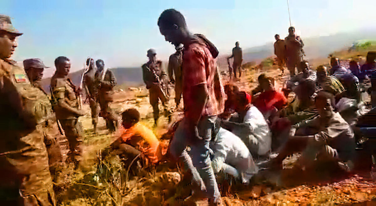
Credit: Timmi Allen / Bellingcat
It should be noted that no flag patches are visible on the other soldiers’ uniforms.
Other open source images show that such sleeve badges showing the national flag are currently worn by active servicemen of the Ethiopian Armed Forces. An image shared on 13 February 2021 by the official Facebook account of the Federal Democratic Republic of Ethiopia’s (FDRE) Defence Force shows a group of soldiers resting. One of the soldiers has an Ethiopian flag patch on his right shoulder, which matches the one seen in the screenshot above:
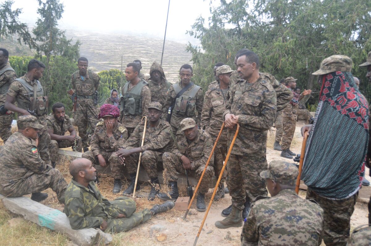
Note that the soldier sitting on the left side of the image has a patch with the Ethiopian flag on his right sleeve. Image is used solely for comparative purposes. (Source: Facebook)
We quickly found that our starting assumption that Video Five had been recorded at the same place as the other four videos was incorrect. The shadows in Video Five suggested that the sun was relatively low on the horizon to the right of the person filming, as was the case in the other four videos. This would have meant that Video Five was filmed looking South. However, none of the landscape features in the background of Video Five matched what we could see in the other four videos.
After we noticed that Video Five appeared to have been taken near the edge of a cliff that ran approximately East-West, we began to check for areas near the other four videos for this feature.
A spot approximately one kilometre to the East of where the other four videos were filmed caught our attention. When seen through PeakVisor, the landscape features to the South-East of this location match those see in Video Five:
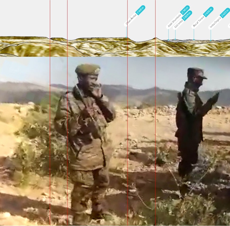
This panorama composite of Video Five matches the view, approximately to the south-south east of this location. The red vertical lines indicate matches in the landscape (Source: PeakVisor)
The image below shows the locations where the five videos were filmed in relation to one another:
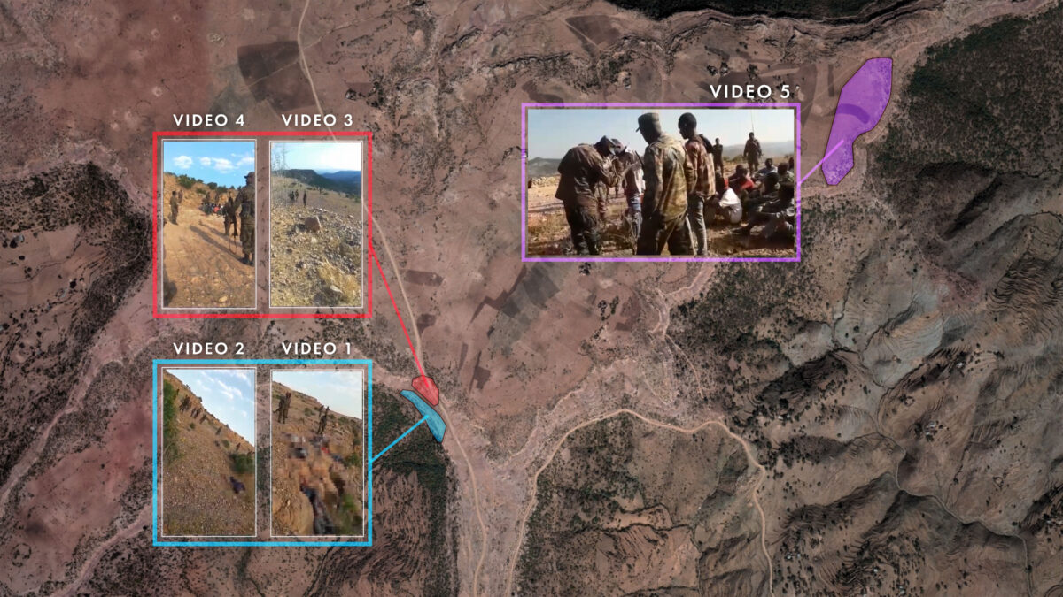
Credit: Jennifer Smart / Newsy for Bellingcat
Because Video Five was filmed at a location approximately one kilometre away from where the other four videos were filmed, we cannot definitively say whether they show the same perpetrators and victims. However, there is at least one individual in Video Five who also seems to appear in two videos from the other site. In Video Five, one of the individuals in civilian clothing is wearing a red long-sleeved shirt and a white head covering:
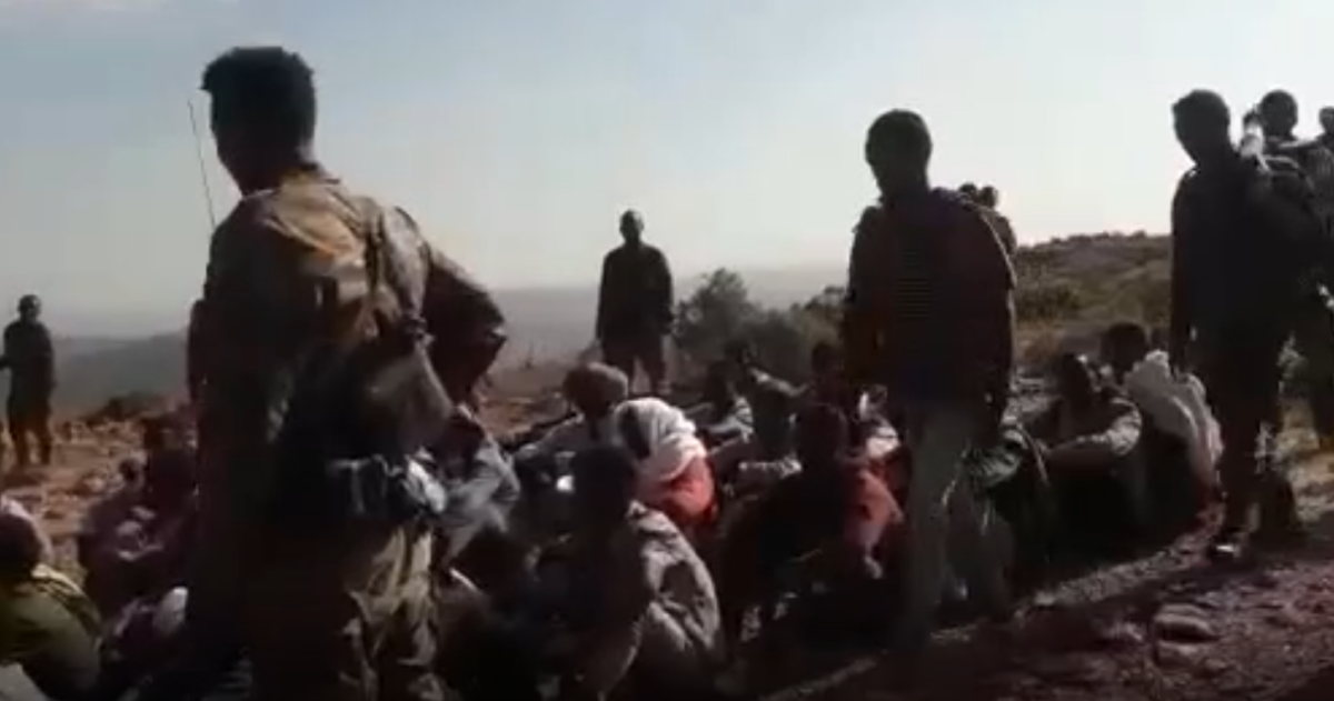
Video Five shows a person wearing a red shirt and a white shawl among those seated.
Video Three also shows a person wearing a long-sleeved red shirt and white shawl. The person is being walked at gunpoint to the edge of the cliff:
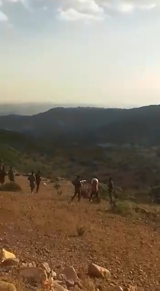
A person wearing a red shirt and white shawl wrapped around their neck is walked at gunpoint to the edge of the cliff where the massacre took place.
Video Two shows the body of a person wearing a red long-sleeved shirt and a white shawl around their neck on the edge of the cliff, surrounded by two other bodies.
Click on this link to see a still from the video. Note that it includes graphic imagery, which we only present for the purposes of detailing our analysis.
Audible Clues
The language used by the soldiers can establish their likely origin. According to Gubae Gundarta Beyene, a translator and communications scholar at the University of Oregon who hails from Ethiopia, the soldiers in the videos are not speaking in Tigrinya or Arabic, the primary languages of Eritrea. Tigrinya is also the native language of the vast majority of the Tigray Region’s inhabitants and of TPLF supporters.
Instead, they are speaking Amharic — Ethiopia’s administrative language and the native tongue of the Amhara people. Gundarta, who produced a translation of the speech in the videos, stated that the soldiers’ accents indicate that they are mostly native Amharic speakers from the Amhara Region, though some may be second language speakers from the Oromia Region.
On several occasions in Video One and Video Two, the armed men describe their victims as “Woyane” (Amharic: ወያኔ, Tigrinya: ወያነ). This word is a particularly important indicator of the armed men’s allegiance.
The scene described at the beginning of this article comes from Video One. “We learned brutality from the Woyane. There isn’t much we can do about it. This is what you become in the end”, asks the man filming the corpses, who, according to Gundarta, speaks Amharic with an Amhara Region accent. A voice in the background recommends dousing the bodies with kerosene to burn them. The speaker regrets that he has none.
In Video Two, a man speaking in Amharic with an Amhara Region accent films three dead bodies by the cliff edge. “As you can see, these are Woyane corpses. We have put them all out here,” he explains. Gunshots ring out in the distance, leading him to turn around and cry “Attaboy! You’re a hero! Such a hero! This is the end for Woyane. We have no mercy left”. Another corpse can be seen on the ground as a group of uniformed men walk away.
Who are the “Woyane”?
This epithet, which roughly translates as “insurgent”, is used derisively for rebels or people believed to be affiliated with the TPLF. However, some Tigrayans use it as a term of pride, referring to the Woyane Rebellion of the 1940s, when their ancestors rose up against the rule of Ethiopia’s Emperor Haile Selassie.
“It was a rallying cry for the Tigrayan struggle, which was also along the lines of demanding autonomy or at least against marginalisation against the central state,” explained the International Crisis Group’s Davison.
“It looks very much like they are accusing those people in the video of being members of the TPLF. The fact that these people are suspected of being Woyane is almost seen as justification for the violence being exacted upon them,” Davison added.
A Military Presence
While the five videos do not contain enough information to determine when exactly they were recorded, other clues may offer further avenues of inquiry.
For example, a satellite image taken on 20 January 2021 shows approximately 16 vehicles just 150 metres from the cliff where the executions took place. The image also shows the presence of an artillery battery on the plateau by the trucks:
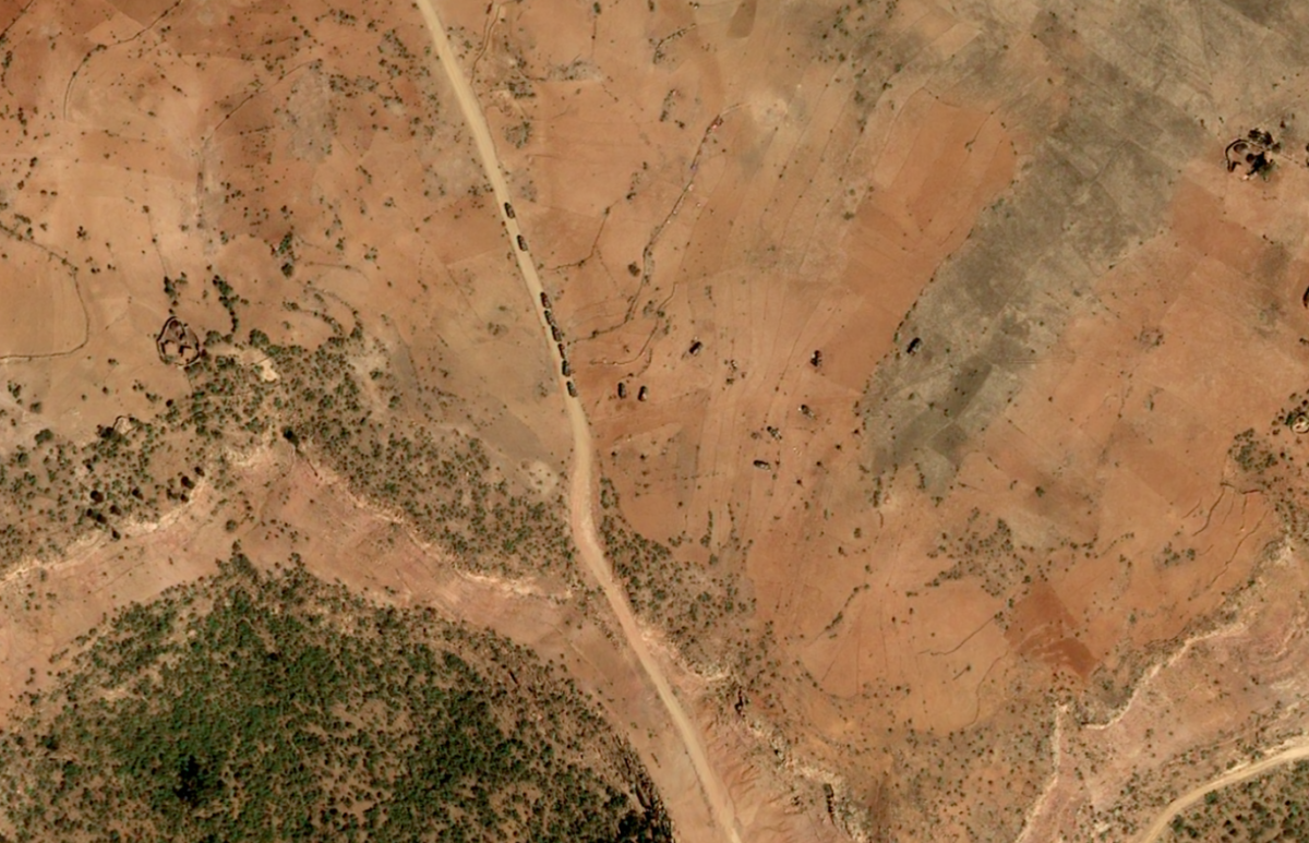
This satellite image taken on 20 January 2021 shows military vehicles and artillery approximately 150 meters north of the cliff where the massacre took place (Source: Includes material © CNES 2021, Distribution Airbus DS all rights reserved / PLEIADES satellite imagery Acquired through ShadowBreak Intl via BBC Africa)
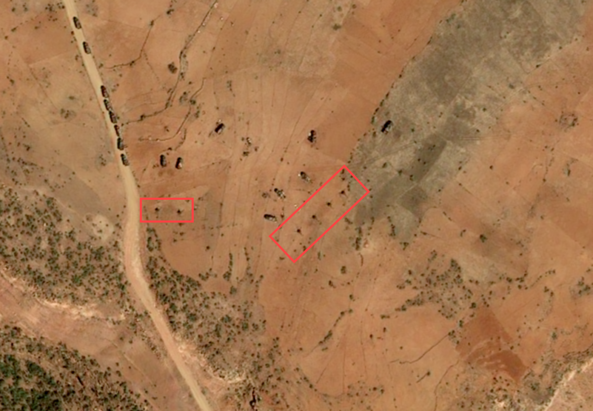
The six objects in the red rectangle above appear to be artillery pieces as they appeared on 20 January 2021 at the site of the massacre (Source: Includes material © CNES 2021, Distribution Airbus DS all rights reserved / PLEIADES satellite imagery Acquired through ShadowBreak Intl via BBC Africa)
While it is not possible to tell from this image to which armed force these vehicles and artillery belonged, it does indicate that the site of the massacre has seen an organised military presence since the conflict entered its latest phase, with the Tigray Defence Forces regrouping in rural areas.
This chimes with a 31 January 2021 situation brief by the European External Action Programme, which notes that fighting had recently taken place in Mahbere Dego.
The Missing Clue
What can we say about the executions at the clifftop that day?
Our geolocation confirms that a massacre took place in Mahbere Dego.
There is some evidence to suggest the allegiance of the soldiers, from an Ethiopian flag on one soldier’s uniform to their use of the Amharic language and the word “Woyane” to describe their victims. These clues point towards the presence of the Ethiopian military or its allies at Mahbere Dego. Beyond these hints, however, the identities of the executioners cannot be conclusively established by open source methods alone at the time of publication.
The final clue may lie in on the ground reporting in Tigray, something which remains particularly dangerous.
Until that changes, open source material continues to be a key resource for documenting the ongoing humanitarian disaster in Tigray, some of which is being provided by perpetrators of the crimes themselves.
“Why don’t you get closer and record?” one armed man exclaims to the camera in Video Four. “How could we not record the way they die?”
Giancarlo Fiorella served as the primary researcher for Bellingcat, together with Jake Godin (Newsy) and Aliaume Leroy (BBC Africa Eye). Additional research by Nick Waters, Carlos Gonzales, Maxim Edwards, and @Obretix. Translation and linguistic analysis of audio tracks by Gubae Gundarta Beyene.
