Gun Safety, Self Defense, and Road Marches - Finding an ISIS Training Camp
Translations:
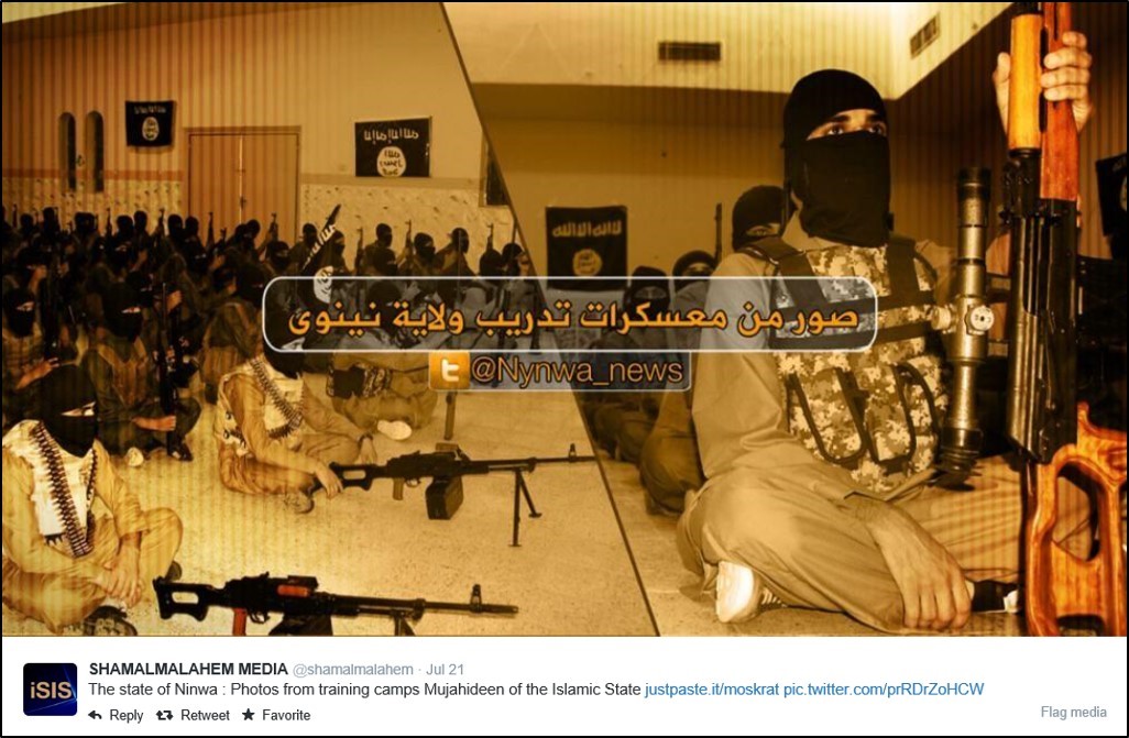
Have you ever wondered what it would be like to go through training as an ISIS terrorist? Or better yet, where you would go to find such advanced training? All you have to do to find the answer to these questions is turn to the nearest ISIS media twitter account and click on that bright blue Justpaste.it link. Let’s take a look at the photos posted in July showing one of the Islamic State’s training camps in Ninewa Province and see what we can learn.
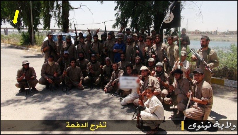
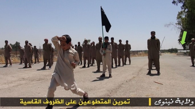
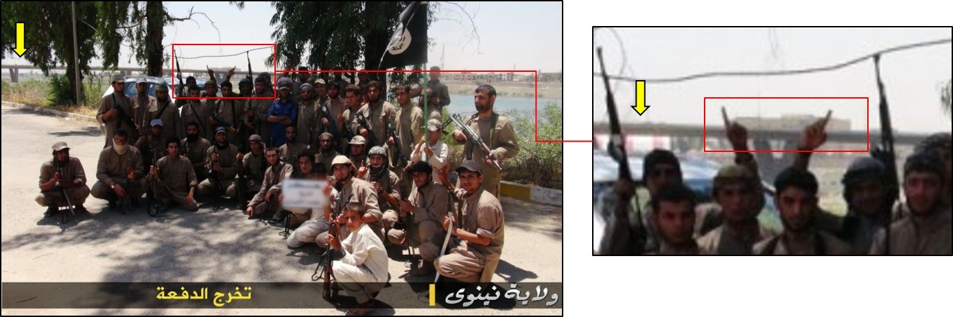
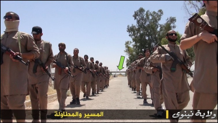
If we examine the ISIS class of 2014 martial arts lesson, road march, and graduation photo, we can see several bridges in the background spanning over a large river.
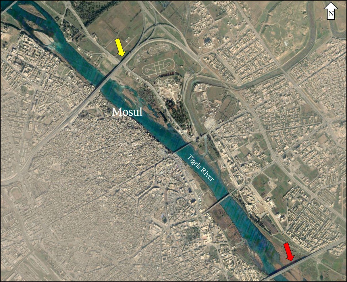
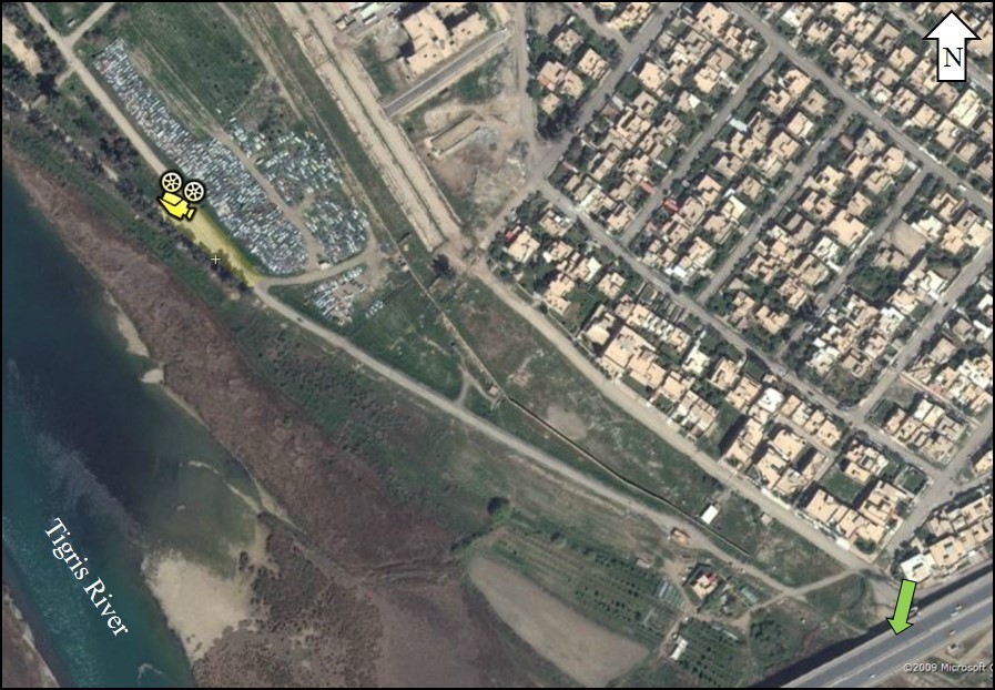
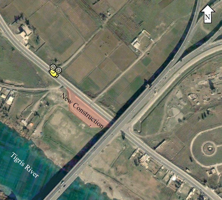
After doing just a little bit of research we find this general area in Google Earth along Tigris River in Mosul that looks like it could be a fit based on the land marks available in the images.
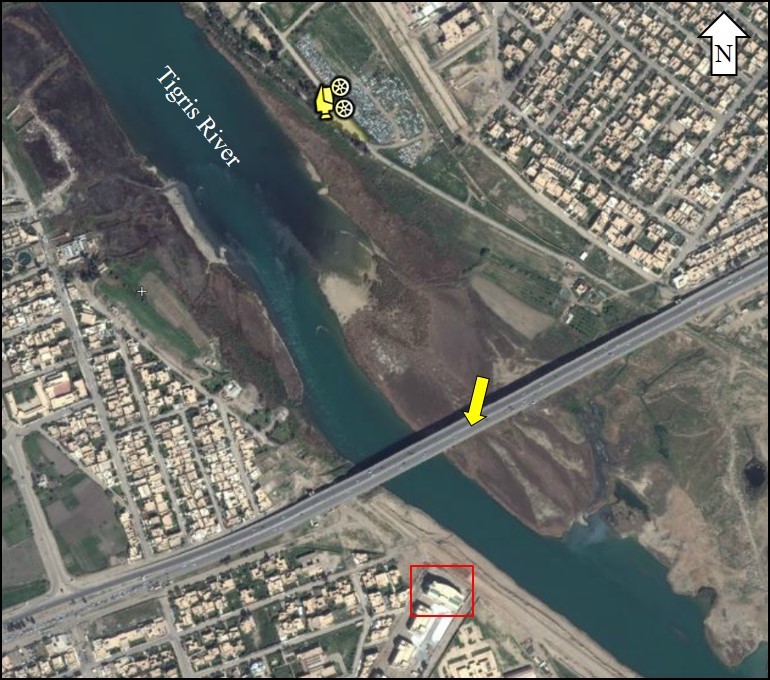
In this graduation photograph we can see one of the bridges with a large building visible in the background, with the photograph taken on a tree lined road. In this case it was necessary to use the site Flash Earth with its more up to date imagery to find the building, which appears to have only been recently constructed
In the entire area there’s only one possible location that matches, on the north side of the river, with the camera pointing south.
It also appears the martial arts lessons were photographed in the same area, with the bridge running over the road visible, and the trees on the right
Next we can use Panoramio to investigate other image. Panoramio is a site which tags the location photographs where taken onto a map. In the below example we can find this photograph, which matches to what can be seen in one of the photographs we are examining
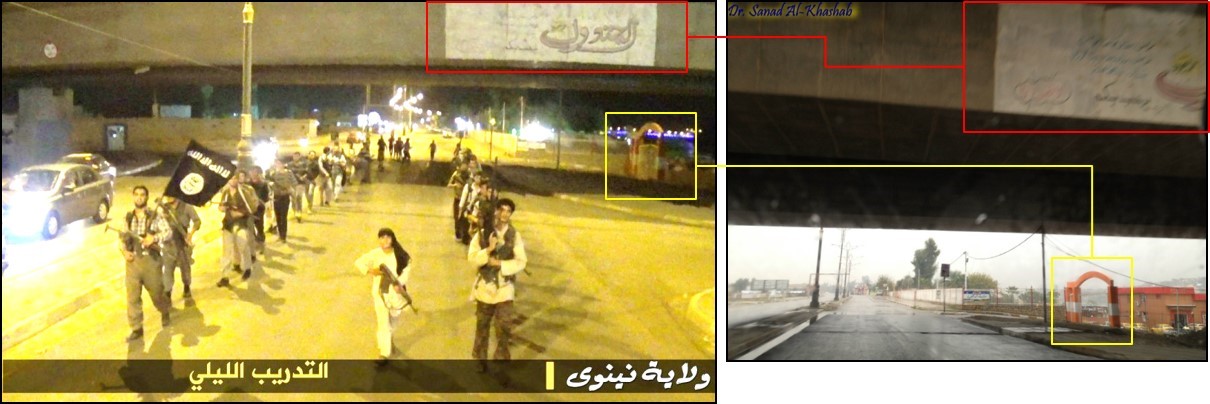
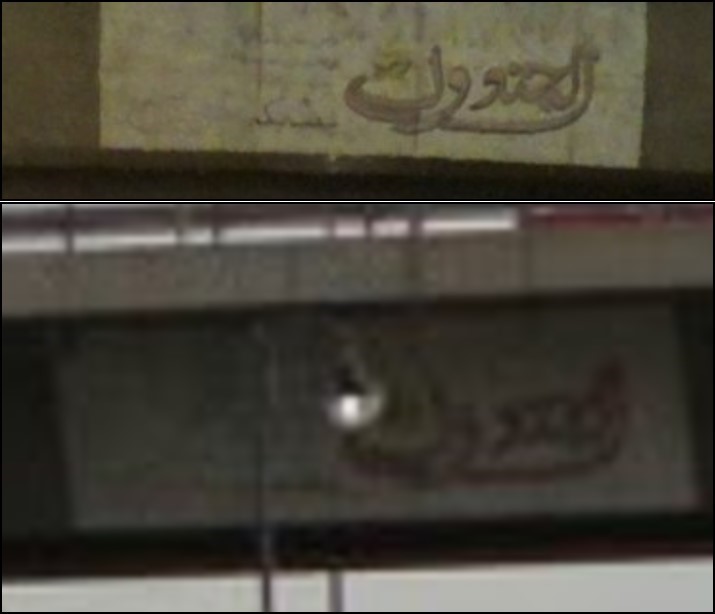
The logo on the bridge in both photographs are a match
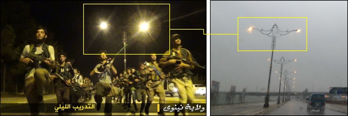
In another Panoramio photo we have images of the street lights in the area, which also match.
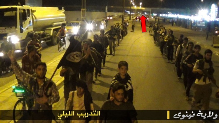
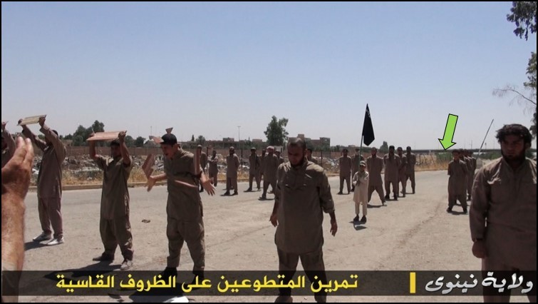
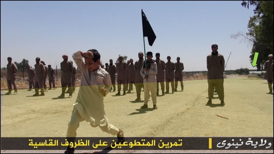
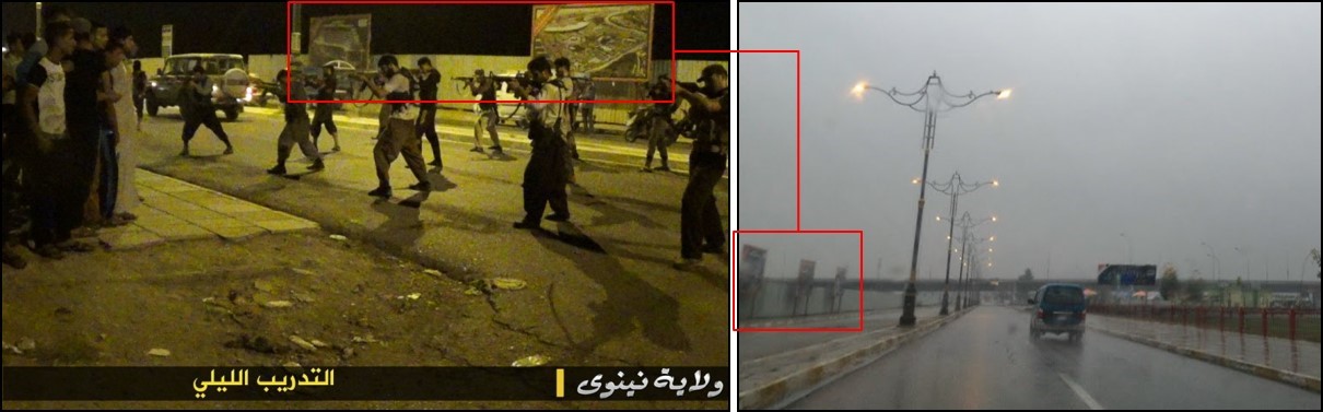
You can see the same signs in the background when they stop to practice some drills towards the end of their road march.
Since the imagery is outdated it doesn’t show the recent construction seen in the ISIS photos as well as Panoramio:
One more photo for good measure. In this Panoramio photo you can see the towers are identical.
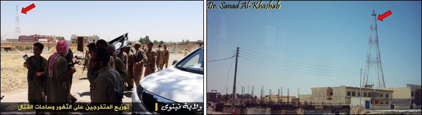
Google Earth imagery shows the shadow of the tower, but there doesn’t seem to be any surrounding buildings that match the ISIS photo. This indicates there must have been recent construction.
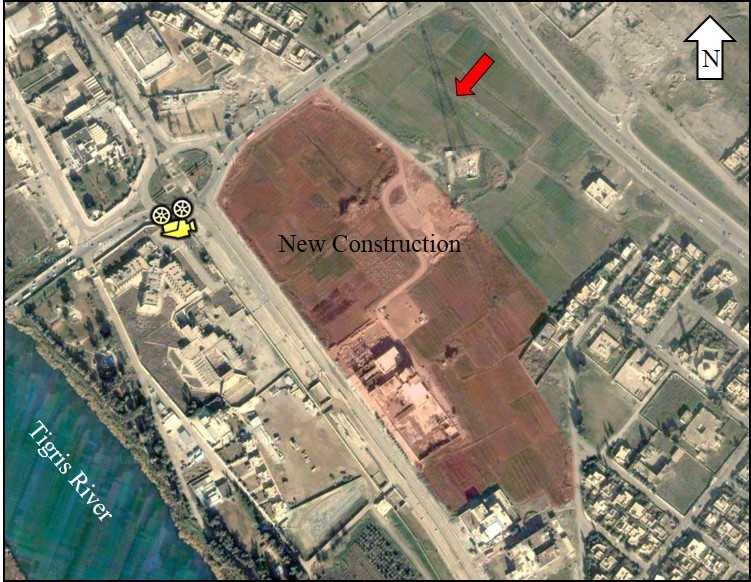
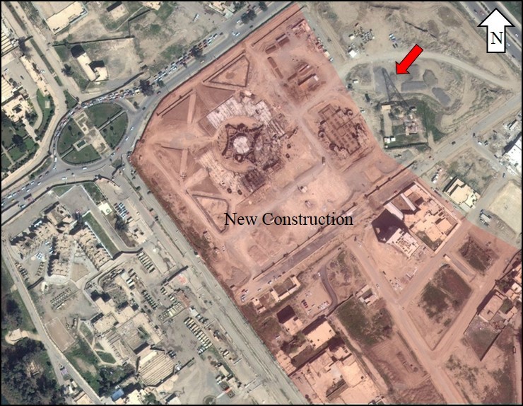
We can confirm by looking at imagery from FlashEarth imagery that shows the construction in progress.
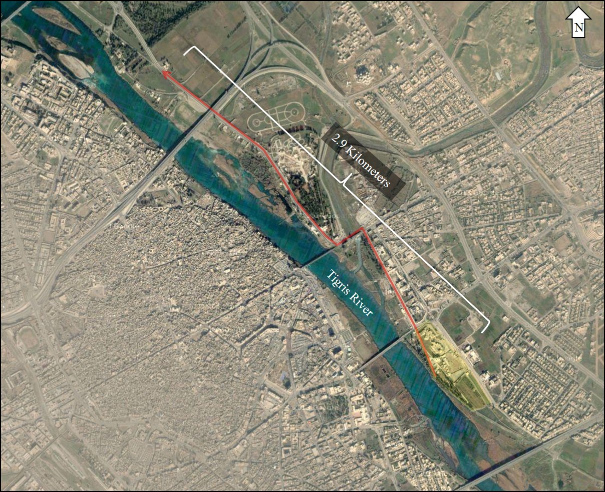
This means they marched a whopping 2.9 km (1.8 mi)!