How the Russian City of Orsk Went Underwater
Floodwaters continue to rise in Russia’s Orenburg Region after dams burst along the River Ural earlier this week. According to the region’s governor, the water levels in its capital city Orenburg have risen to more than ten metres.
The region’s second largest city of Orsk has been particularly badly struck by the floods. A small number of residents took to the streets on Monday in a rare protest against the government. They demanded compensation, accusing authorities of mishandling the evacuation of residents and disputing officials’ claims that residents were notified of the situation before protective embankments were breached in the flood.
The Ural River lies in Russia’s Ural Mountain range and passes through several Russian cities before entering Kazakhstan and emptying into the Caspian Sea. Authorities of both countries have declared states of emergency and approximately 120,000 people have been evacuated from their homes. Climate experts told Reuters that heavy snowfall followed by a swift rise in temperatures contributed to this year’s large floods.
With open source information we can piece together some of what happened in Orsk and across the Orenburg Region, showing the extent of Russia’s worst flooding in decades and the inability of flood protection systems to withstand the surge.
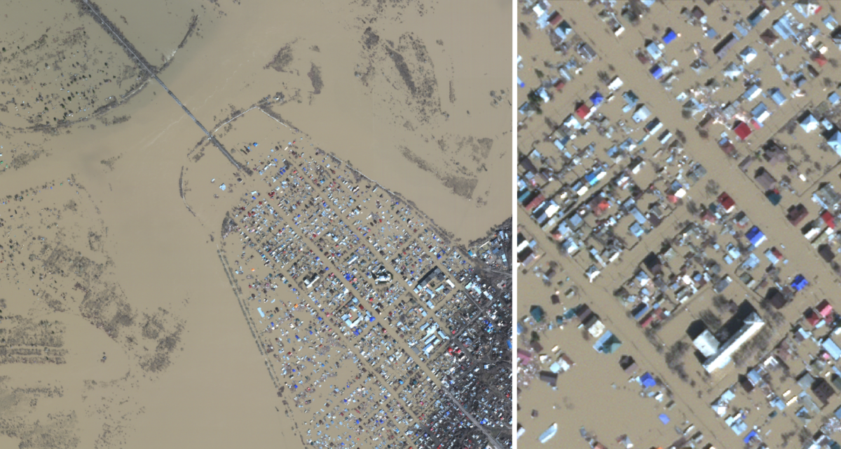
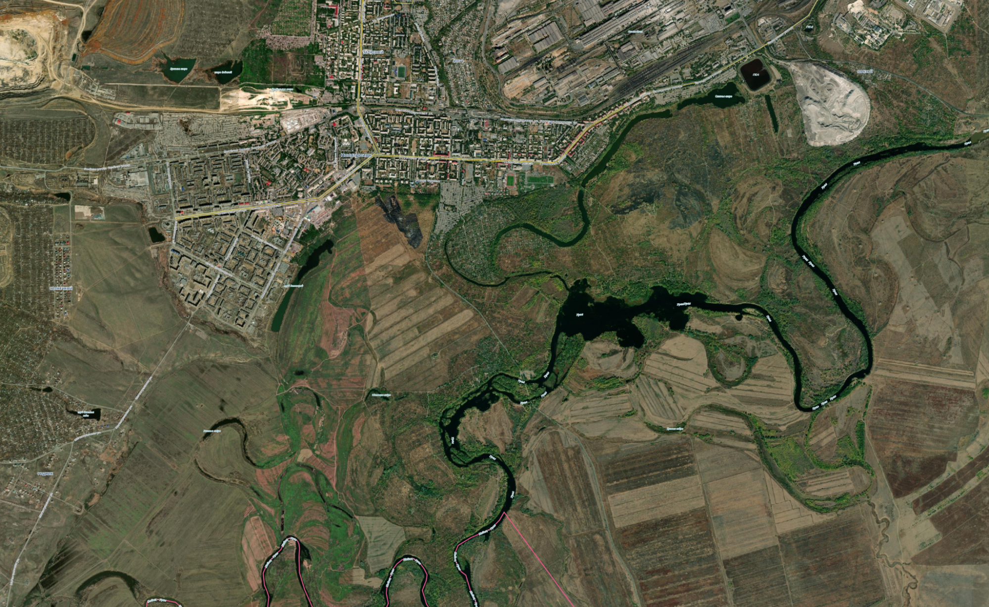
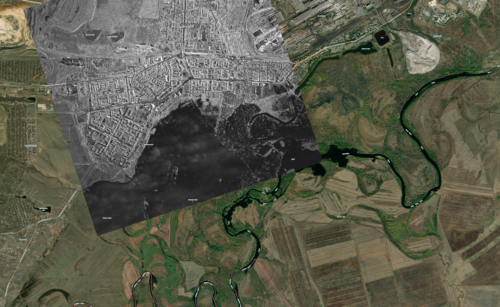
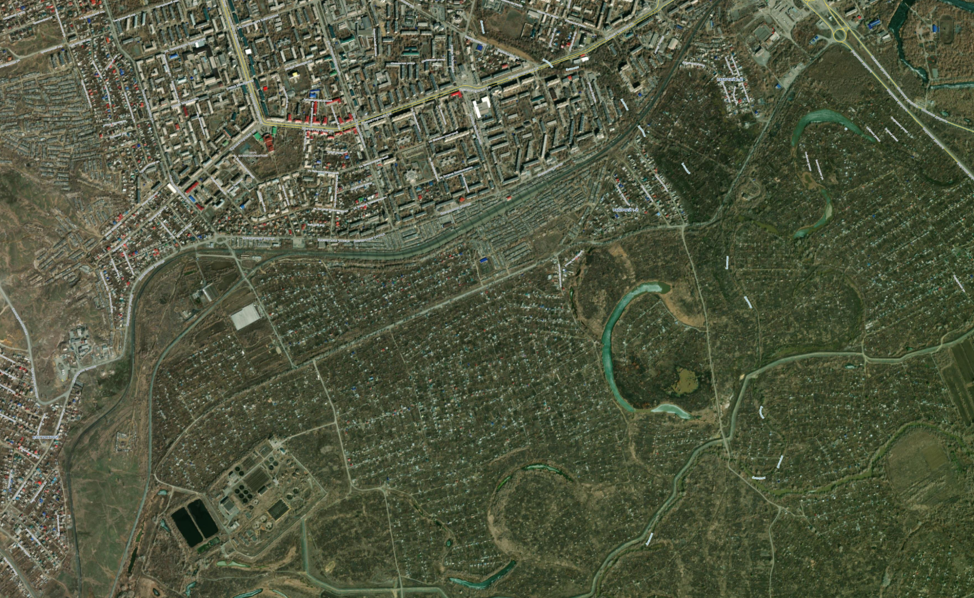
For example, the comparison slider below shows satellite imagery of the old city of Orsk on October 9, 2021 and on April 10, 2024. The streets of the old city (in the centre) are submerged beneath brown floodwaters, as are allotments and agricultural land (upper left).
A Crisis Seen Through the Clouds
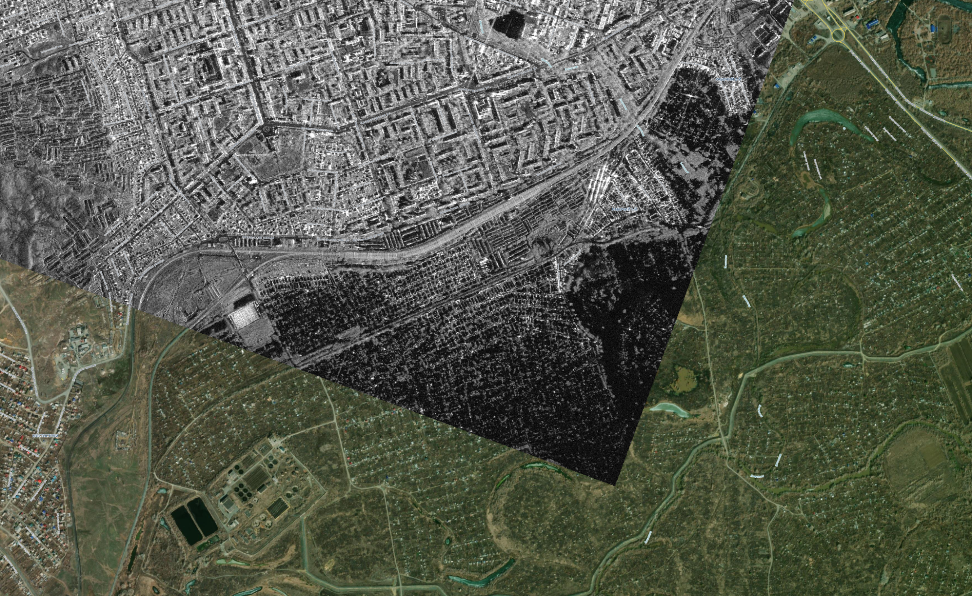
Not all satellite imagery is so clear. This is where Sentinel-1 Synthetic Aperture Radar (SAR) is useful. If a regular optical satellite collects images by registering the light from the sun which reflects off the earth, SAR functions as its own ‘sun’ by emitting signals and registering what is reflected back to them. This allows SAR to ‘see’ through cloud cover – a definite advantage when tasking satellite imagery in winter or spring. Bellingcat has therefore used SAR to investigate issues from Russia’s grain smuggling fleet to the movements of Equatorial Guinea’s ruling family.
Commonly, objects which reflect SAR very intensely will appear on the resulting image with brighter colours. Objects which absorb rather than reflect SAR emissions appear with darker ones – this includes water.
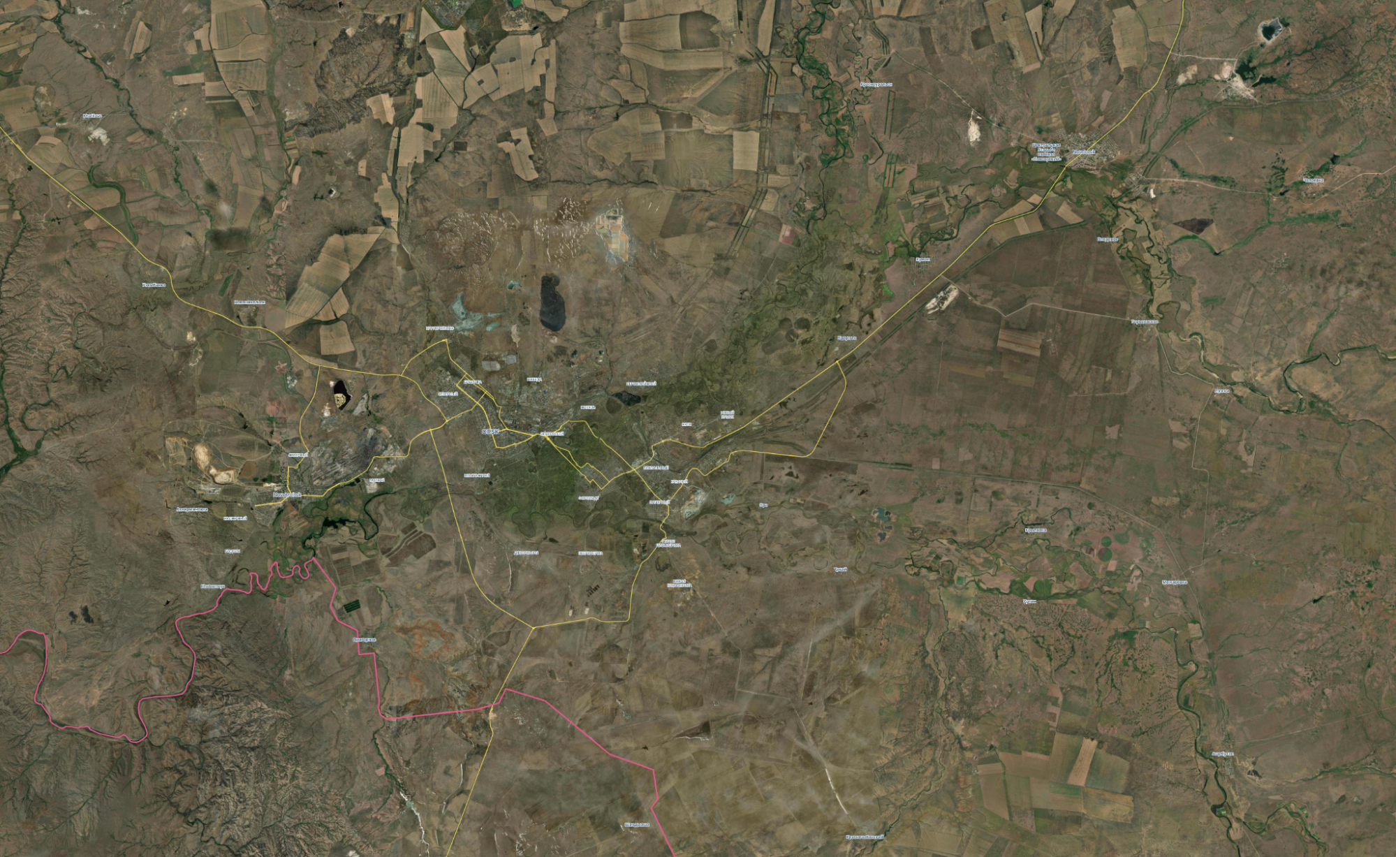
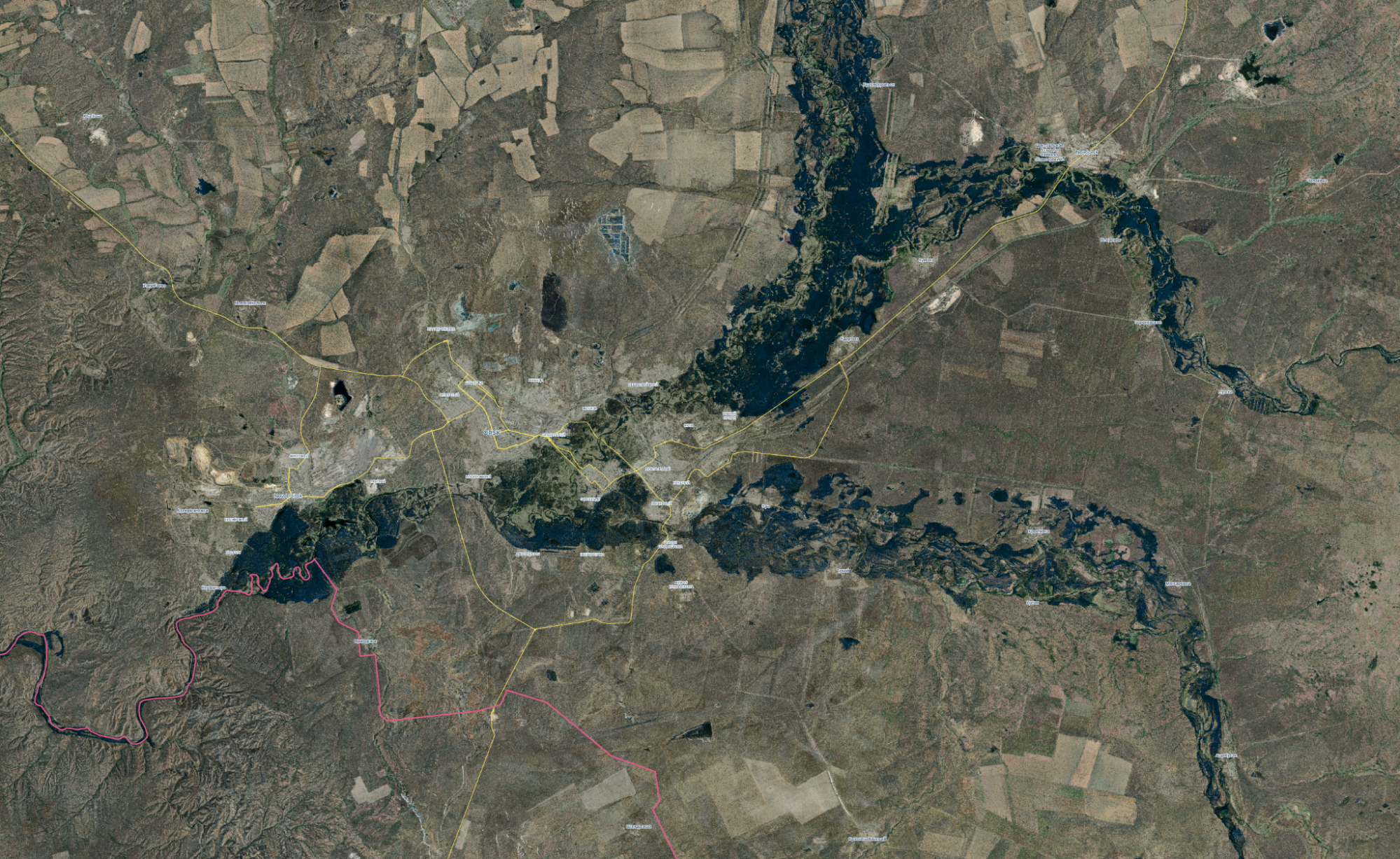
On April 8 at 02:16 local time, the European Space Agency (ESA)’s Sentinel-1 SAR took a satellite image of Orsk and the surrounding area. The extent of the flooding can be clearly seen in black in the image below. This black area was overlaid onto a true colour satellite image from ESRI, which is a composite of imagery from different recent dates within a limited range.
Data from Open Street Map was then added for further context, showing the area’s major roads in yellow and Russia’s border with Kazakhstan in red.
The comparison slider below shows the change in the size of the river in ESRI’s composite image from early 2024 to that seen in the Sentinel-1 SAR imagery from April 8.
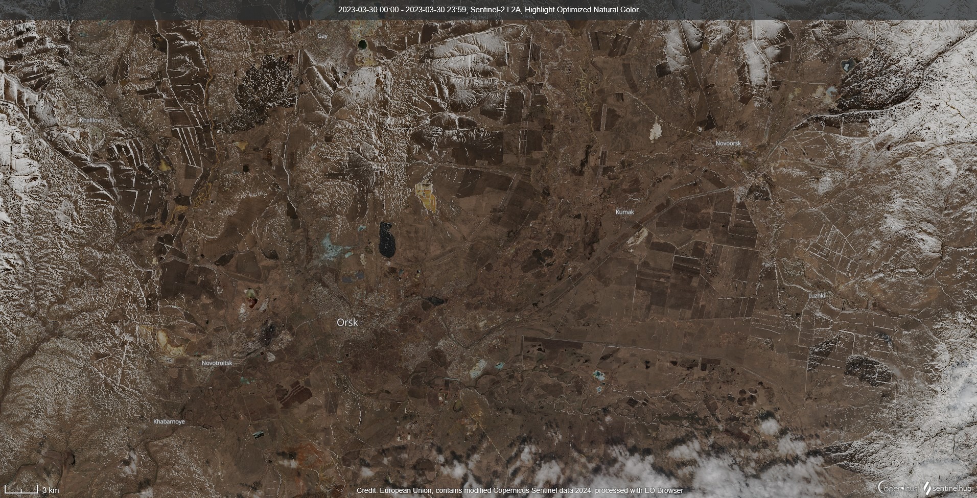
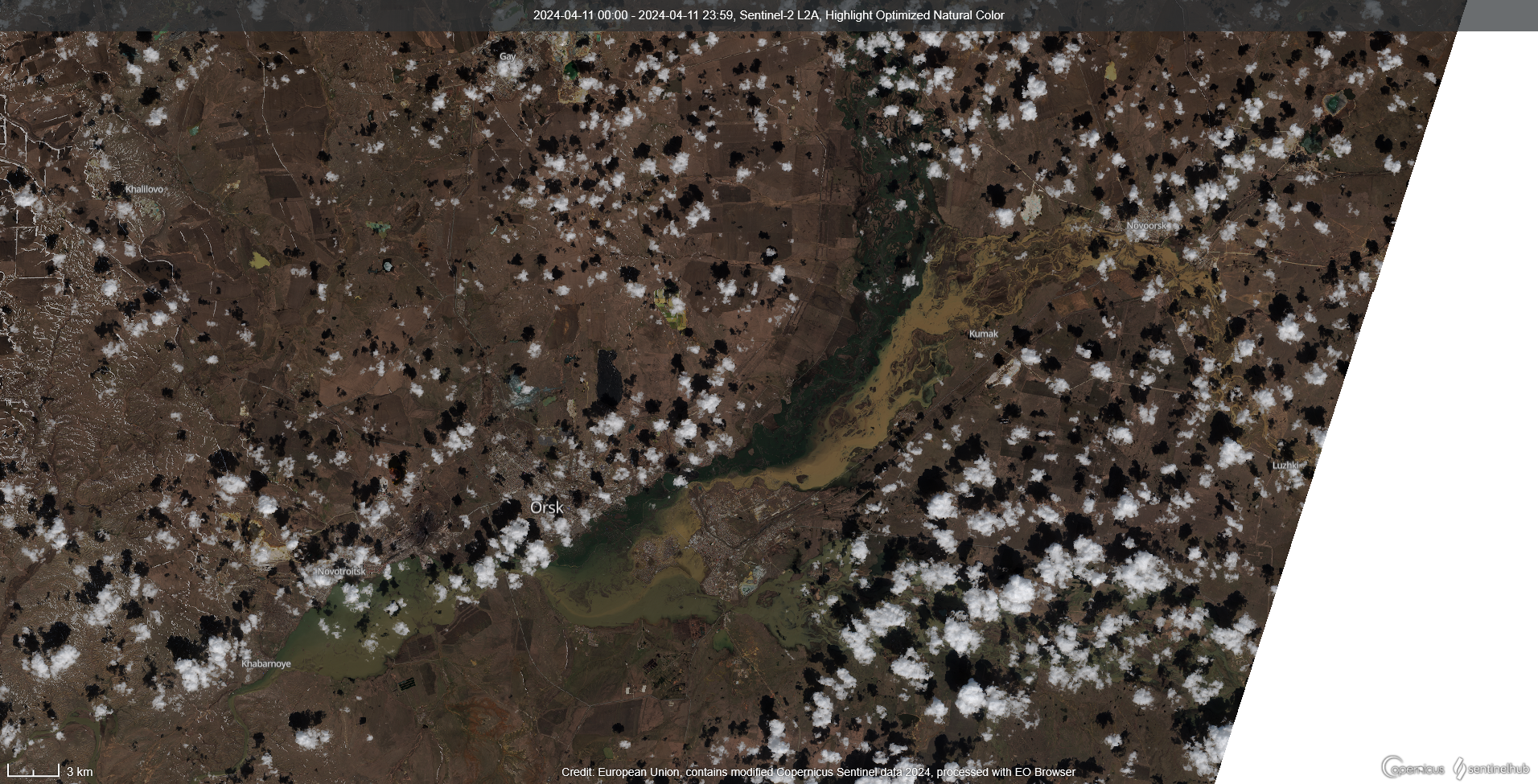
Later true colour (i.e. photographic) satellite imagery from Sentinel-2 showed similar levels of flooding in Orsk on the morning of April 11. Again, the drastic change in water levels was clear when compared to Sentinel-2 imagery taken on March 30, 2023.
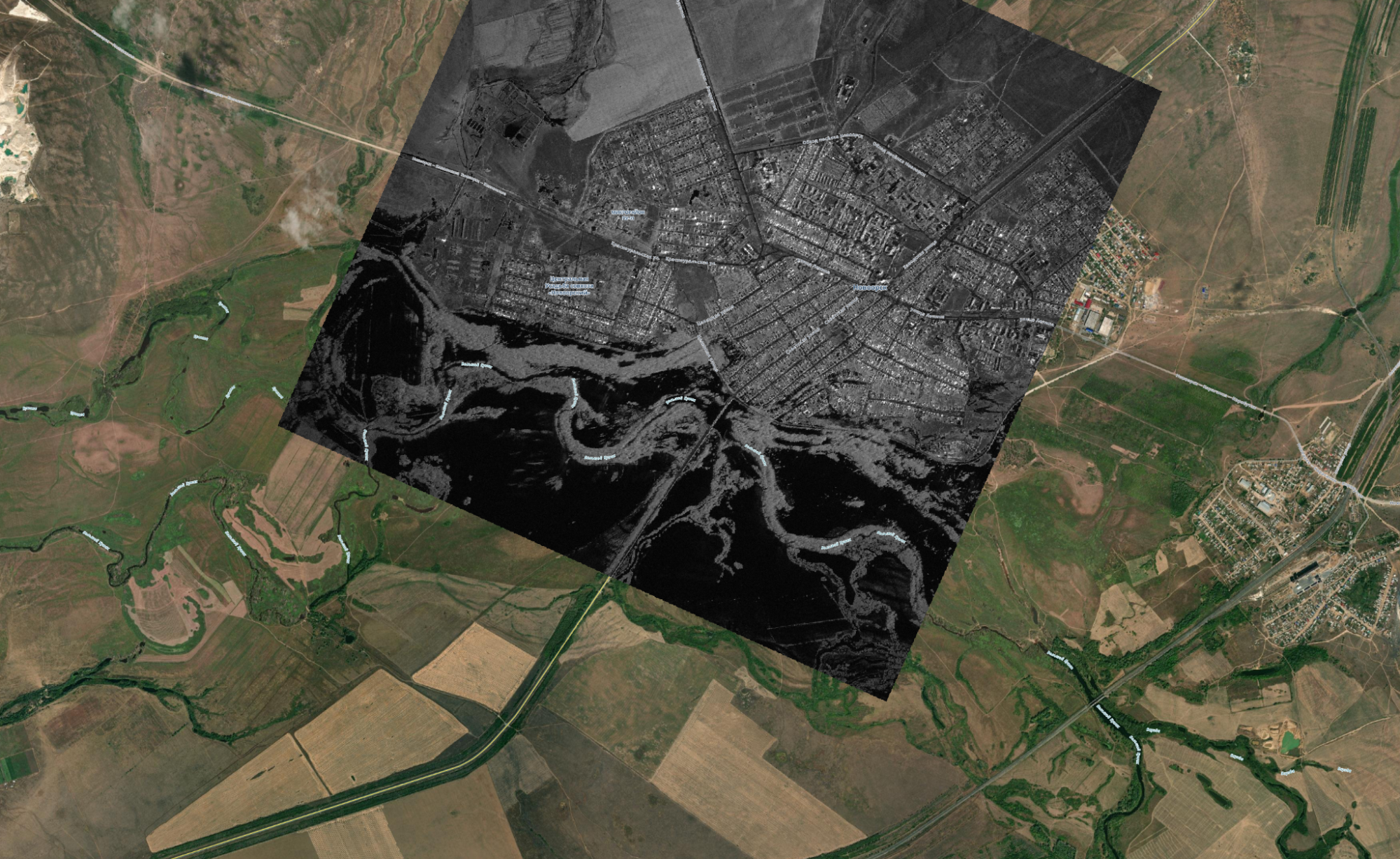
High resolution SAR imagery from Umbra showed the flooding in greater detail. Once again, the black areas show an object with a very low SAR return signal — water.
SAR captures from April 9 showed how some riverside communities were completely submerged.
For example in Novotroitsk, a suburb downstream from Orsk, smaller houses closest to the river had disappeared underwater by April 9, while the city proper appeared above water. The comparison slider below overlays Umbra SAR imagery (in the black and white square) onto an ESRI composite image of the same area from early 2024.
A similar situation unfolded in the Leninsky District of Orsk, where housing nearest the River Ural appeared to be submerged.
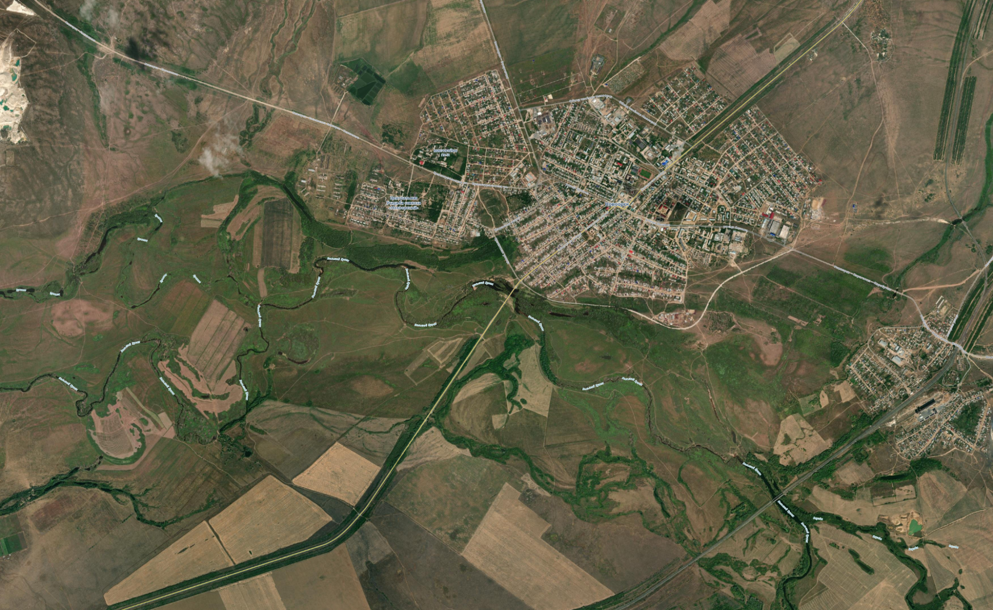
The flooding in Novoorsk, a town to the north-east of Orsk, appeared less catastrophic. However, large amounts of water could still be seen in residential areas nearest the river.
Where the Dams Burst
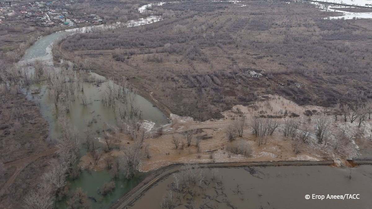
Floodwaters surged through Orsk after protective embankments burst. These earth ramparts, which snake across the landscape, are common parts of flood management systems designed to direct water away from areas of human settlement.
How these embankments collapsed has been a source of some dispute – experts told the local news website Orenburg Media that an earth embankment near Orsk’s old town was only designed to hold back five and a half metres of floodwater. Poor construction quality has also been considered; on April 6 the Investigative Committee of Orenburg Region opened an investigation into criminal negligence on the issue.
“The dam which is being discussed in Orsk isn’t actually a dam. A dam doesn’t cost a billion rubles, 10 kilometres wide… This dam withstood around five and a half metres [of water] but then we got ten. With incredible speed, a huge mass of water surged not towards a dam, but an earthen rampart”, said Russia’s Minister of Construction Irek Fayzullin on April 11.
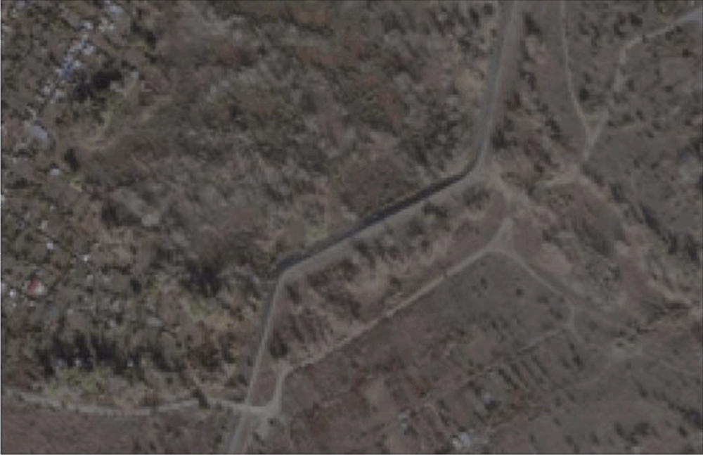
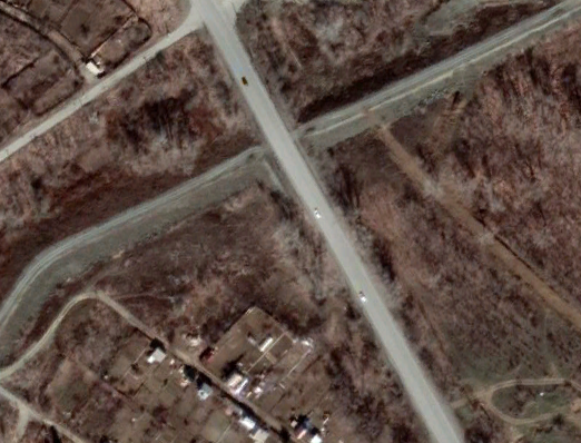
Satellite images and social media posts reveal that the embankments protecting Orsk broke in at least six areas. These locations are represented by yellow pins in the satellite image below. The white pin is the location of a visit which the Mayor of Orsk Vasily Kozupitsa made to one of the embankments shortly before the floods.
Note that the numbers do not represent the chronological order of the breaches:
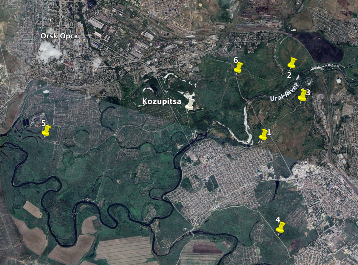
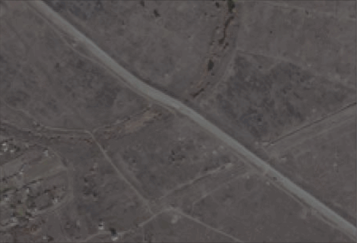
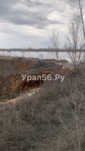
The embankment at Location One (51.216569, 58.578514) stood near Orsk’s old city. It was first reported to be breached on April 5, as seen in footage first shared by the Ural56 Telegram channel. The gif image below shows the intact embankment on May 23, 2022 and its condition by April 10, 2024.
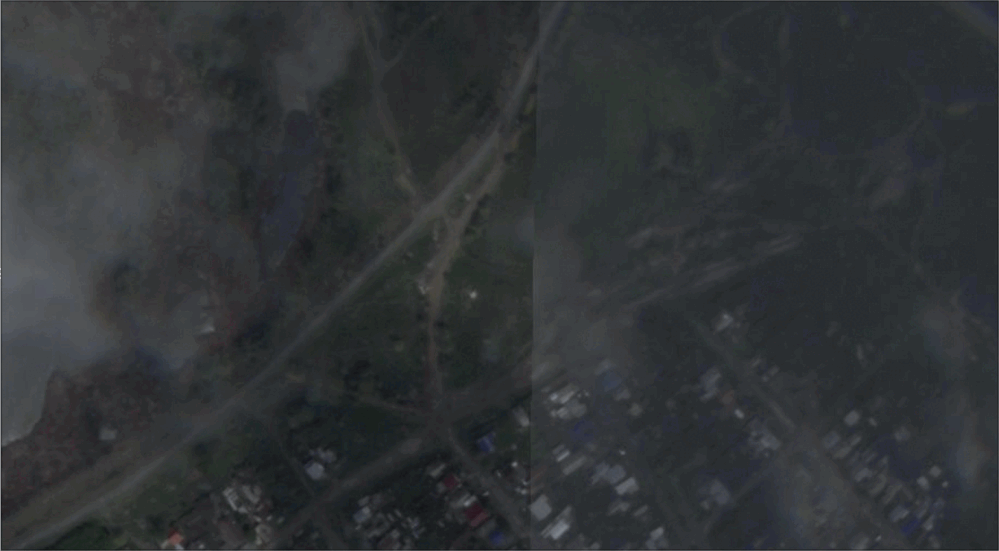
Water can be seen flowing through the breach in photographs published by Ural56 on April 6 and independent media outlet Meduza on April 7.
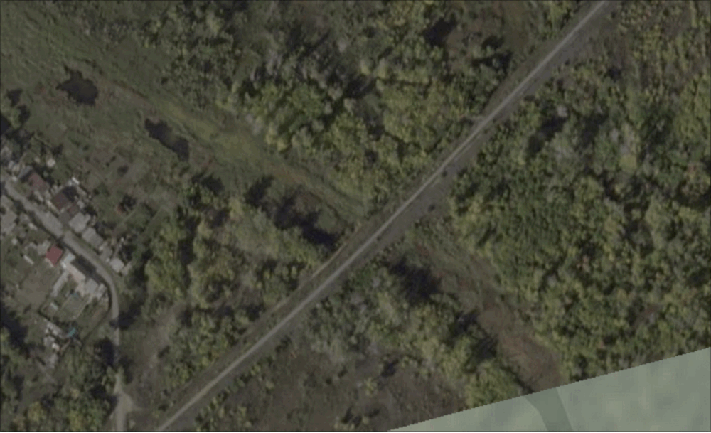
The embankment at Location Two (51.238843, 58.581747) was near Borisoglebskaya Street in the industrial suburb of Nikel, to the east of Orsk’s old town. It was reported to be breached on April 6.
The gif image below shows the intact embankment on September 21, 2023 and its condition by April 10, 2024.
The embankment at Location Three was (51.230404, 58.590614) in the Sovietsky District of Orsk, about a kilometre away from the second. On April 8, the Telegram channel of state media network TASS published drone footage of the broken embankment.
The gif image below shows the intact embankment on October 9, 2021 and its condition by April 10, 2024.
The embankment breach at Location Four (51.193080, 58.597620) was in the east of the Sovietsky District of Orsk, near the village of Nagorny. The gif image below shows the intact embankment on October 9, 2021 and its condition by April 10, 2024.
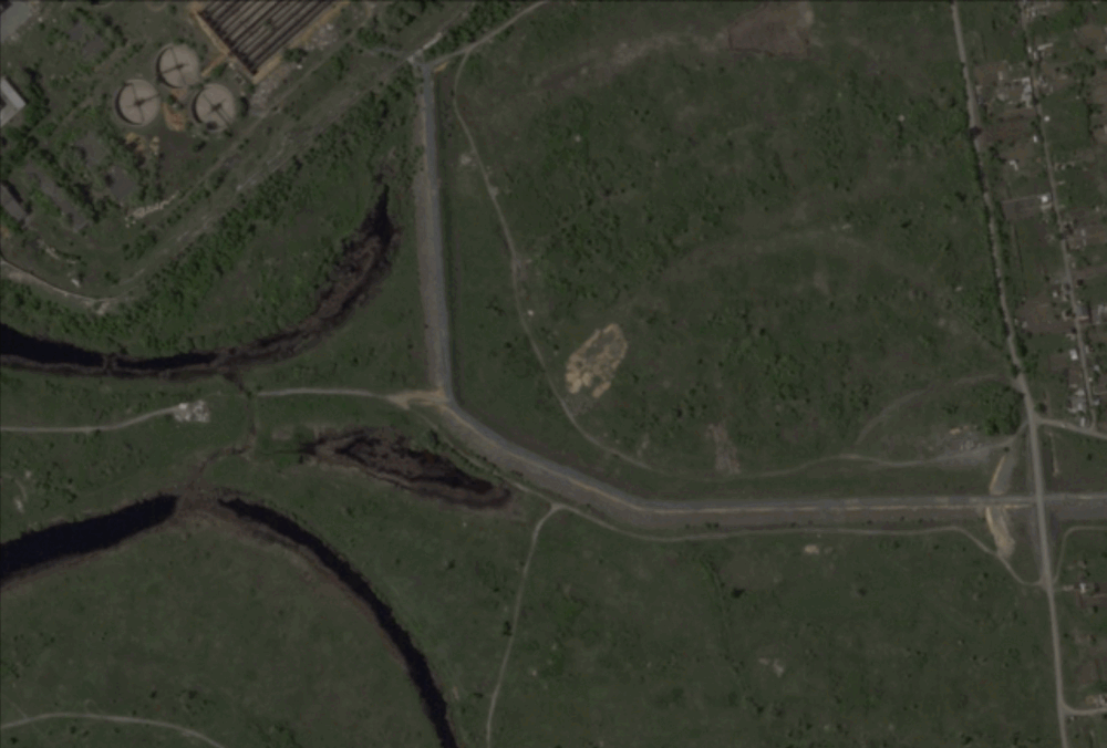
The embankment breach at Location Five (51.199450, 58.484450) took place in the east of the Leninsky District of Orsk, near a water treatment facility belonging to Rosvodokanal. The gif image below shows the intact embankment on May 23, 2023 and its condition by April 10, 2024.
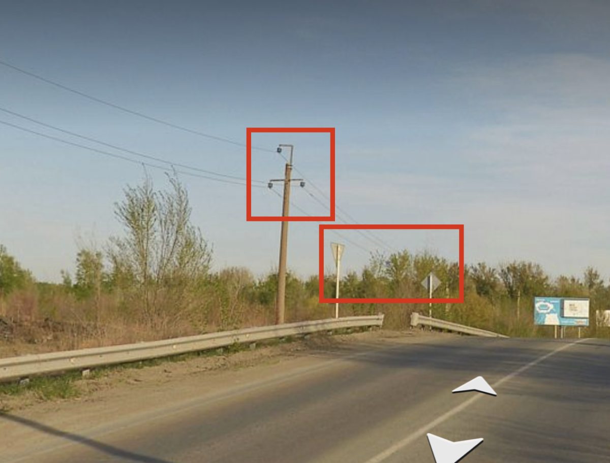
An embankment breach also occurred at Location Six, where the earth structure intersected with with the Novaya Obezdnaya Highway at (51.233064, 58.558656), near the suburb of Nikel.
While this breach could not be seen on Planet satellite imagery, Footage of water flowing through the break was shared by the Ural56 Telegram channel on April 6.
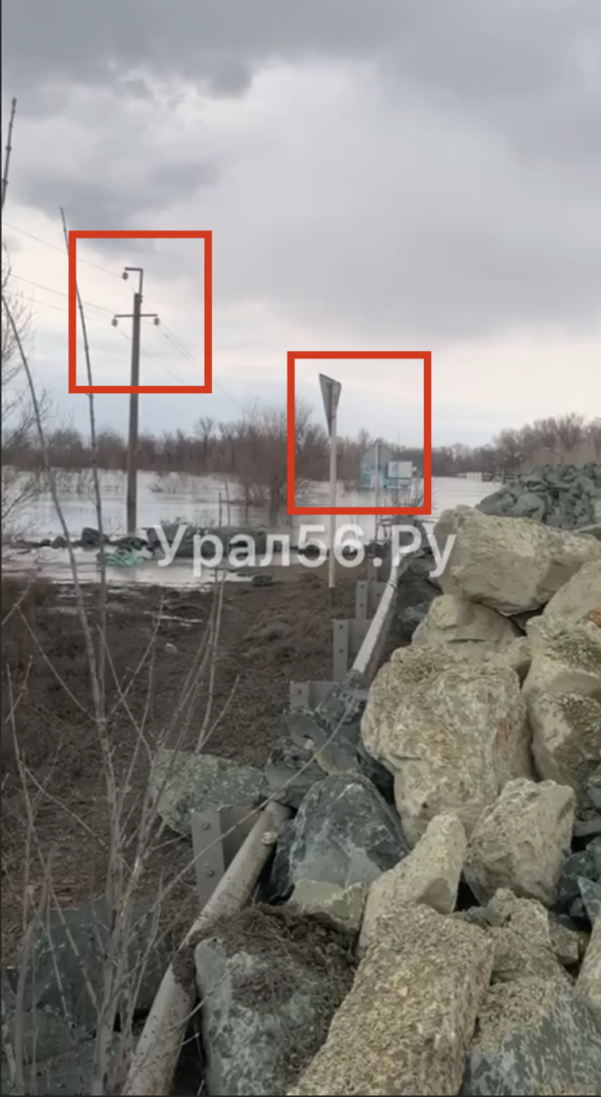
These images could be geolocated thanks to Yandex Panorama imagery of the intact embankment, which was taken in 2023. Note the matching telephone cable pole and road signs, highlighted by Bellingcat in red squares.
The Mayor’s Visit
On April 3, just two days before the first embankment breach Bellingcat found, the Mayor of Orsk Vasily Kozupitsa visited one of the protective structures. In a post on Russian social network VK, he assured his subscribers that there was no serious threat.
Kozupitsa also shared photos of his tour of inspection. But where did he visit?
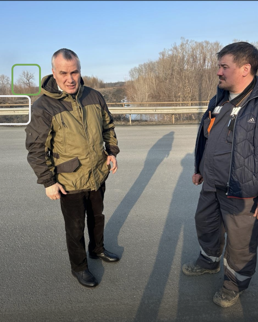
Kozupitsa stands at the intersection of a road and an embankment. His shadow is two to three times his height; in the VK post he mentioned he visited the dam in the evening. The dam is also parallel to his shadow.
Given these details we can recreate the shadow direction on SunCalc, a tool which simulates the movement of the sun through the sky on different dates and locations across the Earth. We can see that Kozupitsa’s shadow is oriented approximately towards the north-east.
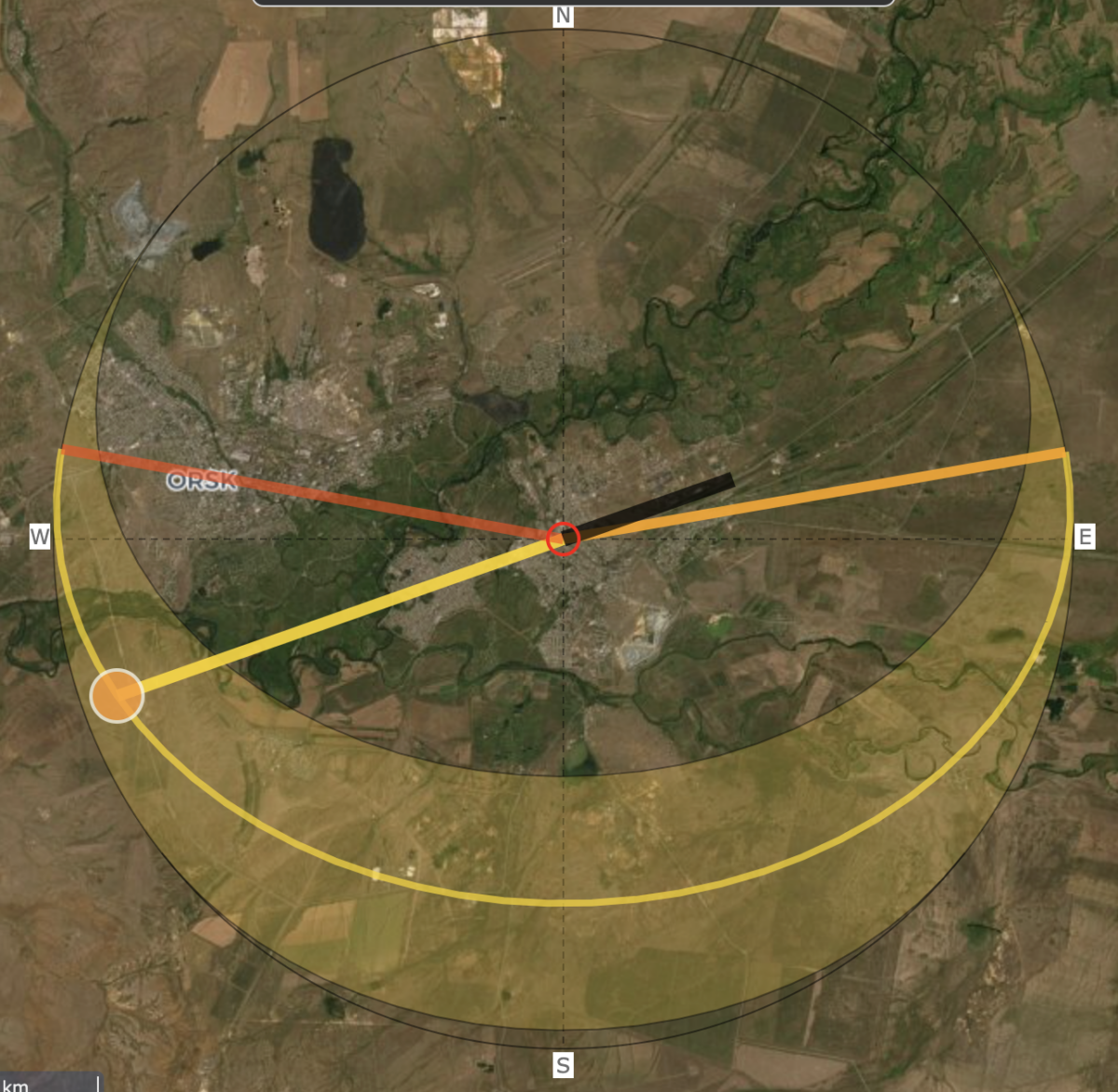
On Google Earth there are only a few areas around Orsk where an embankment has such an orientation and is perpendicular to a wide road. This leads us to a point at (51.218466, 58.542512).
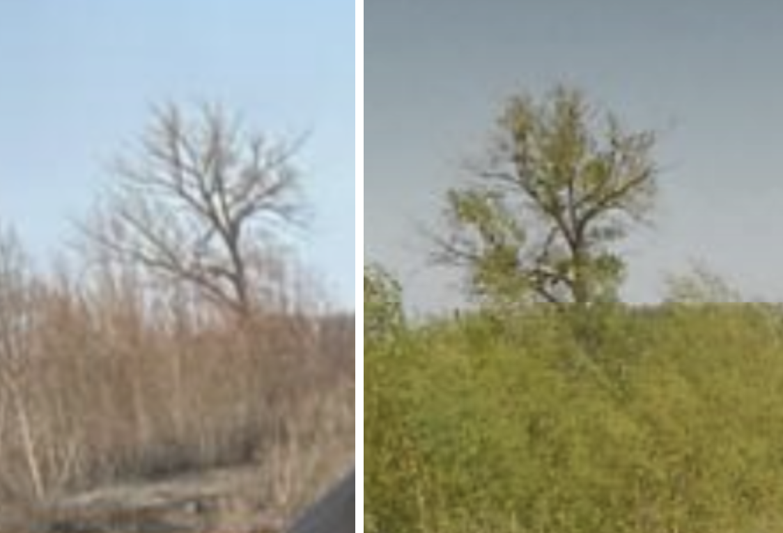
When inputting these coordinates into Yandex Panorama imagery from 2023, we find a road similar to that seen in Kozupitsa’s original image. It is fenced by a low metal barrier and a higher yellow one behind. There is a pile of rocks on the embankment and trees nearby.
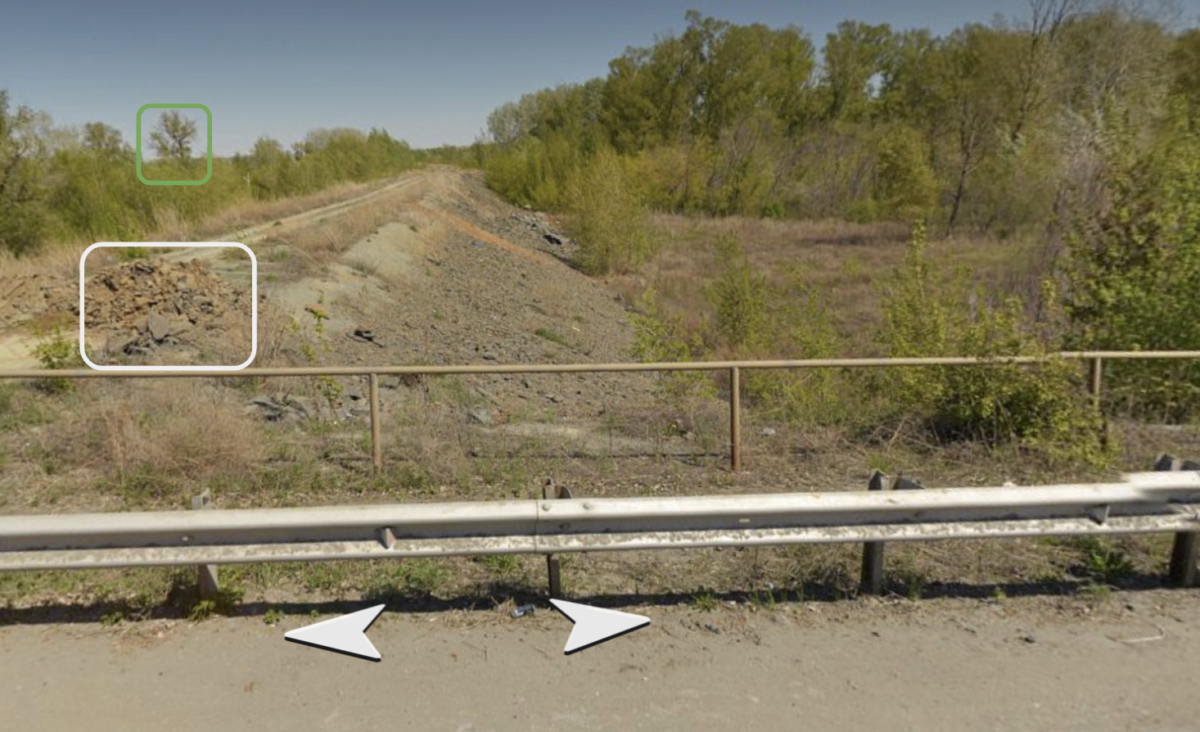
One of these trees has very distinct branches and is an exact match to a tree in the background of Kozupitsa’s photo.
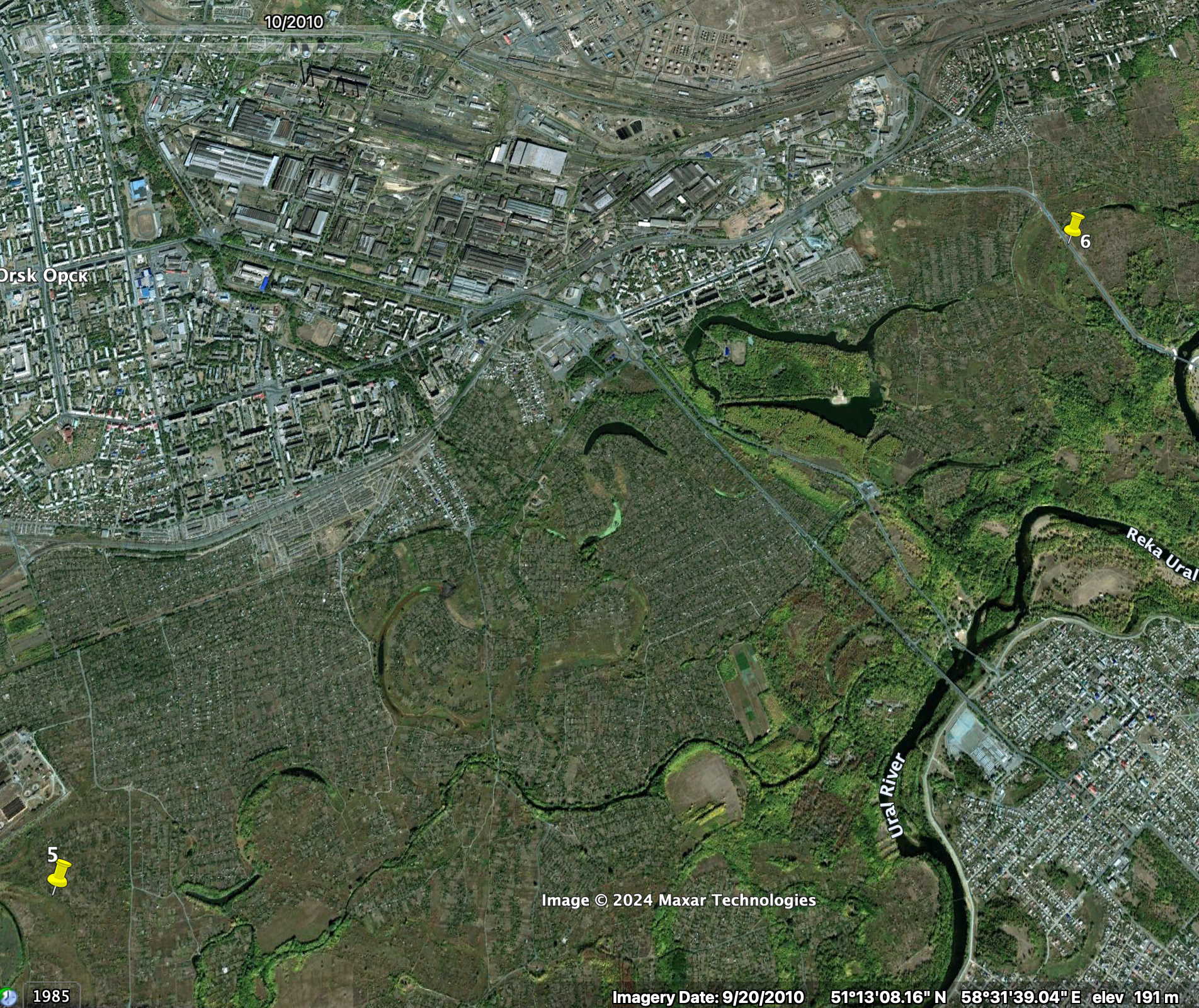
This location is marked with a white pin on the map of embankment breaches earlier in this article. According to NGS, a Novosibirsk-based news website, this structure was built between 2012 and 2014 to protect Orsk from the Ural River. Bellingcat corroborated this with open sources — in Maxar satellite imagery from September 2010 no such structure could be seen between locations five and six.
A few days later the embankment Kozupitsa is standing on will break in three points (locations two, five and six).
The Waters Rise
While open source imagery cannot conclusively answer why flood protection systems were inadequate or how they deteriorated, it does show how rapidly they collapsed when faced with the surge of floodwater.
As flooding continues in Orsk and in neighbouring Kazakhstan, open sources will remain a key tool for monitoring the scale of the crisis.
Bellingcat is a non-profit and the ability to carry out our work is dependent on the kind support of individual donors. If you would like to support our work, you can do so here. You can also subscribe to our Patreon channel here. Subscribe to our Newsletter and follow us on Instagram here, YouTube here, Facebook here, Twitter here and Mastodon here.